Estimated Value: $143,629 - $180,000
2
Beds
1
Bath
1,161
Sq Ft
$137/Sq Ft
Est. Value
About This Home
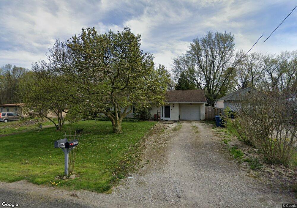
This home is located at 2990 Pepperhill Rd, Akron, OH 44312 and is currently estimated at $159,157, approximately $137 per square foot. 2990 Pepperhill Rd is a home located in Summit County with nearby schools including Springfield High School, Summit Academy Akron Elementary School, and Hatton Community Learning Center.
Ownership History
Date
Name
Owned For
Owner Type
Purchase Details
Closed on
Jul 8, 2021
Sold by
Esatte Of Daniel R Weakland Sr
Bought by
Weakland Daniel R
Current Estimated Value
Purchase Details
Closed on
Apr 17, 2000
Sold by
Richards Paul L and Miller Pamela
Bought by
Weakland Daniel R
Home Financials for this Owner
Home Financials are based on the most recent Mortgage that was taken out on this home.
Original Mortgage
$67,915
Outstanding Balance
$23,251
Interest Rate
8.22%
Estimated Equity
$135,906
Create a Home Valuation Report for This Property
The Home Valuation Report is an in-depth analysis detailing your home's value as well as a comparison with similar homes in the area
Home Values in the Area
Average Home Value in this Area
Purchase History
| Date | Buyer | Sale Price | Title Company |
|---|---|---|---|
| Weakland Daniel R | -- | None Available | |
| Weakland Daniel R | $79,000 | Minnesota Title Agency Inc |
Source: Public Records
Mortgage History
| Date | Status | Borrower | Loan Amount |
|---|---|---|---|
| Open | Weakland Daniel R | $67,915 |
Source: Public Records
Tax History Compared to Growth
Tax History
| Year | Tax Paid | Tax Assessment Tax Assessment Total Assessment is a certain percentage of the fair market value that is determined by local assessors to be the total taxable value of land and additions on the property. | Land | Improvement |
|---|---|---|---|---|
| 2025 | $2,158 | $35,399 | $8,260 | $27,139 |
| 2024 | $2,158 | $35,399 | $8,260 | $27,139 |
| 2023 | $2,158 | $35,399 | $8,260 | $27,139 |
| 2022 | $2,214 | $31,521 | $7,245 | $24,276 |
| 2021 | $2,071 | $31,521 | $7,245 | $24,276 |
| 2020 | $2,043 | $31,530 | $7,250 | $24,280 |
| 2019 | $1,201 | $25,910 | $7,570 | $18,340 |
| 2018 | $1,155 | $25,910 | $7,570 | $18,340 |
| 2017 | $1,200 | $25,910 | $7,570 | $18,340 |
| 2016 | $1,211 | $25,910 | $7,570 | $18,340 |
| 2015 | $1,200 | $25,910 | $7,570 | $18,340 |
| 2014 | $1,186 | $25,910 | $7,570 | $18,340 |
| 2013 | $1,244 | $26,720 | $7,570 | $19,150 |
Source: Public Records
Map
Nearby Homes
- 2948 Trenton Rd
- 379 Stull Ave
- 0 Kreiner Ave
- V/L Marion Ave
- 117 Kreiner Ave
- 233 Marion Ave
- 307 Pauline Ave
- 48 Marion Ave
- 47 Kreiner Ave
- 366 Dennison Ave
- 3472 Curtis St
- 6 Kreiner Ave
- 5 Kreiner Ave
- 544 Dennison Ave
- 3394 Albrecht Ave
- 490 Stevenson Ave
- 412 Stevenson Ave
- 256 High Grove Blvd
- 3474 Albrecht Ave
- 2863 Burnside St
- 2998 Pepperhill Rd
- 2982 Pepperhill Rd
- 3006 Pepperhill Rd
- 2970 Pepperhill Rd
- 2987 Gale Dr
- 3001 Pepperhill Rd
- 2977 Gale Dr
- 2993 Gale Dr
- 257 Columbine Ave
- 3014 Pepperhill Rd
- 275 Columbine Ave
- 265 Columbine Ave
- 3009 Pepperhill Rd
- 3001 Gale Dr
- 2993 Pepperhill Rd
- 2985 Pepperhill Rd
- 251 Columbine Ave
- 233 Columbine Ave
- 3022 Pepperhill Rd
- 3009 Gale Dr