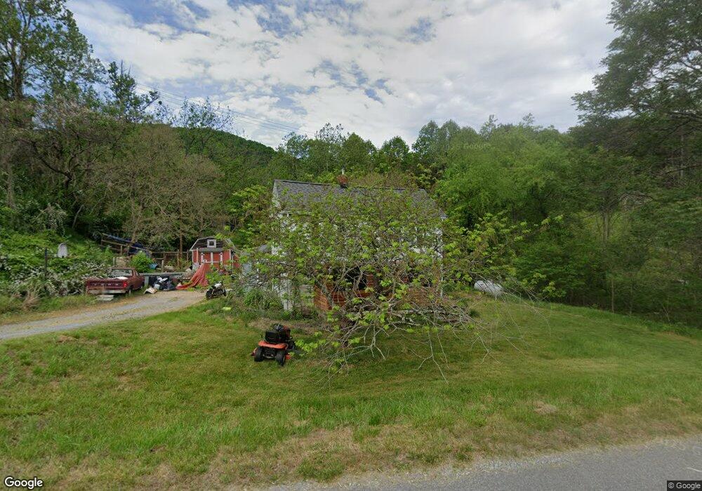
2991 Drewrys Hill Rd Vinton, VA 24179
Estimated Value: $133,000 - $254,000
3
Beds
2
Baths
1,490
Sq Ft
$132/Sq Ft
Est. Value
About This Home
This home is located at 2991 Drewrys Hill Rd, Vinton, VA 24179 and is currently estimated at $196,974, approximately $132 per square foot. 2991 Drewrys Hill Rd is a home with nearby schools including Stewartsville Elementary School, Staunton River Middle School, and Staunton River High School.
Ownership History
Date
Name
Owned For
Owner Type
Purchase Details
Closed on
May 14, 2008
Sold by
Sink Mark S and Sink Jennifer L
Bought by
Simmons Brandon D and Simmons Brittany D
Current Estimated Value
Home Financials for this Owner
Home Financials are based on the most recent Mortgage that was taken out on this home.
Original Mortgage
$4,600
Outstanding Balance
$2,948
Interest Rate
6.11%
Mortgage Type
Stand Alone Second
Estimated Equity
$194,026
Create a Home Valuation Report for This Property
The Home Valuation Report is an in-depth analysis detailing your home's value as well as a comparison with similar homes in the area
Home Values in the Area
Average Home Value in this Area
Purchase History
| Date | Buyer | Sale Price | Title Company |
|---|---|---|---|
| Simmons Brandon D | $128,500 | Acquistion Title |
Source: Public Records
Mortgage History
| Date | Status | Borrower | Loan Amount |
|---|---|---|---|
| Open | Simmons Brandon D | $4,600 | |
| Open | Simmons Brandon D | $125,860 |
Source: Public Records
Tax History Compared to Growth
Tax History
| Year | Tax Paid | Tax Assessment Tax Assessment Total Assessment is a certain percentage of the fair market value that is determined by local assessors to be the total taxable value of land and additions on the property. | Land | Improvement |
|---|---|---|---|---|
| 2025 | $417 | $101,800 | $25,000 | $76,800 |
| 2024 | $417 | $101,800 | $25,000 | $76,800 |
| 2023 | $417 | $50,900 | $0 | $0 |
| 2022 | $475 | $47,500 | $0 | $0 |
| 2021 | $475 | $95,000 | $22,000 | $73,000 |
| 2020 | $475 | $95,000 | $22,000 | $73,000 |
| 2019 | $475 | $95,000 | $22,000 | $73,000 |
| 2018 | $564 | $108,500 | $25,000 | $83,500 |
| 2017 | $564 | $108,500 | $25,000 | $83,500 |
| 2016 | $564 | $108,500 | $25,000 | $83,500 |
| 2015 | $564 | $108,500 | $25,000 | $83,500 |
| 2014 | $571 | $109,900 | $25,000 | $84,900 |
Source: Public Records
Map
Nearby Homes
- 407 Brookledge Dr
- 301 Brookledge Dr
- 106 Sedgefield Ln
- 200 Cascade Dr
- 1737 Beagle Club Rd
- 1075 Windstar Cir
- 201 Willowood Dr
- 108 Trapper Ln
- 10685 Hardy Rd
- 1156 Rosemont Ln
- 1150 Drewrys Hill Rd
- 2606 Paddington Station Ln
- 2971 Stonebridge Cir
- 522 Cambridge Court Rd
- 221 Spring Grove Dr
- 7074 Blue Ridge Pkwy
- 7063 Blue Ridge Pkwy
- 4196 Toddsbury Dr
- 2876 Tulip Ln
- 1035 Oyler Rd
- 16780 Stewartsville Rd
- 1054 Butterfly Ln
- 2868 Drewrys Hill Rd
- 1053 Butterfly Ln
- 16910 Stewartsville Rd
- 1183 Butterfly Ln
- 1184 Butterfly Ln
- 418 Brookledge Dr
- 417 Brookledge Dr
- 1006 British Way
- 1091 British Way
- 16450 Stewartsville Rd
- 1141 Emerts Way Dr
- 1199 Davis Ln
- 415 Brookledge Dr
- 416 Brookledge Dr
- 413 Brookledge Dr
- 1200 Davis Ln
- 1161 Emerts Way Dr
- 414 Brookledge Dr