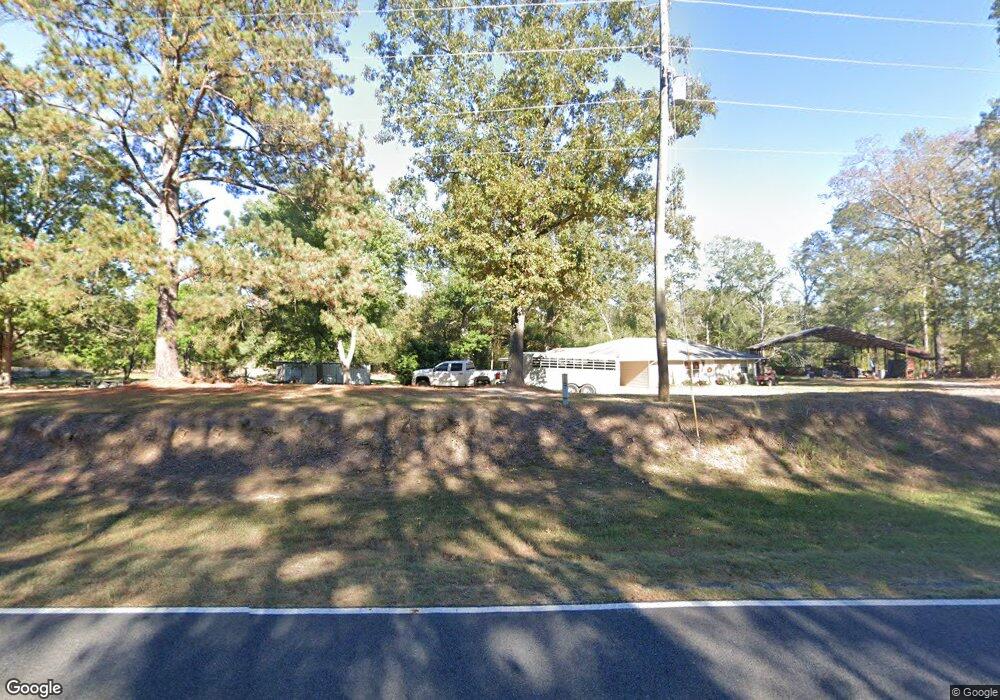
2991 Highway 151 S Calhoun, LA 71225
Estimated Value: $180,000 - $278,000
3
Beds
2
Baths
1,768
Sq Ft
$130/Sq Ft
Est. Value
About This Home
This home is located at 2991 Highway 151 S, Calhoun, LA 71225 and is currently estimated at $230,217, approximately $130 per square foot. 2991 Highway 151 S is a home located in Ouachita Parish with nearby schools including Calhoun Elementary School, Central Elementary School, and Calhoun Middle School.
Ownership History
Date
Name
Owned For
Owner Type
Purchase Details
Closed on
Nov 3, 2011
Sold by
Moose Realty Llc
Bought by
Mcbride Daniel Glen and Mcbride Crystal Michele Little
Current Estimated Value
Home Financials for this Owner
Home Financials are based on the most recent Mortgage that was taken out on this home.
Original Mortgage
$137,750
Outstanding Balance
$92,060
Interest Rate
3.99%
Mortgage Type
Future Advance Clause Open End Mortgage
Estimated Equity
$138,157
Purchase Details
Closed on
Aug 11, 2010
Sold by
Mcneese Joseph H
Bought by
Moose Realty Llc
Home Financials for this Owner
Home Financials are based on the most recent Mortgage that was taken out on this home.
Original Mortgage
$31,424
Interest Rate
4.6%
Mortgage Type
Future Advance Clause Open End Mortgage
Create a Home Valuation Report for This Property
The Home Valuation Report is an in-depth analysis detailing your home's value as well as a comparison with similar homes in the area
Purchase History
| Date | Buyer | Sale Price | Title Company |
|---|---|---|---|
| Mcbride Daniel Glen | $145,000 | First Security Title | |
| Moose Realty Llc | $30,000 | Title West |
Source: Public Records
Mortgage History
| Date | Status | Borrower | Loan Amount |
|---|---|---|---|
| Open | Mcbride Daniel Glen | $137,750 | |
| Previous Owner | Moose Realty Llc | $31,424 |
Source: Public Records
Tax History
| Year | Tax Paid | Tax Assessment Tax Assessment Total Assessment is a certain percentage of the fair market value that is determined by local assessors to be the total taxable value of land and additions on the property. | Land | Improvement |
|---|---|---|---|---|
| 2025 | $761 | $15,821 | $1,694 | $14,127 |
| 2024 | $761 | $15,821 | $1,694 | $14,127 |
| 2023 | $770 | $15,821 | $1,694 | $14,127 |
| 2022 | $1,286 | $14,500 | $1,694 | $12,806 |
| 2021 | $1,302 | $14,500 | $1,694 | $12,806 |
| 2020 | $1,302 | $14,500 | $1,694 | $12,806 |
| 2019 | $1,299 | $14,500 | $1,694 | $12,806 |
| 2018 | $627 | $14,500 | $1,694 | $12,806 |
| 2017 | $1,299 | $14,500 | $1,694 | $12,806 |
| 2016 | $1,298 | $14,500 | $1,694 | $12,806 |
| 2015 | $625 | $14,500 | $1,694 | $12,806 |
| 2014 | $625 | $14,500 | $1,694 | $12,806 |
| 2013 | $623 | $14,500 | $1,694 | $12,806 |
Source: Public Records
Map
Nearby Homes
- 00 Cadeville Lodge Rd
- 010 Cadeville Lodge Rd
- 013 Cadeville Lodge Rd
- 014 Cadeville Lodge Rd
- 08 Cadeville Lodge Rd
- 09 Cadeville Lodge Rd
- 012 Cadeville Lodge Rd
- 011 Cadeville Lodge Rd
- 103 Bradford Ln
- 03 Cadeville Cutoff Rd
- 04 Cadeville Cutoff Rd
- 07 Cadeville Cutoff Rd
- 02 Cadeville Cutoff Rd
- 05 Cadeville Cutoff Rd
- 06 Cadeville Cutoff Rd
- 01 Cadeville Cutoff Rd
- 283 New Mineral Springs Rd
- 715 New Mineral Springs Rd
- 0 Leckie Rd Unit Lot B 11551630
- 0 Leckie Rd Unit 11347493
- 2991 Louisiana 151
- 2969 Louisiana 151
- 2981 Highway 151 S
- 2945 Highway 151 S
- 2993 Highway 151 S
- 3035 Highway 151 S
- 2973 Highway 151 S
- 2970 Highway 151 S
- 2970 Louisiana 151
- 167 Handsorp Rd
- 3146 Highway 151 S
- 3146 Highway 151 S
- 0 Handsorp Rd Unit 191083
- 0 Handsorp Rd Unit 181815
- 229 Zach Ln
- Tract 1 Handsorp Rd
- 187 Zach Ln
- 116 Handsorp Rd
- 164 Harry Johnson Rd
- 176 Ray Dr
Your Personal Tour Guide
Ask me questions while you tour the home.