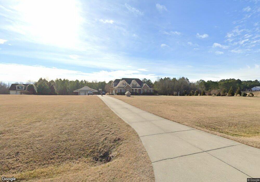
2992 Hallie Burnette Rd Oxford, NC 27565
Estimated Value: $669,000 - $1,163,316
--
Bed
1
Bath
4,268
Sq Ft
$205/Sq Ft
Est. Value
About This Home
This home is located at 2992 Hallie Burnette Rd, Oxford, NC 27565 and is currently estimated at $873,439, approximately $204 per square foot. 2992 Hallie Burnette Rd is a home with nearby schools including West Oxford Elementary School, Northern Granville Middle School, and Granville Central High School.
Ownership History
Date
Name
Owned For
Owner Type
Purchase Details
Closed on
May 13, 2011
Sold by
Hardy Betty Jean Hall
Bought by
Holliman Donald D and Holliman Maribeth
Current Estimated Value
Purchase Details
Closed on
Feb 21, 2011
Sold by
Vaughan Virginia W and Vaughan Michael Joseph
Bought by
Frund Nathan and Frund Julie
Purchase Details
Closed on
Jul 28, 2010
Sold by
Ellington Mark A and Ellington Susan P
Bought by
Paul William K and Paul Melissa M
Home Financials for this Owner
Home Financials are based on the most recent Mortgage that was taken out on this home.
Original Mortgage
$52,000
Interest Rate
4.74%
Mortgage Type
Purchase Money Mortgage
Create a Home Valuation Report for This Property
The Home Valuation Report is an in-depth analysis detailing your home's value as well as a comparison with similar homes in the area
Home Values in the Area
Average Home Value in this Area
Purchase History
| Date | Buyer | Sale Price | Title Company |
|---|---|---|---|
| Holliman Donald D | $8,000 | -- | |
| Frund Nathan | $173,000 | -- | |
| Paul William K | $70,000 | -- |
Source: Public Records
Mortgage History
| Date | Status | Borrower | Loan Amount |
|---|---|---|---|
| Previous Owner | Paul William K | $52,000 |
Source: Public Records
Tax History Compared to Growth
Tax History
| Year | Tax Paid | Tax Assessment Tax Assessment Total Assessment is a certain percentage of the fair market value that is determined by local assessors to be the total taxable value of land and additions on the property. | Land | Improvement |
|---|---|---|---|---|
| 2025 | $6,948 | $1,001,290 | $105,352 | $895,938 |
| 2024 | $6,948 | $1,001,290 | $105,352 | $895,938 |
| 2023 | $4,777 | $517,453 | $58,390 | $459,063 |
| 2022 | $4,756 | $517,453 | $58,390 | $459,063 |
| 2021 | $4,441 | $517,453 | $58,390 | $459,063 |
| 2020 | $4,441 | $517,453 | $58,390 | $459,063 |
| 2019 | $4,441 | $517,453 | $58,390 | $459,063 |
| 2018 | $4,441 | $517,453 | $58,390 | $459,063 |
| 2016 | $3,797 | $420,995 | $59,716 | $361,279 |
| 2015 | $3,581 | $420,995 | $59,716 | $361,279 |
| 2014 | $3,581 | $420,995 | $59,716 | $361,279 |
| 2013 | -- | $420,995 | $59,716 | $361,279 |
Source: Public Records
Map
Nearby Homes
- 905 Brookrun Dr
- 906 Brookrun Dr
- 1106 Brookrun Dr
- 1105 Brookrun Dr
- 1103 Brookrun Dr
- 1104 Brookrun Dr
- Lot 18 Spring Grove Dr
- 0 Spring Grove Dr
- Lot 25 Spring Grove Dr
- 201 Providence Rd
- 111 Ward Ave
- 105 W Thorndale Dr
- 104 Seaman St
- 2536 Enon Rd
- 96 North St
- 204 Cardinal Ct
- 206 Cardinal Ct
- 43 Church St
- 609 N Country Club Dr
- 230 Maple Dr Unit 232
- 7304 Farm Bell Ln
- 2998 Hallie Burnette Rd
- 3002 Hallie Burnette Rd
- 8808 Farm Bell Ln
- Lot 3 Hallie Burnette Rd
- 3005 Hallie Burnette Rd
- 2983 Hallie Burnette Rd
- 3011 Hallie Burnette Rd
- 2960 Hallie Burnette Rd
- 3018 Hallie Burnette Rd
- 3019 Hallie Burnette Rd
- 2952 Hallie Burnette Rd
- 5656 Burnette Rd
- 3023 Hallie Burnette Rd
- 2782 Lake Devin Rd
- 2948 Hallie Burnette Rd
- 3012 Lake Devin Rd
- 2942 Hallie Burnette Rd
- 3018 Lake Devin Rd
- 2763 Lake Devin Rd