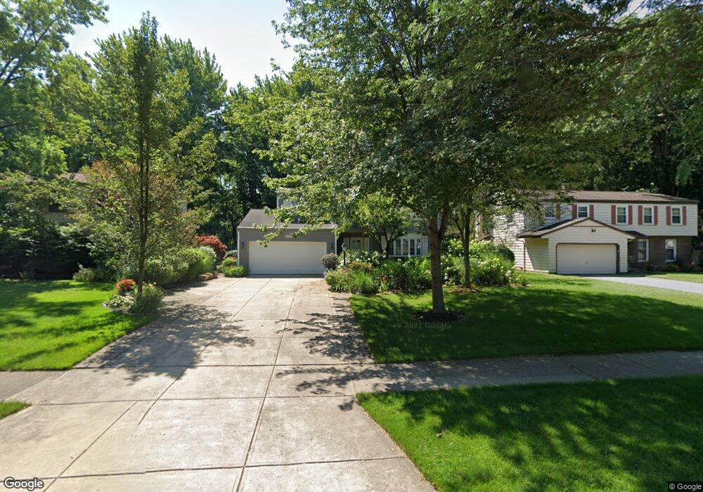
29947 Sutton Dr North Olmsted, OH 44070
Estimated Value: $323,197 - $367,000
4
Beds
2
Baths
2,044
Sq Ft
$168/Sq Ft
Est. Value
About This Home
This home is located at 29947 Sutton Dr, North Olmsted, OH 44070 and is currently estimated at $343,049, approximately $167 per square foot. 29947 Sutton Dr is a home located in Cuyahoga County with nearby schools including Chestnut Intermediate Elementary School, Pine Intermediate School, and North Olmsted Middle School.
Ownership History
Date
Name
Owned For
Owner Type
Purchase Details
Closed on
Oct 24, 1991
Sold by
Tomusko Dale P
Bought by
Tomusko Dale P
Current Estimated Value
Purchase Details
Closed on
May 24, 1991
Sold by
Hullinger Robert A and Hullinger Judy L
Bought by
Tomusko Dale P
Purchase Details
Closed on
Jan 1, 1975
Bought by
Hullinger Robert A and Hullinger Judy L
Create a Home Valuation Report for This Property
The Home Valuation Report is an in-depth analysis detailing your home's value as well as a comparison with similar homes in the area
Home Values in the Area
Average Home Value in this Area
Purchase History
| Date | Buyer | Sale Price | Title Company |
|---|---|---|---|
| Tomusko Dale P | -- | -- | |
| Tomusko Dale P | $126,000 | -- | |
| Hullinger Robert A | -- | -- |
Source: Public Records
Tax History Compared to Growth
Tax History
| Year | Tax Paid | Tax Assessment Tax Assessment Total Assessment is a certain percentage of the fair market value that is determined by local assessors to be the total taxable value of land and additions on the property. | Land | Improvement |
|---|---|---|---|---|
| 2024 | $5,769 | $93,975 | $19,250 | $74,725 |
| 2023 | $5,131 | $72,000 | $15,160 | $56,840 |
| 2022 | $5,139 | $72,000 | $15,160 | $56,840 |
| 2021 | $4,650 | $72,000 | $15,160 | $56,840 |
| 2020 | $4,381 | $61,530 | $12,950 | $48,580 |
| 2019 | $4,263 | $175,800 | $37,000 | $138,800 |
| 2018 | $4,034 | $61,530 | $12,950 | $48,580 |
| 2017 | $4,225 | $56,220 | $11,240 | $44,980 |
| 2016 | $3,774 | $51,530 | $11,240 | $40,290 |
| 2015 | $3,662 | $51,530 | $11,240 | $40,290 |
| 2014 | $3,662 | $50,020 | $10,920 | $39,100 |
Source: Public Records
Map
Nearby Homes
- 6617 Sutton Dr
- 29667 Bretton Ridge Dr
- 6723 Warrington Dr
- 6321 Brighton Dr
- 29861 Wellington Dr
- 6305 Christman Dr
- 6281 Christman Dr
- 6580 Barton Rd
- 30247 Lorain Rd
- 0 Stearns Rd
- 30630 Lorain Rd
- 7100 Barton Rd
- 28628 Aspen Dr
- 29408 Stewart Dr
- 28625 Elder Dr
- 30241 Sugar Sand Ln Unit 14B
- 31134 Lorain Rd
- 5833 Stearns Rd
- 5920 Sherwood Dr
- 6926 Mackenzie Rd
- 29915 Sutton Dr
- 29979 Sutton Dr
- 29883 Sutton Dr
- 30011 Sutton Dr
- 6524 Surrey Dr
- 29851 Sutton Dr
- 6545 Sutton Dr
- 6531 Brighton Dr
- 29819 Sutton Dr
- 6512 Surrey Dr
- 6557 Sutton Dr
- 6519 Brighton Dr
- 6569 Sutton Dr
- 29787 Sutton Dr
- 6500 Surrey Dr
- 6501 Surrey Dr
- 6505 Brighton Dr
- 6581 Sutton Dr
- 29755 Sutton Dr
- 6488 Surrey Dr