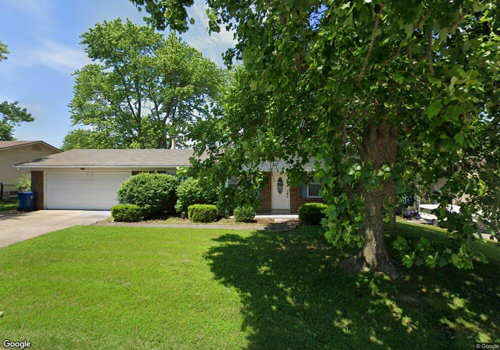
2995 Brooklands Way Saint Charles, MO 63303
Heritage NeighborhoodEstimated Value: $294,000 - $322,000
3
Beds
2
Baths
1,464
Sq Ft
$212/Sq Ft
Est. Value
About This Home
This home is located at 2995 Brooklands Way, Saint Charles, MO 63303 and is currently estimated at $310,285, approximately $211 per square foot. 2995 Brooklands Way is a home located in St. Charles County with nearby schools including Becky-David Elementary School, Barnwell Middle School, and Francis Howell North High School.
Ownership History
Date
Name
Owned For
Owner Type
Purchase Details
Closed on
May 6, 2011
Sold by
Harmon Ronald A and Harmon Elizabeth A
Bought by
Hilke Daniel C
Current Estimated Value
Home Financials for this Owner
Home Financials are based on the most recent Mortgage that was taken out on this home.
Original Mortgage
$110,000
Outstanding Balance
$71,404
Interest Rate
3.5%
Mortgage Type
Adjustable Rate Mortgage/ARM
Estimated Equity
$238,881
Purchase Details
Closed on
May 28, 1998
Sold by
Brickey Linda J
Bought by
Harmon Ronald A and Harmon Elizabeth A
Home Financials for this Owner
Home Financials are based on the most recent Mortgage that was taken out on this home.
Original Mortgage
$83,600
Interest Rate
7.2%
Create a Home Valuation Report for This Property
The Home Valuation Report is an in-depth analysis detailing your home's value as well as a comparison with similar homes in the area
Home Values in the Area
Average Home Value in this Area
Purchase History
| Date | Buyer | Sale Price | Title Company |
|---|---|---|---|
| Hilke Daniel C | $141,500 | Integrity Land Title Co Inc | |
| Harmon Ronald A | -- | -- |
Source: Public Records
Mortgage History
| Date | Status | Borrower | Loan Amount |
|---|---|---|---|
| Open | Hilke Daniel C | $110,000 | |
| Previous Owner | Harmon Ronald A | $83,600 |
Source: Public Records
Tax History Compared to Growth
Tax History
| Year | Tax Paid | Tax Assessment Tax Assessment Total Assessment is a certain percentage of the fair market value that is determined by local assessors to be the total taxable value of land and additions on the property. | Land | Improvement |
|---|---|---|---|---|
| 2025 | $2,800 | $49,606 | -- | -- |
| 2023 | $2,796 | $45,131 | $0 | $0 |
| 2022 | $2,491 | $37,203 | $0 | $0 |
| 2021 | $2,486 | $37,203 | $0 | $0 |
| 2020 | $2,338 | $34,092 | $0 | $0 |
| 2019 | $2,329 | $34,092 | $0 | $0 |
| 2018 | $2,111 | $29,462 | $0 | $0 |
| 2017 | $2,100 | $29,462 | $0 | $0 |
| 2016 | $1,935 | $27,197 | $0 | $0 |
| 2015 | $1,903 | $27,197 | $0 | $0 |
| 2014 | $1,738 | $24,076 | $0 | $0 |
Source: Public Records
Map
Nearby Homes
- 1004 Cobbler Ln
- 2948 Oetting Dr
- 632 Weeping Willow Dr
- 1488 Gettysburg Landing
- 38 Trailside Ct Unit 3
- 46 Meadow Run Ct Unit 5
- 1283 Dell Ridge Ct
- 3310 Hampton Crossing
- 1611 Burnside Ln
- 1350 Spring Park Dr
- 1633 Mount Vernon Dr Unit 2
- 1428 Hudson Landing
- 515 Newkirk Cir
- 3042 Winding River Dr
- 506 Newkirk Cir
- 2709 Heritage Landing
- 1505 Lienemann Dr Unit 32
- 3594 Westport Dr
- 3150 Arrow Rock Dr
- 1421 Granite Ridge Dr
- 2991 Brooklands Way
- 2999 Brooklands Way
- 2942 Plum Leaf Cir
- 2944 Plum Leaf Cir
- 2946 Plum Leaf Cir
- 2987 Brooklands Way
- 2992 Brooklands Way
- 2940 Plum Leaf Cir
- 2996 Brooklands Way
- 2948 Plum Leaf Cir
- 938 Mallory Dr
- 2983 Brooklands Way
- 2938 Plum Leaf Cir
- 2943 Plum Leaf Cir
- 941 Mallory Dr
- 11101114 Jungs Station Rd
- 2984 Brooklands Way
- 2950 Plum Leaf Cir
- 2941 Plum Leaf Cir
- 944 Jungs Station Rd