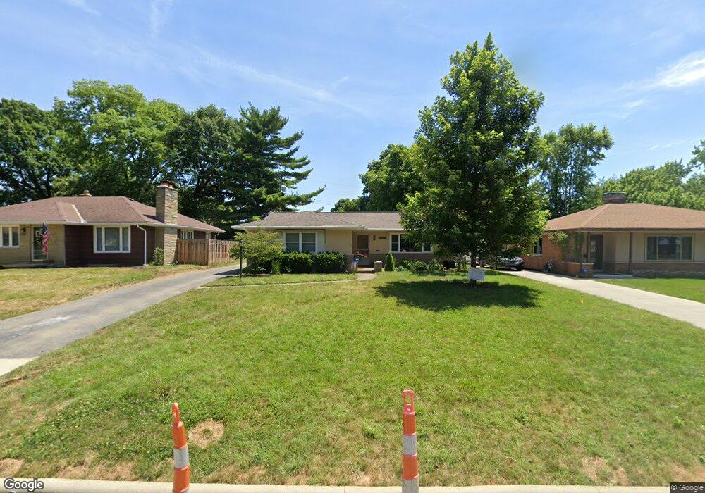
2996 Melford Rd Columbus, OH 43221
Estimated Value: $489,817 - $542,000
3
Beds
2
Baths
1,553
Sq Ft
$336/Sq Ft
Est. Value
About This Home
This home is located at 2996 Melford Rd, Columbus, OH 43221 and is currently estimated at $521,454, approximately $335 per square foot. 2996 Melford Rd is a home located in Franklin County with nearby schools including Tremont Elementary School, Jones Middle School, and Upper Arlington High School.
Ownership History
Date
Name
Owned For
Owner Type
Purchase Details
Closed on
Jun 29, 2011
Sold by
Dury Jeffrey R and Dury Joanne L
Bought by
Dury Jeffrey R and Dury Joanne L
Current Estimated Value
Home Financials for this Owner
Home Financials are based on the most recent Mortgage that was taken out on this home.
Original Mortgage
$132,250
Outstanding Balance
$83,647
Interest Rate
2.87%
Mortgage Type
New Conventional
Estimated Equity
$437,807
Purchase Details
Closed on
Apr 30, 2007
Sold by
Good Gregory W and Good Susan
Bought by
Dury Jeffrey R and Boos Joanne L
Home Financials for this Owner
Home Financials are based on the most recent Mortgage that was taken out on this home.
Original Mortgage
$136,350
Interest Rate
6.2%
Mortgage Type
Purchase Money Mortgage
Purchase Details
Closed on
Sep 27, 1988
Bought by
Good Gregory W
Purchase Details
Closed on
Aug 28, 1987
Create a Home Valuation Report for This Property
The Home Valuation Report is an in-depth analysis detailing your home's value as well as a comparison with similar homes in the area
Home Values in the Area
Average Home Value in this Area
Purchase History
| Date | Buyer | Sale Price | Title Company |
|---|---|---|---|
| Dury Jeffrey R | -- | None Available | |
| Dury Jeffrey R | $170,500 | Chicago Tit | |
| Good Gregory W | $105,900 | -- | |
| -- | $102,000 | -- |
Source: Public Records
Mortgage History
| Date | Status | Borrower | Loan Amount |
|---|---|---|---|
| Open | Dury Jeffrey R | $132,250 | |
| Closed | Dury Jeffrey R | $136,350 |
Source: Public Records
Tax History Compared to Growth
Tax History
| Year | Tax Paid | Tax Assessment Tax Assessment Total Assessment is a certain percentage of the fair market value that is determined by local assessors to be the total taxable value of land and additions on the property. | Land | Improvement |
|---|---|---|---|---|
| 2024 | $7,779 | $134,370 | $46,310 | $88,060 |
| 2023 | $7,683 | $134,370 | $46,310 | $88,060 |
| 2022 | $6,569 | $94,010 | $34,510 | $59,500 |
| 2021 | $5,815 | $94,010 | $34,510 | $59,500 |
| 2020 | $5,764 | $94,010 | $34,510 | $59,500 |
| 2019 | $5,303 | $76,480 | $34,510 | $41,970 |
| 2018 | $4,776 | $76,480 | $34,510 | $41,970 |
| 2017 | $4,772 | $76,480 | $34,510 | $41,970 |
| 2016 | $4,282 | $64,760 | $21,180 | $43,580 |
| 2015 | $4,278 | $64,760 | $21,180 | $43,580 |
| 2014 | $4,283 | $64,760 | $21,180 | $43,580 |
| 2013 | $2,250 | $64,750 | $21,175 | $43,575 |
Source: Public Records
Map
Nearby Homes
- 3015 Welsford Rd
- 2835 Katmai Dr
- 1909 Inchcliff Rd
- 1887-1891 Kentwell Rd
- 3106 Somerford Rd
- 3175 Tremont Rd Unit 502
- 1764 Ridgecliff Rd Unit 1764
- 2027-2033 Ridgeview Rd
- 2648 Chester Rd
- 3156 Mt Holyoke Rd
- 2615 Northwest Blvd
- 3296 Leighton Rd
- 2585 Westmont Blvd
- 2569 Chester Rd
- 1767 Riverhill Rd
- 1560 Pemberton Dr
- 3444 Sunningdale Way
- 1205 Sunny Hill Dr
- 2227 Zollinger Rd
- 2593 Coventry Rd
- 2988 Melford Rd
- 3004 Melford Rd
- 3012 Melford Rd
- 2993 Welsford Rd
- 1770 Inchcliff Rd
- 2981 Welsford Rd
- 3005 Welsford Rd
- 2993 Melford Rd
- 1760 Inchcliff Rd
- 3005 Melford Rd
- 2983 Melford Rd
- 3020 Melford Rd
- 3015 Melford Rd
- 3025 Melford Rd
- 1806 Inchcliff Rd
- 2990 Welsford Rd
- 1757 Inchcliff Rd
- 1767 Inchcliff Rd
- 2980 Welsford Rd
- 3004 Sudbury Rd