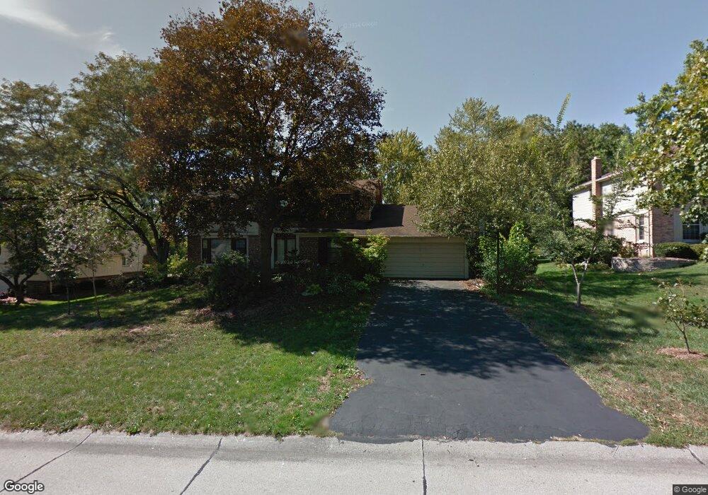
29969 Mayfair Dr Farmington Hills, MI 48331
Estimated Value: $520,793 - $616,000
4
Beds
3
Baths
3,168
Sq Ft
$175/Sq Ft
Est. Value
About This Home
This home is located at 29969 Mayfair Dr, Farmington Hills, MI 48331 and is currently estimated at $554,948, approximately $175 per square foot. 29969 Mayfair Dr is a home located in Oakland County with nearby schools including Forest Elementary School, Warner Upper Elementary School, and North Farmington High School.
Ownership History
Date
Name
Owned For
Owner Type
Purchase Details
Closed on
May 31, 2011
Sold by
Nathanson Stacey Rhona and Nathanson Stacey
Bought by
Nathanson Keith M
Current Estimated Value
Home Financials for this Owner
Home Financials are based on the most recent Mortgage that was taken out on this home.
Original Mortgage
$311,568
Outstanding Balance
$216,594
Interest Rate
4.81%
Mortgage Type
New Conventional
Estimated Equity
$338,354
Purchase Details
Closed on
Jul 31, 1998
Sold by
Donlon James D
Bought by
Nathanson Keith
Home Financials for this Owner
Home Financials are based on the most recent Mortgage that was taken out on this home.
Original Mortgage
$220,000
Interest Rate
6.99%
Mortgage Type
Purchase Money Mortgage
Create a Home Valuation Report for This Property
The Home Valuation Report is an in-depth analysis detailing your home's value as well as a comparison with similar homes in the area
Home Values in the Area
Average Home Value in this Area
Purchase History
| Date | Buyer | Sale Price | Title Company |
|---|---|---|---|
| Nathanson Keith M | -- | Title First Agency | |
| Nathanson Keith | $290,000 | -- |
Source: Public Records
Mortgage History
| Date | Status | Borrower | Loan Amount |
|---|---|---|---|
| Open | Nathanson Keith M | $311,568 | |
| Previous Owner | Nathanson Keith | $220,000 |
Source: Public Records
Tax History Compared to Growth
Tax History
| Year | Tax Paid | Tax Assessment Tax Assessment Total Assessment is a certain percentage of the fair market value that is determined by local assessors to be the total taxable value of land and additions on the property. | Land | Improvement |
|---|---|---|---|---|
| 2024 | $5,407 | $230,790 | $35,000 | $195,790 |
| 2022 | $5,195 | $194,580 | $29,500 | $165,080 |
| 2021 | $5,895 | $182,500 | $29,500 | $153,000 |
| 2020 | $4,918 | $177,820 | $29,500 | $148,320 |
| 2018 | $5,534 | $168,690 | $0 | $0 |
| 2015 | -- | $143,110 | $0 | $0 |
| 2014 | -- | $131,200 | $0 | $0 |
| 2011 | -- | $117,080 | $0 | $0 |
Source: Public Records
Map
Nearby Homes
- 30056 Mayfair Dr
- 29837 High Valley Ct
- 29645 Mayfair Dr
- 29998 Beacontree St
- 29580 Mayfair Dr
- 34023 Glouster Cir
- 34021 Northwick St
- 29342 New Bradford Dr
- 29251 Creek Bend Dr
- 29738 Nova Woods Dr
- 35155 Gary St
- 29260 New Bradford Dr
- 29620 Nova Woods Dr Unit 10
- 35565 Cross Creek N Unit 2
- 31017 Carriage Hill Rd
- 31037 N Park Dr
- 35518 Woodfield Dr
- 35609 Bradford Ct
- 30935 Perrys Crossing
- 35268 Northmont Dr
- 29951 Mayfair Dr
- 29991 Mayfair Dr
- 29929 Mayfair Dr
- 29966 Mayfair Dr
- 29984 Mayfair Dr
- 30015 Mayfair Dr
- 34437 Mayfair Ct
- 29946 Mayfair Dr
- 30002 Mayfair Dr
- 29911 Mayfair Dr
- 34455 Mayfair Ct
- 29920 Mayfair Dr
- 30020 Mayfair Dr
- 29880 High Valley Ct
- 29967 Ravenscroft St
- 29868 High Valley Ct
- 29945 Ravenscroft St
- 29989 Ravenscroft St
- 30038 Mayfair Dr
- 29856 High Valley Ct