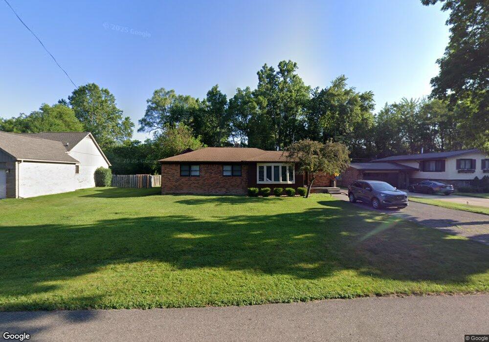
29970 Munger St Livonia, MI 48154
Estimated Value: $341,000 - $377,000
--
Bed
1
Bath
1,611
Sq Ft
$224/Sq Ft
Est. Value
About This Home
This home is located at 29970 Munger St, Livonia, MI 48154 and is currently estimated at $360,336, approximately $223 per square foot. 29970 Munger St is a home located in Wayne County with nearby schools including Riley Upper Elementary School, Buchanan Elementary School, and Holmes Middle School.
Ownership History
Date
Name
Owned For
Owner Type
Purchase Details
Closed on
Aug 18, 2021
Sold by
Cash David and Cash David Scott
Bought by
Gaither Katelyn E and Fredline Evan
Current Estimated Value
Purchase Details
Closed on
Oct 17, 2018
Sold by
Dick Alexander C
Bought by
Cash David
Home Financials for this Owner
Home Financials are based on the most recent Mortgage that was taken out on this home.
Original Mortgage
$223,100
Interest Rate
4.6%
Mortgage Type
New Conventional
Purchase Details
Closed on
Nov 30, 2006
Sold by
Haeger Stephen A
Bought by
Dick Ii Alexander C
Purchase Details
Closed on
Jul 21, 2005
Sold by
Liv Watt Darcee
Bought by
Haeger Stephen A
Create a Home Valuation Report for This Property
The Home Valuation Report is an in-depth analysis detailing your home's value as well as a comparison with similar homes in the area
Home Values in the Area
Average Home Value in this Area
Purchase History
| Date | Buyer | Sale Price | Title Company |
|---|---|---|---|
| Gaither Katelyn E | $297,000 | Fidelity National Title | |
| Cash David | $230,000 | None Available | |
| Cash David | $230,000 | First National Title | |
| Dick Ii Alexander C | $217,000 | Title Source Inc | |
| Haeger Stephen A | -- | None Available |
Source: Public Records
Mortgage History
| Date | Status | Borrower | Loan Amount |
|---|---|---|---|
| Previous Owner | Cash David | $223,100 |
Source: Public Records
Tax History Compared to Growth
Tax History
| Year | Tax Paid | Tax Assessment Tax Assessment Total Assessment is a certain percentage of the fair market value that is determined by local assessors to be the total taxable value of land and additions on the property. | Land | Improvement |
|---|---|---|---|---|
| 2025 | $2,898 | $152,800 | $0 | $0 |
| 2024 | $2,898 | $142,000 | $0 | $0 |
| 2023 | $2,765 | $133,700 | $0 | $0 |
| 2022 | $4,855 | $118,900 | $0 | $0 |
| 2021 | $4,542 | $113,300 | $0 | $0 |
| 2019 | $4,357 | $107,300 | $0 | $0 |
| 2018 | $1,627 | $89,000 | $0 | $0 |
| 2017 | $2,879 | $87,000 | $0 | $0 |
| 2016 | $2,966 | $84,800 | $0 | $0 |
| 2015 | $7,180 | $76,240 | $0 | $0 |
| 2012 | -- | $70,570 | $18,800 | $51,770 |
Source: Public Records
Map
Nearby Homes
- 29945 6 Mile Rd
- 30115 Munger Dr
- 30425 Munger Dr
- 29766 Puritan St
- 29836 Bobrich St
- 31069 Munger Dr
- 15608 Hidden Ln
- 29106 Broadmoor St
- 31366 Mayville St
- 29721 Pickford St
- 31005 Roycroft St
- 15345 Bainbridge St
- 28692 Bayberry Park Dr
- 29760 Hoy St
- 18659 Flamingo Blvd
- 29560 Clarita St Unit 11
- 18725 Flamingo Blvd
- 18061 Lathers St
- 18872 Hillcrest St
- 15600 Auburndale St
- 29970 Munger Dr
- 29998 Munger Dr
- 29998 Munger St
- 29960 Munger St
- 30024 Munger St
- 30009 Munger St
- 29950 Munger St
- 0 Munger Dr Unit 3253616
- 0 Munger Dr Unit 3258900
- 29930 Munger Dr
- 16904 Oporto St
- 29963 Munger Dr
- 16928 Oporto St
- 16944 Oporto St
- 29931 Munger Dr
- 29900 Munger Dr
- 29991 Munger St
- 16978 Oporto St
- 29860 Munger St
- 16905 Oporto St