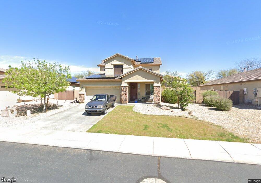
29981 N 72nd Ln Peoria, AZ 85383
Estimated Value: $582,743 - $599,000
5
Beds
3
Baths
2,437
Sq Ft
$242/Sq Ft
Est. Value
About This Home
This home is located at 29981 N 72nd Ln, Peoria, AZ 85383 and is currently estimated at $590,186, approximately $242 per square foot. 29981 N 72nd Ln is a home located in Maricopa County with nearby schools including Copper Creek Elementary School, Hillcrest Middle School, and Mountain Ridge High School.
Ownership History
Date
Name
Owned For
Owner Type
Purchase Details
Closed on
Jul 18, 2023
Sold by
Brazel Traci Michelle
Bought by
Brazel Matthew Wayne
Current Estimated Value
Home Financials for this Owner
Home Financials are based on the most recent Mortgage that was taken out on this home.
Original Mortgage
$396,900
Outstanding Balance
$387,432
Interest Rate
6.79%
Mortgage Type
New Conventional
Estimated Equity
$202,754
Purchase Details
Closed on
Mar 13, 2006
Sold by
First American Title Insurance Co
Bought by
Brazel Matthew Wayne and Brazel Traci Michelle
Home Financials for this Owner
Home Financials are based on the most recent Mortgage that was taken out on this home.
Original Mortgage
$296,400
Interest Rate
6.29%
Mortgage Type
New Conventional
Create a Home Valuation Report for This Property
The Home Valuation Report is an in-depth analysis detailing your home's value as well as a comparison with similar homes in the area
Home Values in the Area
Average Home Value in this Area
Purchase History
| Date | Buyer | Sale Price | Title Company |
|---|---|---|---|
| Brazel Matthew Wayne | -- | Lawyers Title Of Arizona | |
| Brazel Matthew Wayne | $370,518 | First American Title Ins Co |
Source: Public Records
Mortgage History
| Date | Status | Borrower | Loan Amount |
|---|---|---|---|
| Open | Brazel Matthew Wayne | $396,900 | |
| Previous Owner | Brazel Matthew Wayne | $296,400 |
Source: Public Records
Tax History Compared to Growth
Tax History
| Year | Tax Paid | Tax Assessment Tax Assessment Total Assessment is a certain percentage of the fair market value that is determined by local assessors to be the total taxable value of land and additions on the property. | Land | Improvement |
|---|---|---|---|---|
| 2025 | $2,332 | $28,277 | -- | -- |
| 2024 | $2,270 | $26,931 | -- | -- |
| 2023 | $2,270 | $40,830 | $8,160 | $32,670 |
| 2022 | $2,185 | $31,310 | $6,260 | $25,050 |
| 2021 | $2,293 | $29,410 | $5,880 | $23,530 |
| 2020 | $2,255 | $27,170 | $5,430 | $21,740 |
| 2019 | $2,191 | $26,050 | $5,210 | $20,840 |
| 2018 | $2,095 | $24,970 | $4,990 | $19,980 |
| 2017 | $2,024 | $23,200 | $4,640 | $18,560 |
| 2016 | $1,891 | $22,570 | $4,510 | $18,060 |
| 2015 | $1,757 | $22,310 | $4,460 | $17,850 |
Source: Public Records
Map
Nearby Homes
- 7336 W Desert Mirage Dr
- 7034 W Lone Tree Trail
- 30341 N 73rd Ln
- 7383 W Milton Dr
- 7351 W Palo Brea Ln
- 7039 W Katharine Way
- 7350 W Montgomery Rd
- 29247 N 70th Ave
- 29067 N 71st Ave
- 29433 N 68th Ln
- 29374 N 68th Ln
- 29058 N 71st Ave Unit 45
- 28995 N 71st Ave
- 29024 N 70th Ave
- 6807 W Palo Brea Ln
- 28894 N Chalfen Blvd Unit 21
- 29356 N 67th Ave
- 29051 N 69th Ave
- 29339 N 67th Ave
- 6858 W Peak View Rd
- 29993 N 72nd Ln
- 29969 N 72nd Ln
- 29986 N 72nd Dr
- 29996 N 72nd Dr
- 7267 W Eagle Ridge Ln
- 29976 N 72nd Dr
- 7258 W Lone Tree Trail
- 7242 W Lone Tree Trail
- 29968 N 72nd Ln
- 7226 W Lone Tree Trail
- 7279 W Eagle Ridge Ln
- 7238 W Eagle Ridge Ln
- 7226 W Eagle Ridge Ln
- 7250 W Eagle Ridge Ln
- 7210 W Lone Tree Trail
- 7262 W Eagle Ridge Ln
- 7214 W Eagle Ridge Ln
- 7274 W Eagle Ridge Ln
- 7194 W Lone Tree Trail
- 29908 N 72nd Ln