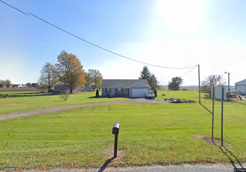
29988 State Route 67 Waynesfield, OH 45896
Estimated Value: $247,000 - $268,000
3
Beds
2
Baths
1,280
Sq Ft
$200/Sq Ft
Est. Value
About This Home
This home is located at 29988 State Route 67, Waynesfield, OH 45896 and is currently estimated at $256,488, approximately $200 per square foot. 29988 State Route 67 is a home located in Auglaize County with nearby schools including Waynesfield-Goshen Local Elementary School and Waynesfield-Goshen Local High School.
Ownership History
Date
Name
Owned For
Owner Type
Purchase Details
Closed on
Aug 7, 2025
Sold by
Martinez Miguel A and Martinez Brisa
Bought by
Arevalo Jerel and Arevalo Janneth
Current Estimated Value
Home Financials for this Owner
Home Financials are based on the most recent Mortgage that was taken out on this home.
Original Mortgage
$245,471
Outstanding Balance
$245,256
Interest Rate
6.67%
Mortgage Type
FHA
Estimated Equity
$11,232
Purchase Details
Closed on
Feb 10, 2017
Sold by
Engle Jason E and Engle Linda A
Bought by
Martinez Miguel A
Home Financials for this Owner
Home Financials are based on the most recent Mortgage that was taken out on this home.
Original Mortgage
$118,097
Interest Rate
4.32%
Mortgage Type
Purchase Money Mortgage
Purchase Details
Closed on
Feb 16, 2011
Sold by
Estate Of Nelson H Ulrey
Bought by
Ulrey Cora E
Purchase Details
Closed on
Jun 10, 1994
Sold by
Ulrey Frank A
Bought by
Ulrey Nelson H
Create a Home Valuation Report for This Property
The Home Valuation Report is an in-depth analysis detailing your home's value as well as a comparison with similar homes in the area
Purchase History
| Date | Buyer | Sale Price | Title Company |
|---|---|---|---|
| Arevalo Jerel | $250,000 | Scout Title | |
| Martinez Miguel A | $121,766 | Kilco Title | |
| Ulrey Cora E | -- | None Available | |
| Ulrey Nelson H | $5,000 | -- |
Source: Public Records
Mortgage History
| Date | Status | Borrower | Loan Amount |
|---|---|---|---|
| Open | Arevalo Jerel | $245,471 | |
| Previous Owner | Martinez Miguel A | $118,097 |
Source: Public Records
Tax History
| Year | Tax Paid | Tax Assessment Tax Assessment Total Assessment is a certain percentage of the fair market value that is determined by local assessors to be the total taxable value of land and additions on the property. | Land | Improvement |
|---|---|---|---|---|
| 2025 | $5,003 | $79,530 | $7,830 | $71,700 |
| 2024 | $5,003 | $79,530 | $7,830 | $71,700 |
| 2023 | $2,847 | $79,530 | $7,830 | $71,700 |
| 2022 | $2,264 | $54,100 | $7,240 | $46,860 |
| 2021 | $1,126 | $54,100 | $7,240 | $46,860 |
| 2020 | $1,129 | $54,100 | $7,238 | $46,862 |
| 2019 | $1,843 | $45,087 | $6,034 | $39,053 |
| 2018 | $1,793 | $45,087 | $6,034 | $39,053 |
| 2017 | $1,770 | $45,087 | $6,034 | $39,053 |
| 2016 | $1,579 | $41,489 | $5,747 | $35,742 |
| 2015 | $67 | $3,280 | $3,129 | $151 |
| 2014 | $129 | $3,280 | $3,129 | $151 |
| 2013 | $209 | $4,999 | $4,848 | $151 |
Source: Public Records
Map
Nearby Homes
- 211 E Wapakoneta St
- 25836 Ohio 67
- 105 Guthrie St
- 25353 Buckland Holden Rd
- 15527 State Route 235
- 11475 Township Road 293 Unit 330
- 14606 Beech Ave
- 16235 Maple Ave
- 11588 Blackhawk Path
- 11298 Northlake Dr
- 11377 Township Road 266 Unit 99
- 11377 Township Road 266 Unit 34
- 11377 Township Road 266 Unit 28
- 11377 Township Road 266 Unit 109
- 11377 Township Rd 266 Unit 66
- 11377 Township Rd 266 Unit 59
- 16074 Buckeye Ave
- 11571 Mohawk Path
- 11262 Northlake Dr
- 9371 Sassafras Dr
- 29988 State Route 67
- 17031 County Road 15
- 29996 State Route 67
- 29898 Ohio 67
- 29898 State Route 67
- 29965 State Route 67
- 29983 State Route 67
- 29878 State Route 67
- 17002 State Route 117
- 14872 County Road 15
- 17106 State Route 117
- 15017 State Route 117
- 17233 State Route 117
- 14888 State Route 117
- 29772 Ohio 67
- 15104 Bellfontaine Rd
- 17313 State Route 117
- 14508 County Road 15
- 15265 State Route 117
Your Personal Tour Guide
Ask me questions while you tour the home.