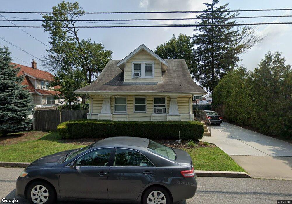
2A Denton Place Farmingdale, NY 11735
Estimated Value: $520,107 - $834,000
2
Beds
1
Bath
1,282
Sq Ft
$583/Sq Ft
Est. Value
About This Home
This home is located at 2A Denton Place, Farmingdale, NY 11735 and is currently estimated at $747,027, approximately $582 per square foot. 2A Denton Place is a home located in Suffolk County with nearby schools including Saltzman East Memorial Elementary School, Weldon E. Howitt Middle School, and Farmingdale Senior High School.
Ownership History
Date
Name
Owned For
Owner Type
Purchase Details
Closed on
Jul 12, 2006
Current Estimated Value
Create a Home Valuation Report for This Property
The Home Valuation Report is an in-depth analysis detailing your home's value as well as a comparison with similar homes in the area
Home Values in the Area
Average Home Value in this Area
Purchase History
| Date | Buyer | Sale Price | Title Company |
|---|---|---|---|
| -- | -- | -- |
Source: Public Records
Tax History Compared to Growth
Tax History
| Year | Tax Paid | Tax Assessment Tax Assessment Total Assessment is a certain percentage of the fair market value that is determined by local assessors to be the total taxable value of land and additions on the property. | Land | Improvement |
|---|---|---|---|---|
| 2024 | $8,958 | $2,340 | $370 | $1,970 |
| 2023 | $8,958 | $2,340 | $370 | $1,970 |
| 2022 | $7,638 | $2,340 | $370 | $1,970 |
| 2021 | $7,638 | $2,340 | $370 | $1,970 |
| 2020 | $7,906 | $2,340 | $370 | $1,970 |
| 2019 | $7,906 | $0 | $0 | $0 |
| 2018 | $7,448 | $2,340 | $370 | $1,970 |
| 2017 | $7,448 | $2,340 | $370 | $1,970 |
| 2016 | $7,448 | $2,340 | $370 | $1,970 |
| 2015 | -- | $2,340 | $370 | $1,970 |
| 2014 | -- | $2,340 | $370 | $1,970 |
Source: Public Records
Map
Nearby Homes
- 290 Eastern Pkwy
- 82 Jervis Ave Unit 82
- 98 Jervis Ave Unit 98
- 114 Jervis Ave
- 159 Oakview Ave
- 19 Ivy St
- 18 Cedar Ave
- 76 Balcom Rd
- 18 Wall St
- 18 Ivy St Unit 1B
- 45 Cedar Ave
- 591 Conklin St
- 65 Sullivan Rd
- 32 Beechwood St
- 457 Secatogue Ave
- 63 Cedar Ave
- 23 Avenue I
- 29 Manetto Rd
- 7 Dogwood St
- 530 Melville Rd
- 2 Denton Place
- 4 Denton Place
- 6 Denton Place
- 785 Conklin St
- 8 Denton Place
- 1 Denton Place
- 781 Conklin St
- 1 Maplewood Ave
- 3 Maplewood Ave
- 5 Denton Place
- 5 Maplewood Ave
- 7 Denton Place
- 793 Conklin St
- 11 Denton Place
- 10 Dean St
- 826 Conklin St Unit B
- 826 Conklin St
- 826 Conklin St Unit C
- 775 Conklin St
- 795 Conklin St