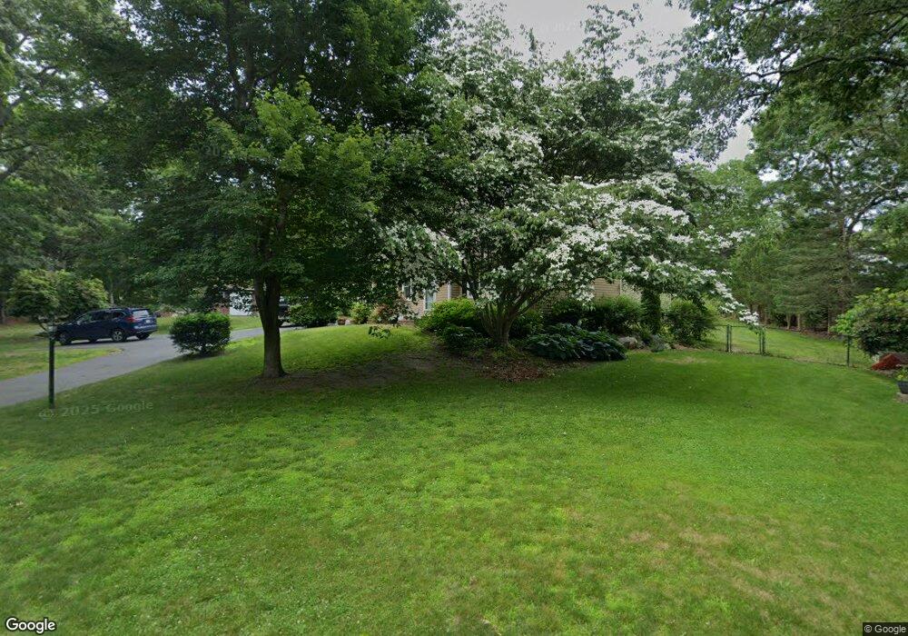
2A Robinwood Rd Buzzards Bay, MA 02532
Estimated Value: $588,000 - $669,000
2
Beds
3
Baths
1,700
Sq Ft
$370/Sq Ft
Est. Value
About This Home
This home is located at 2A Robinwood Rd, Buzzards Bay, MA 02532 and is currently estimated at $628,877, approximately $369 per square foot. 2A Robinwood Rd is a home with nearby schools including St Margaret Regional School.
Ownership History
Date
Name
Owned For
Owner Type
Purchase Details
Closed on
Mar 21, 2024
Sold by
Evans Cheryl R and Evans David C
Bought by
Evans Ft and Evans
Current Estimated Value
Purchase Details
Closed on
May 25, 1999
Sold by
Byrne Kimberly A
Bought by
Evans David C and Evans Cheryl R
Home Financials for this Owner
Home Financials are based on the most recent Mortgage that was taken out on this home.
Original Mortgage
$161,100
Interest Rate
6.88%
Mortgage Type
Purchase Money Mortgage
Purchase Details
Closed on
Mar 22, 1993
Sold by
Sime Sb Of Ny Fsb
Bought by
Gallagher Kimberly A
Home Financials for this Owner
Home Financials are based on the most recent Mortgage that was taken out on this home.
Original Mortgage
$105,000
Interest Rate
7.75%
Mortgage Type
Purchase Money Mortgage
Purchase Details
Closed on
Nov 5, 1992
Sold by
Orne Anthony R
Bought by
Dime Sb Of Ny Fsb
Create a Home Valuation Report for This Property
The Home Valuation Report is an in-depth analysis detailing your home's value as well as a comparison with similar homes in the area
Purchase History
| Date | Buyer | Sale Price | Title Company |
|---|---|---|---|
| Evans Ft | -- | None Available | |
| Evans David C | $179,000 | -- | |
| Gallagher Kimberly A | $120,000 | -- | |
| Dime Sb Of Ny Fsb | $114,544 | -- |
Source: Public Records
Mortgage History
| Date | Status | Borrower | Loan Amount |
|---|---|---|---|
| Previous Owner | Dime Sb Of Ny Fsb | $161,100 | |
| Previous Owner | Dime Sb Of Ny Fsb | $98,700 | |
| Previous Owner | Dime Sb Of Ny Fsb | $105,000 |
Source: Public Records
Tax History
| Year | Tax Paid | Tax Assessment Tax Assessment Total Assessment is a certain percentage of the fair market value that is determined by local assessors to be the total taxable value of land and additions on the property. | Land | Improvement |
|---|---|---|---|---|
| 2025 | $6,088 | $554,500 | $161,100 | $393,400 |
| 2024 | $6,150 | $526,500 | $129,100 | $397,400 |
| 2023 | $5,362 | $467,300 | $117,300 | $350,000 |
| 2022 | $5,362 | $393,700 | $117,300 | $276,400 |
| 2021 | $5,331 | $380,800 | $117,300 | $263,500 |
| 2020 | $5,044 | $367,900 | $117,300 | $250,600 |
| 2019 | $5,085 | $375,000 | $133,500 | $241,500 |
| 2018 | $4,781 | $340,500 | $133,500 | $207,000 |
| 2017 | $4,704 | $336,500 | $133,500 | $203,000 |
| 2016 | $4,932 | $350,000 | $160,200 | $189,800 |
| 2015 | $4,396 | $320,900 | $140,300 | $180,600 |
| 2014 | $4,226 | $318,000 | $140,300 | $177,700 |
Source: Public Records
Map
Nearby Homes
- 36B Starboard Dr Unit 36E
- 36B Starboard Dr Unit 36G
- 36B Starboard Dr Unit 36C
- 36B Starboard Dr Unit 36A
- 36B Starboard Dr Unit 36D
- 36B Starboard Dr Unit 36B
- 36B Starboard Dr Unit 36F
- 36B Starboard Dr Unit 36H
- 23 Starboard Dr Unit Lot 50
- 32 Carleton St Unit 32
- 3 Carleton St Unit 3
- 3 Fairway Dr Unit F
- 0 Broad St Off Unit 72362523
- 35 Locust St
- 35 Locust St
- 13 Bay Pointe Drive Extension Unit 13
- 3132 Cranberry Hwy Unit 59
- 22 Long Neck Rd
- 38 Amos Way
- 12 Beacon St Unit 84
