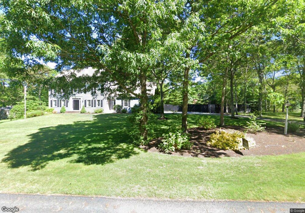
2A Vanbuskirk Way Sandwich, MA 02563
Estimated Value: $993,788 - $1,351,000
4
Beds
3
Baths
2,948
Sq Ft
$394/Sq Ft
Est. Value
About This Home
This home is located at 2A Vanbuskirk Way, Sandwich, MA 02563 and is currently estimated at $1,160,447, approximately $393 per square foot. 2A Vanbuskirk Way is a home located in Barnstable County with nearby schools including Sandwich Middle High School and Sandwich Montessori School.
Ownership History
Date
Name
Owned For
Owner Type
Purchase Details
Closed on
Jan 14, 2005
Sold by
R W Anderson & Sons In
Bought by
Finn Amy Jean and Finn Timothy Edward
Current Estimated Value
Home Financials for this Owner
Home Financials are based on the most recent Mortgage that was taken out on this home.
Original Mortgage
$330,000
Outstanding Balance
$167,272
Interest Rate
5.81%
Mortgage Type
Purchase Money Mortgage
Estimated Equity
$993,175
Purchase Details
Closed on
Jun 20, 2003
Sold by
Vanbuskirk Clarence R
Bought by
Rw Anderson & Sons Inc
Create a Home Valuation Report for This Property
The Home Valuation Report is an in-depth analysis detailing your home's value as well as a comparison with similar homes in the area
Purchase History
| Date | Buyer | Sale Price | Title Company |
|---|---|---|---|
| Finn Amy Jean | $635,000 | -- | |
| Rw Anderson & Sons Inc | $150,000 | -- |
Source: Public Records
Mortgage History
| Date | Status | Borrower | Loan Amount |
|---|---|---|---|
| Open | Finn Amy Jean | $330,000 |
Source: Public Records
Tax History
| Year | Tax Paid | Tax Assessment Tax Assessment Total Assessment is a certain percentage of the fair market value that is determined by local assessors to be the total taxable value of land and additions on the property. | Land | Improvement |
|---|---|---|---|---|
| 2025 | $9,645 | $912,500 | $190,900 | $721,600 |
| 2024 | $9,667 | $895,100 | $170,500 | $724,600 |
| 2023 | $9,465 | $823,000 | $155,000 | $668,000 |
| 2022 | $8,833 | $671,200 | $138,400 | $532,800 |
| 2021 | $8,402 | $610,200 | $137,700 | $472,500 |
| 2020 | $8,450 | $590,500 | $137,600 | $452,900 |
| 2019 | $7,929 | $553,700 | $135,100 | $418,600 |
| 2018 | $8,144 | $516,800 | $123,200 | $393,600 |
| 2017 | $7,249 | $485,500 | $119,200 | $366,300 |
| 2016 | $6,885 | $475,800 | $115,300 | $360,500 |
| 2015 | $6,983 | $471,200 | $93,800 | $377,400 |
Source: Public Records
Map
Nearby Homes
- 28 Spinnaker St
- 58 Southpoint Dr Unit J
- 113 Farmersville Rd
- 33 Easterly Dr
- 9 Viking Ln
- 185 Cotuit Rd Unit JP1
- 185 Cotuit Rd Unit C5 Aspen
- 93 Deerfield Rd
- 46 Kensington Dr
- 36 Moon Compass Ln
- 2 Open Space Dr
- 10 Wintergreen Ln
- 86 Greenville Dr
- 7 Hunter's Trail
- 48 Holly Ridge Dr
- 17 Kensington Dr
- 82 Old Fields Rd
- 24 East Rd
- 24 Widow Coombs Walk
- 5 Bluestone Terrace
- 1 Vanbuskirk Way
- 2 Vanbuskirk Way
- 163 Farmersville Rd
- 160 Farmersville Rd
- 3 Vanbuskirk Way
- 165 Farmersville Rd
- 151 Farmersville Rd
- 2 Agnus Rd
- 4 Agnus Rd
- 150 Farmersville Rd
- 167 Farmersville Rd
- 1 Fox Bottom Cir
- 4 Vanbuskirk Way
- 147 Farmersville Rd
- 34 Spinnaker St
- 6 Agnus Rd
- 6 Agnus St
- 168 Farmersville Rd
- 3 Agnus St
- 38 Spinnaker St
Your Personal Tour Guide
Ask me questions while you tour the home.