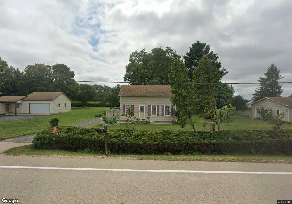
2S022 Harter Rd Elburn, IL 60119
Estimated Value: $252,000 - $285,000
3
Beds
2
Baths
950
Sq Ft
$288/Sq Ft
Est. Value
About This Home
This home is located at 2S022 Harter Rd, Elburn, IL 60119 and is currently estimated at $274,050, approximately $288 per square foot. 2S022 Harter Rd is a home located in Kane County with nearby schools including Kaneland Blackberry Creek Elementary School, Harter Middle School, and Kaneland Senior High School.
Ownership History
Date
Name
Owned For
Owner Type
Purchase Details
Closed on
Mar 14, 2014
Sold by
Lewis Trisha A
Bought by
Diehl Grogory A
Current Estimated Value
Home Financials for this Owner
Home Financials are based on the most recent Mortgage that was taken out on this home.
Original Mortgage
$147,500
Outstanding Balance
$111,842
Interest Rate
4.35%
Mortgage Type
New Conventional
Estimated Equity
$162,208
Purchase Details
Closed on
May 2, 2010
Sold by
Walsh James R and Walsh Mary T
Bought by
Lewis Trisha A
Home Financials for this Owner
Home Financials are based on the most recent Mortgage that was taken out on this home.
Original Mortgage
$166,754
Interest Rate
5.25%
Mortgage Type
FHA
Purchase Details
Closed on
Feb 26, 1999
Sold by
Lafortune David B and Lafortune Angelina M
Bought by
Walsh James R and Walsh Mary T
Home Financials for this Owner
Home Financials are based on the most recent Mortgage that was taken out on this home.
Original Mortgage
$140,500
Interest Rate
6.92%
Create a Home Valuation Report for This Property
The Home Valuation Report is an in-depth analysis detailing your home's value as well as a comparison with similar homes in the area
Home Values in the Area
Average Home Value in this Area
Purchase History
| Date | Buyer | Sale Price | Title Company |
|---|---|---|---|
| Diehl Grogory A | $157,500 | First American Title | |
| Lewis Trisha A | $169,000 | Multiple | |
| Walsh James R | $140,500 | Law Title |
Source: Public Records
Mortgage History
| Date | Status | Borrower | Loan Amount |
|---|---|---|---|
| Open | Diehl Grogory A | $147,500 | |
| Previous Owner | Lewis Trisha A | $166,754 | |
| Previous Owner | Walsh James R | $140,500 |
Source: Public Records
Tax History Compared to Growth
Tax History
| Year | Tax Paid | Tax Assessment Tax Assessment Total Assessment is a certain percentage of the fair market value that is determined by local assessors to be the total taxable value of land and additions on the property. | Land | Improvement |
|---|---|---|---|---|
| 2024 | $5,007 | $70,432 | $23,516 | $46,916 |
| 2023 | $4,952 | $65,616 | $21,908 | $43,708 |
| 2022 | $4,781 | $60,165 | $20,088 | $40,077 |
| 2021 | $4,623 | $57,657 | $19,251 | $38,406 |
| 2020 | $4,496 | $55,669 | $18,587 | $37,082 |
| 2019 | $4,391 | $53,446 | $17,845 | $35,601 |
| 2018 | $4,079 | $48,716 | $16,266 | $32,450 |
| 2017 | $3,771 | $44,567 | $14,881 | $29,686 |
| 2016 | $3,486 | $40,596 | $13,555 | $27,041 |
| 2015 | -- | $37,904 | $12,656 | $25,248 |
| 2014 | -- | $37,904 | $12,656 | $25,248 |
| 2013 | -- | $40,872 | $13,647 | $27,225 |
Source: Public Records
Map
Nearby Homes
- 2S114 Harter Rd
- 2S234 Harter Rd
- 0N119 Dauberman Rd
- 44W301 Main St
- Lot 37 Houtz Cir
- Lot 84 Houtz Cir
- 18-acres Rt 47 - Hughes Rd
- 43W714 Willow Creek Ct Unit 4
- Willow Creek Lot 60 Willow Creek Dr
- 165 Schneider Rd
- 000 Finley Rd
- 00 Rt 38 Rd
- 44W700 Rowe Rd
- LOT 7 Rowe Rd
- 48W201 Keslinger Rd
- 43W690 Marian Cir
- 44W099 Finley Rd
- Lot #7 Derek Dr
- 12 Derek Dr
- 16 Derek Dr
- 2S022 Harter Rd
- 2S040 Harter Rd
- 2S004 Harter Rd
- 2s Harter Rd
- 2S391 Harter Rd
- 1S952 Harter Rd
- 46W726 Main St
- 46W726 Main Street Rd
- 46W786 Main Street Rd
- 46W798 Main Street Rd
- 46W826 Main Street Rd
- 46W765 Main Street Rd
- 46W691 Main Street Rd
- 46W785 Main Street Rd
- 46W634 Main Street Rd
- 46W797 Main Street Rd
- 46W622 Main St
- 1S890 Harter Rd
- 46W747 W Main St