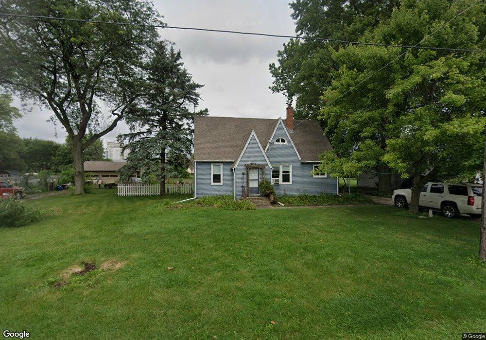
2S265 Harter Rd Elburn, IL 60119
Estimated Value: $301,000 - $328,000
4
Beds
1
Bath
1,530
Sq Ft
$205/Sq Ft
Est. Value
About This Home
This home is located at 2S265 Harter Rd, Elburn, IL 60119 and is currently estimated at $313,863, approximately $205 per square foot. 2S265 Harter Rd is a home located in Kane County with nearby schools including Kaneland Blackberry Creek Elementary School, Harter Middle School, and Kaneland High School.
Ownership History
Date
Name
Owned For
Owner Type
Purchase Details
Closed on
Oct 26, 2018
Sold by
Olson Dwight and Olson Laurie
Bought by
Chase Brittany
Current Estimated Value
Home Financials for this Owner
Home Financials are based on the most recent Mortgage that was taken out on this home.
Original Mortgage
$166,500
Outstanding Balance
$145,802
Interest Rate
4.6%
Mortgage Type
New Conventional
Estimated Equity
$168,061
Purchase Details
Closed on
Oct 31, 2013
Sold by
Heinberg Karen and Nier Myron L
Bought by
Olson Dwight and Olson Laurie
Purchase Details
Closed on
Aug 10, 2010
Sold by
Nier Myron L and Nier Lenore S
Bought by
Nier Myron L and Nier Lenore S
Purchase Details
Closed on
Nov 13, 2008
Sold by
Nier Sharon
Bought by
Heinberg Karen and Nier Myron
Purchase Details
Closed on
Jul 1, 1996
Sold by
Nier Doris M
Bought by
Heinberg Karen and Nier Eugene A
Create a Home Valuation Report for This Property
The Home Valuation Report is an in-depth analysis detailing your home's value as well as a comparison with similar homes in the area
Home Values in the Area
Average Home Value in this Area
Purchase History
| Date | Buyer | Sale Price | Title Company |
|---|---|---|---|
| Chase Brittany | $185,000 | American Title Guaranty | |
| Olson Dwight | $145,000 | Chicago Title Insurance Comp | |
| Nier Myron L | -- | None Available | |
| Heinberg Karen | $60,000 | Chicago Title Insurance Co | |
| Heinberg Karen | -- | -- |
Source: Public Records
Mortgage History
| Date | Status | Borrower | Loan Amount |
|---|---|---|---|
| Open | Chase Brittany | $166,500 |
Source: Public Records
Tax History Compared to Growth
Tax History
| Year | Tax Paid | Tax Assessment Tax Assessment Total Assessment is a certain percentage of the fair market value that is determined by local assessors to be the total taxable value of land and additions on the property. | Land | Improvement |
|---|---|---|---|---|
| 2024 | $5,976 | $82,509 | $23,516 | $58,993 |
| 2023 | $5,919 | $76,867 | $21,908 | $54,959 |
| 2022 | $5,692 | $70,481 | $20,088 | $50,393 |
| 2021 | $5,508 | $67,543 | $19,251 | $48,292 |
| 2020 | $5,360 | $65,214 | $18,587 | $46,627 |
| 2019 | $5,239 | $62,610 | $17,845 | $44,765 |
| 2018 | $5,449 | $57,069 | $16,266 | $40,803 |
| 2017 | $5,105 | $52,209 | $14,881 | $37,328 |
| 2016 | $4,792 | $47,558 | $13,555 | $34,003 |
| 2015 | -- | $44,405 | $12,656 | $31,749 |
| 2014 | -- | $44,405 | $12,656 | $31,749 |
| 2013 | -- | $47,881 | $13,647 | $34,234 |
Source: Public Records
Map
Nearby Homes
- 0N119 Dauberman Rd
- 000 Finley Rd
- 3S520 Marian Ln
- 165 Schneider Rd
- 43W690 Marian Cir
- 44W099 Finley Rd
- 2S227 Green Rd
- LOT 7 Rowe Rd
- 44W700 Rowe Rd
- Lot 9 Rowe Rd
- 00 Rt 38 Rd
- 43W493 Thornapple Tree Rd
- 48W201 Keslinger Rd
- Lot #7 Derek Dr
- 16 Derek Dr
- 12 Derek Dr
- 6 Derek Dr
- 5 Derek Dr
- 4 Derek Dr
- 11 Derek Dr
- 2S273 Harter Rd
- 2S251 Harter Rd
- 2S272 Harter Rd
- 2S286 Harter Rd
- 2S243 Harter Rd
- 2S256 Harter Rd
- 2S316 Harter Rd
- 2S246 Harter Rd
- 2S225 Harter Rd
- 2S225 Harter Rd
- 2S324 Harter Rd
- 2S222 Harter Rd
- 2S330 Harter Rd
- 46W587 Lovell St
- 2S327 Merrill Ave
- 2S327 Merril Rd
- 2S295 Merrill Ave
- 46W600 Locust St
- 46W620 Locust St