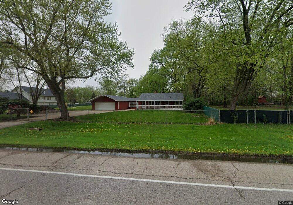
2S280 State Route 59 Warrenville, IL 60555
Estimated Value: $305,258 - $474,000
--
Bed
--
Bath
1,750
Sq Ft
$225/Sq Ft
Est. Value
About This Home
This home is located at 2S280 State Route 59, Warrenville, IL 60555 and is currently estimated at $393,315, approximately $224 per square foot. 2S280 State Route 59 is a home located in DuPage County with nearby schools including Clifford Johnson School, Hubble Middle School, and Wheaton Warrenville South High School.
Ownership History
Date
Name
Owned For
Owner Type
Purchase Details
Closed on
Mar 23, 2023
Sold by
Martin Carol M
Bought by
Martin Carol M and Brown Cindy Lynn
Current Estimated Value
Purchase Details
Closed on
May 7, 2007
Sold by
Chicago Title Land Trust Co
Bought by
Martin James C and Martin Carol M
Create a Home Valuation Report for This Property
The Home Valuation Report is an in-depth analysis detailing your home's value as well as a comparison with similar homes in the area
Home Values in the Area
Average Home Value in this Area
Purchase History
| Date | Buyer | Sale Price | Title Company |
|---|---|---|---|
| Martin Carol M | -- | None Listed On Document | |
| Martin James C | -- | None Available |
Source: Public Records
Tax History Compared to Growth
Tax History
| Year | Tax Paid | Tax Assessment Tax Assessment Total Assessment is a certain percentage of the fair market value that is determined by local assessors to be the total taxable value of land and additions on the property. | Land | Improvement |
|---|---|---|---|---|
| 2024 | $4,511 | $77,607 | $42,603 | $35,004 |
| 2023 | $4,192 | $70,880 | $38,910 | $31,970 |
| 2022 | $4,255 | $66,260 | $36,370 | $29,890 |
| 2021 | $4,015 | $63,510 | $34,860 | $28,650 |
| 2020 | $3,894 | $61,580 | $33,800 | $27,780 |
| 2019 | $3,688 | $58,640 | $32,190 | $26,450 |
| 2018 | $3,909 | $61,450 | $30,080 | $31,370 |
| 2017 | $3,773 | $58,390 | $28,580 | $29,810 |
| 2016 | $3,586 | $54,440 | $26,650 | $27,790 |
| 2015 | $3,404 | $50,390 | $24,670 | $25,720 |
| 2014 | $4,374 | $60,640 | $23,280 | $37,360 |
| 2013 | $4,421 | $62,860 | $24,130 | $38,730 |
Source: Public Records
Map
Nearby Homes
- 2S283 Illinois Route 59
- 29W715 Branch Ave
- 2S452 Riverside Ave
- 30W151 Arlington Ct
- 29W749 Hurlingham Dr
- 2S030 Essex Ln
- 30W105 Maplewood Dr
- 2S467 Cherice Dr
- 30W274 Bedford Ln
- 30W021 Danbury Dr Unit 2A
- 2S547 Continental Dr
- 2S590 Seraph Holmes Ct
- 2S723 Winchester Cir E Unit 4
- 29W574 Winchester Cir N Unit 1
- 2S739 Winchester Cir E Unit 1
- 2S708 Timber Dr
- Lot 1 Elizabeth St
- 3S072 Timber Dr Unit 9C
- 3S054 Timber Dr Unit 11A
- 2S778 Timber Dr Unit 778
- 2S254 State Route 59
- 2S254 Illinois Rte 59
- 2S310 State Route 59
- 29W700 Waverly Ave
- 29W650 Ridge Dr
- 2S281 Riverside Ave
- 2S269 Riverside Ave
- 29W640 Ridge Dr
- 2S309 Riverside Ave
- 2S255 Riverside Ave
- 2S309 Riverside Ave
- 2S323 Riverside Ave
- 29W740 Waverly Ave
- 2S241 Riverside Ave
- 2S330 River Oaks Dr
- 29W630 Ridge Dr
- 29 Ridge Dr
- 29W701 Waverly Ave
- 2S216 State Route 59
- 29W715 Waverly Ave