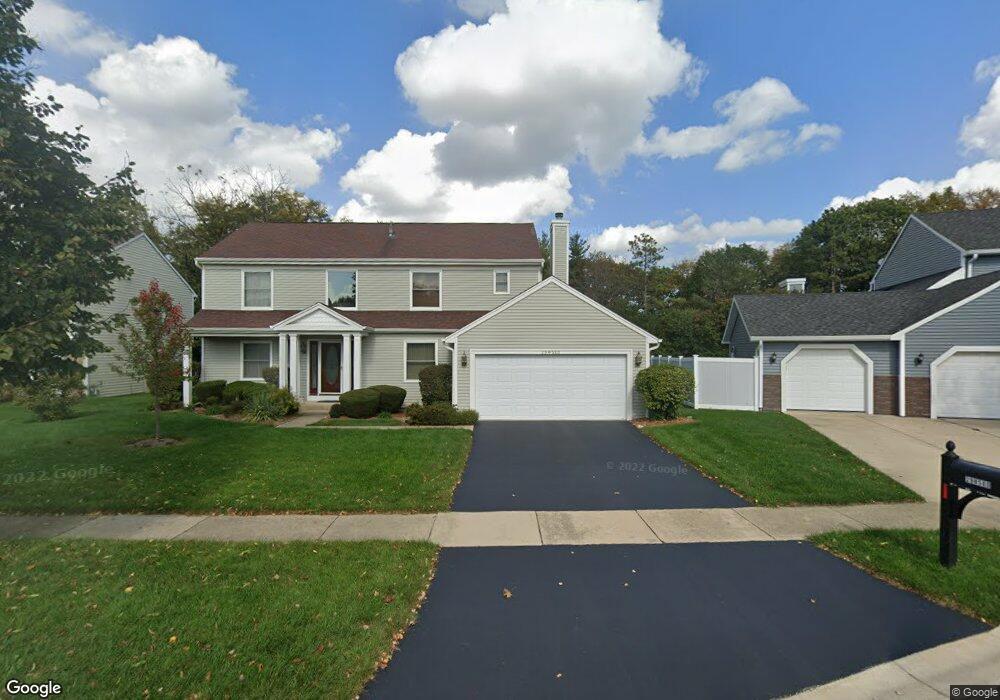
2S283 Illinois Route 59 Warrenville, IL 60555
Estimated Value: $651,000 - $707,622
4
Beds
4
Baths
2,544
Sq Ft
$270/Sq Ft
Est. Value
About This Home
This home is located at 2S283 Illinois Route 59, Warrenville, IL 60555 and is currently estimated at $687,406, approximately $270 per square foot. 2S283 Illinois Route 59 is a home located in DuPage County with nearby schools including Clifford Johnson School, Millbrook Junior High School, and Hubble Middle School.
Ownership History
Date
Name
Owned For
Owner Type
Purchase Details
Closed on
Jun 23, 2021
Sold by
Thompson Thomas and Moen Kristi
Bought by
Czarny Robin and Mccarthy Robert
Current Estimated Value
Purchase Details
Closed on
Jul 22, 2004
Sold by
Latal Edward J
Bought by
Thompson Thomas C and Moen Kristi L
Home Financials for this Owner
Home Financials are based on the most recent Mortgage that was taken out on this home.
Original Mortgage
$227,950
Interest Rate
6.42%
Mortgage Type
Purchase Money Mortgage
Create a Home Valuation Report for This Property
The Home Valuation Report is an in-depth analysis detailing your home's value as well as a comparison with similar homes in the area
Home Values in the Area
Average Home Value in this Area
Purchase History
| Date | Buyer | Sale Price | Title Company |
|---|---|---|---|
| Czarny Robin | $638,000 | Fidelity National Title | |
| Thompson Thomas C | $285,000 | Multiple |
Source: Public Records
Mortgage History
| Date | Status | Borrower | Loan Amount |
|---|---|---|---|
| Previous Owner | Thompson Thomas C | $227,950 | |
| Closed | Thompson Thomas C | $28,400 |
Source: Public Records
Tax History Compared to Growth
Tax History
| Year | Tax Paid | Tax Assessment Tax Assessment Total Assessment is a certain percentage of the fair market value that is determined by local assessors to be the total taxable value of land and additions on the property. | Land | Improvement |
|---|---|---|---|---|
| 2024 | $11,878 | $170,213 | $48,143 | $122,070 |
| 2023 | $11,263 | $155,460 | $43,970 | $111,490 |
| 2022 | $10,727 | $145,300 | $41,100 | $104,200 |
| 2021 | $10,190 | $139,280 | $39,400 | $99,880 |
| 2020 | $9,935 | $135,050 | $38,200 | $96,850 |
| 2019 | $9,493 | $128,610 | $36,380 | $92,230 |
| 2018 | $8,847 | $120,190 | $33,990 | $86,200 |
| 2017 | $8,615 | $114,210 | $32,300 | $81,910 |
| 2016 | $8,295 | $106,490 | $30,120 | $76,370 |
| 2015 | $7,999 | $98,570 | $27,880 | $70,690 |
| 2014 | $7,662 | $92,950 | $26,310 | $66,640 |
| 2013 | $7,703 | $96,350 | $27,270 | $69,080 |
Source: Public Records
Map
Nearby Homes
- 2S261 Sanchez Dr Unit 4
- 30W105 Maplewood Dr
- 30W056 Mulberry Ct Unit 56
- 30W021 Danbury Dr Unit 2A
- 30W171 Maplewood Ct
- 2S739 Winchester Cir E Unit 1
- Lot 1 Elizabeth St
- 2S616 Linden Square
- 2S737 Timber Dr
- 30W260 Holyoke Ct
- 2S547 Continental Dr
- 29W101 Morris Ct
- 30W073 Penny Ln
- 30W091 Penny Ln
- 30W023 Cedar Ct
- 30W015 Juniper Ct
- 29W477 Blackthorn Ln
- 3S260 Birchwood Dr
- 3S268 Twin Pines Dr
- 3S284 Pattermann Rd
- 2S283 State Route 59
- 29W580 Ridge Dr
- 29W610 Ridge Dr
- 29W570 Ridge Dr
- 2S271 State Route 59
- 29W620 Ridge Dr
- 29W560 Ridge Dr
- 29W571 Ridge Dr
- 2S245 State Route 59
- 29W630 Ridge Dr
- 29 Ridge Dr
- 29W611 Ridge Dr
- 2S239 State Route 59
- 29W601 Ridge Dr
- 29W640 Ridge Dr
- 29W621 Ridge Dr
- 29W581 Ridge Dr
- 29W650 Ridge Dr
- 2S330 River Oaks Dr
- 2S445 River Oaks Dr