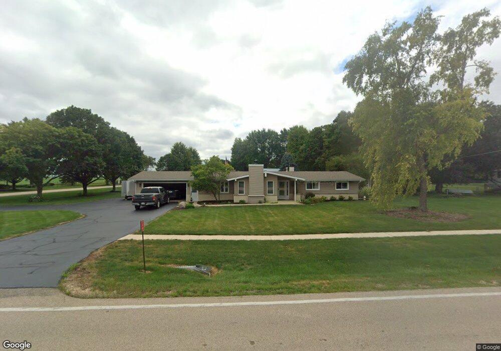
2S432 Harter Rd Unit 2 Elburn, IL 60119
Estimated Value: $371,826 - $404,000
3
Beds
2
Baths
1,620
Sq Ft
$240/Sq Ft
Est. Value
About This Home
This home is located at 2S432 Harter Rd Unit 2, Elburn, IL 60119 and is currently estimated at $388,707, approximately $239 per square foot. 2S432 Harter Rd Unit 2 is a home located in Kane County with nearby schools including Kaneland Blackberry Creek Elementary School, Harter Middle School, and Kaneland High School.
Ownership History
Date
Name
Owned For
Owner Type
Purchase Details
Closed on
Feb 22, 2003
Sold by
Domena Peggy R and Ward Peggy R
Bought by
Ward Delbert G and Ward Peggy R
Current Estimated Value
Home Financials for this Owner
Home Financials are based on the most recent Mortgage that was taken out on this home.
Original Mortgage
$120,000
Interest Rate
6%
Purchase Details
Closed on
Oct 19, 1998
Sold by
Beth Donald and Beth Sheila
Bought by
Domena Peggy R
Home Financials for this Owner
Home Financials are based on the most recent Mortgage that was taken out on this home.
Original Mortgage
$125,000
Interest Rate
6.88%
Purchase Details
Closed on
Aug 30, 1995
Sold by
Rothfuss David M and Pattee Kathleen D
Bought by
Beth Donald and Beth Sheila
Home Financials for this Owner
Home Financials are based on the most recent Mortgage that was taken out on this home.
Original Mortgage
$130,400
Interest Rate
7.37%
Create a Home Valuation Report for This Property
The Home Valuation Report is an in-depth analysis detailing your home's value as well as a comparison with similar homes in the area
Home Values in the Area
Average Home Value in this Area
Purchase History
| Date | Buyer | Sale Price | Title Company |
|---|---|---|---|
| Ward Delbert G | -- | First American Title | |
| Domena Peggy R | $179,000 | -- | |
| Beth Donald | $163,000 | Law Title Ins Co Inc |
Source: Public Records
Mortgage History
| Date | Status | Borrower | Loan Amount |
|---|---|---|---|
| Closed | Ward Delbert G | $120,000 | |
| Closed | Domena Peggy R | $125,000 | |
| Previous Owner | Beth Donald | $130,400 |
Source: Public Records
Tax History Compared to Growth
Tax History
| Year | Tax Paid | Tax Assessment Tax Assessment Total Assessment is a certain percentage of the fair market value that is determined by local assessors to be the total taxable value of land and additions on the property. | Land | Improvement |
|---|---|---|---|---|
| 2024 | $7,540 | $110,009 | $23,516 | $86,493 |
| 2023 | $7,433 | $102,487 | $21,908 | $80,579 |
| 2022 | $7,324 | $93,973 | $20,088 | $73,885 |
| 2021 | $7,075 | $90,056 | $19,251 | $70,805 |
| 2020 | $6,874 | $86,951 | $18,587 | $68,364 |
| 2019 | $6,708 | $83,479 | $17,845 | $65,634 |
| 2018 | $6,215 | $76,091 | $16,266 | $59,825 |
| 2017 | $5,731 | $69,611 | $14,881 | $54,730 |
| 2016 | $5,785 | $63,409 | $13,555 | $49,854 |
| 2015 | -- | $59,205 | $12,656 | $46,549 |
| 2014 | -- | $59,205 | $12,656 | $46,549 |
| 2013 | -- | $63,840 | $13,647 | $50,193 |
Source: Public Records
Map
Nearby Homes
- 000 Finley Rd
- 0N119 Dauberman Rd
- 3S520 Marian Ln
- 43W690 Marian Cir
- 44W099 Finley Rd
- 2S227 Green Rd
- 165 Schneider Rd
- 43W493 Thornapple Tree Rd
- LOT 7 Rowe Rd
- 44W700 Rowe Rd
- Lot 9 Rowe Rd
- 00 Rt 38 Rd
- Lot #7 Derek Dr
- 16 Derek Dr
- 12 Derek Dr
- 6 Derek Dr
- 5 Derek Dr
- 4 Derek Dr
- 11 Derek Dr
- 48W201 Keslinger Rd
- 2S404 Harter Rd
- 46W418 Locust St Unit 2
- 46W385 Locust St
- 2S392 Harter Rd
- 2S389 Harter Rd
- 2S472 Harter Rd
- 2S382 Harter Rd
- 46W464 Locust St
- 2S371 Harter Rd
- 46W500 Locust St Unit 2
- 2S356 Harter Rd
- 2S347 Harter Rd
- 46W512 Locust St
- 46W495 Locust St
- 2S339 Harter Rd
- 46W524 Locust St
- 2S342 Harter Rd
- 2S295 Merrill Ave
- 2S327 Merrill Ave