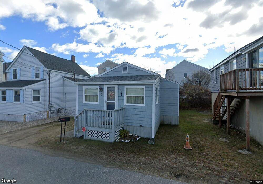
3 17th St W Salisbury, MA 01952
Estimated Value: $345,000 - $575,000
2
Beds
1
Bath
930
Sq Ft
$491/Sq Ft
Est. Value
About This Home
This home is located at 3 17th St W, Salisbury, MA 01952 and is currently estimated at $456,874, approximately $491 per square foot. 3 17th St W is a home located in Essex County with nearby schools including Triton Regional High School.
Ownership History
Date
Name
Owned For
Owner Type
Purchase Details
Closed on
May 19, 2006
Sold by
Moore Tricia F and Torrisi Tricia F
Bought by
Moore Tricia F
Current Estimated Value
Purchase Details
Closed on
Aug 14, 2000
Sold by
Thompson Arthur L and Thompson Paula
Bought by
Torrisi Thomas R and Torrisi Tricia F
Home Financials for this Owner
Home Financials are based on the most recent Mortgage that was taken out on this home.
Original Mortgage
$109,250
Interest Rate
8.21%
Mortgage Type
Purchase Money Mortgage
Create a Home Valuation Report for This Property
The Home Valuation Report is an in-depth analysis detailing your home's value as well as a comparison with similar homes in the area
Home Values in the Area
Average Home Value in this Area
Purchase History
| Date | Buyer | Sale Price | Title Company |
|---|---|---|---|
| Moore Tricia F | -- | -- | |
| Torrisi Thomas R | $115,000 | -- |
Source: Public Records
Mortgage History
| Date | Status | Borrower | Loan Amount |
|---|---|---|---|
| Previous Owner | Torrisi Thomas R | $125,000 | |
| Previous Owner | Torrisi Thomas R | $109,250 |
Source: Public Records
Tax History Compared to Growth
Tax History
| Year | Tax Paid | Tax Assessment Tax Assessment Total Assessment is a certain percentage of the fair market value that is determined by local assessors to be the total taxable value of land and additions on the property. | Land | Improvement |
|---|---|---|---|---|
| 2025 | $3,623 | $359,400 | $224,400 | $135,000 |
| 2024 | $3,642 | $348,500 | $224,400 | $124,100 |
| 2023 | $3,009 | $278,600 | $179,500 | $99,100 |
| 2022 | $2,716 | $243,800 | $164,600 | $79,200 |
| 2021 | $2,717 | $241,300 | $164,600 | $76,700 |
| 2020 | $2,528 | $220,600 | $158,700 | $61,900 |
| 2019 | $2,308 | $194,600 | $136,800 | $57,800 |
| 2018 | $2,316 | $196,600 | $138,900 | $57,700 |
| 2017 | $1,927 | $161,700 | $108,400 | $53,300 |
| 2016 | $2,005 | $171,800 | $118,500 | $53,300 |
| 2015 | $2,154 | $183,300 | $135,800 | $47,500 |
Source: Public Records
Map
Nearby Homes
- 178 N End Blvd Unit C
- 178 N End Blvd Unit F
- 188 N End Blvd Unit 3
- 98 Central Ave
- 10 Liberty St
- 38-40 Central Ave
- 16 N End Blvd Unit 10
- 16 N End Blvd Unit 8
- 16 N End Blvd Unit 3
- 16 N End Blvd Unit 12
- 16 N End Blvd Unit 5
- 45 Old County Rd Unit 1
- 20 Cable Ave Unit 11
- 432 N End Blvd
- 170 Beach Rd Unit 52
- 103 Railroad Ave
- 52 Brissette Ave
- 114 Railroad Ave
- 116 Railroad Ave
- 2 Old County Rd Unit 13
- 1 17th St W
- 5 17th St W
- 177 North End Blvd
- 181 North End Blvd
- 179 N End Blvd Unit A
- 181 N End Blvd
- 177 N End Blvd Unit A2
- 177 N End Blvd
- 179 North End Blvd
- 7 17th St W
- 183 North End Blvd
- 183 North End Blvd
- 6 18th St W
- 173 North End Blvd
- 6 17th St W
- 9 17th St W
- 8 17th St W
- 4 18th St W
- 171 North End Blvd
- 178 N End Blvd