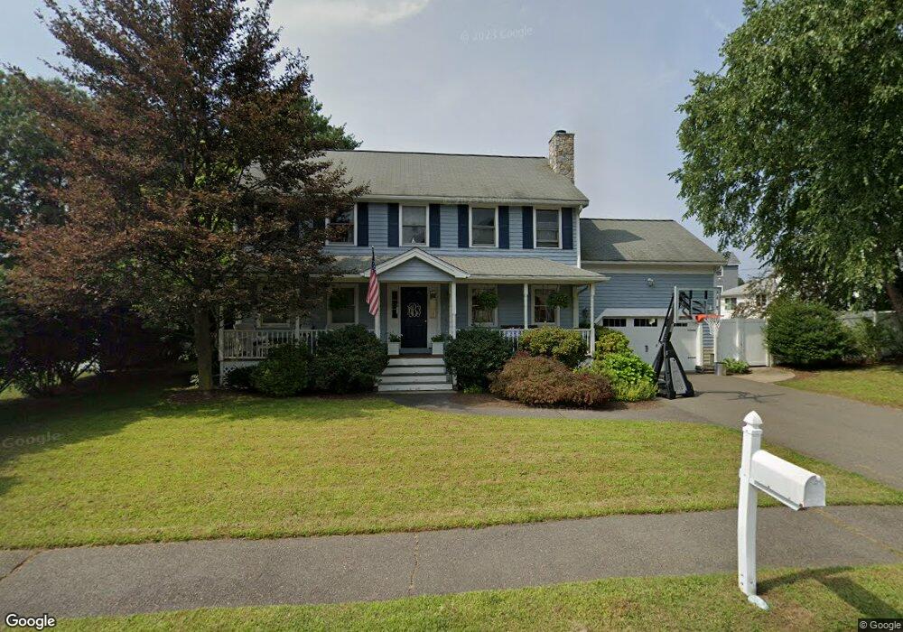
3 Arthur g Pernokas Dr Woburn, MA 01801
Walnut Hill NeighborhoodEstimated Value: $926,839 - $1,033,000
3
Beds
3
Baths
1,800
Sq Ft
$545/Sq Ft
Est. Value
About This Home
This home is located at 3 Arthur g Pernokas Dr, Woburn, MA 01801 and is currently estimated at $980,460, approximately $544 per square foot. 3 Arthur g Pernokas Dr is a home located in Middlesex County with nearby schools including Goodyear Elementary School, John F. Kennedy Middle School, and Woburn High School.
Ownership History
Date
Name
Owned For
Owner Type
Purchase Details
Closed on
Sep 1, 2011
Sold by
Spencer Padget B and Spencer Lisa J
Bought by
Byrne Peter A and Pascucci-Byrne Marla C
Current Estimated Value
Home Financials for this Owner
Home Financials are based on the most recent Mortgage that was taken out on this home.
Original Mortgage
$373,000
Outstanding Balance
$258,578
Interest Rate
4.52%
Mortgage Type
Purchase Money Mortgage
Estimated Equity
$721,882
Purchase Details
Closed on
Aug 26, 2003
Sold by
Meuse Donna M and Oliveira Donna M
Bought by
Spencer Lisa J and Spencer Padget B
Home Financials for this Owner
Home Financials are based on the most recent Mortgage that was taken out on this home.
Original Mortgage
$322,700
Interest Rate
5.52%
Mortgage Type
Purchase Money Mortgage
Purchase Details
Closed on
Jan 3, 1996
Sold by
Cranberry Est T and Ruping
Bought by
Meuse Jay R and Oliveira Donna M
Home Financials for this Owner
Home Financials are based on the most recent Mortgage that was taken out on this home.
Original Mortgage
$150,000
Interest Rate
7.34%
Mortgage Type
Purchase Money Mortgage
Create a Home Valuation Report for This Property
The Home Valuation Report is an in-depth analysis detailing your home's value as well as a comparison with similar homes in the area
Home Values in the Area
Average Home Value in this Area
Purchase History
| Date | Buyer | Sale Price | Title Company |
|---|---|---|---|
| Byrne Peter A | $470,000 | -- | |
| Byrne Peter A | $470,000 | -- | |
| Spencer Lisa J | $450,000 | -- | |
| Spencer Lisa J | $450,000 | -- | |
| Meuse Jay R | $254,000 | -- |
Source: Public Records
Mortgage History
| Date | Status | Borrower | Loan Amount |
|---|---|---|---|
| Open | Byrne Peter A | $373,000 | |
| Closed | Meuse Jay R | $373,000 | |
| Previous Owner | Meuse Jay R | $352,000 | |
| Previous Owner | Spencer Lisa J | $322,700 | |
| Previous Owner | Meuse Jay R | $150,000 |
Source: Public Records
Tax History Compared to Growth
Tax History
| Year | Tax Paid | Tax Assessment Tax Assessment Total Assessment is a certain percentage of the fair market value that is determined by local assessors to be the total taxable value of land and additions on the property. | Land | Improvement |
|---|---|---|---|---|
| 2025 | $7,157 | $838,100 | $365,500 | $472,600 |
| 2024 | $6,438 | $798,800 | $348,100 | $450,700 |
| 2023 | $6,294 | $723,400 | $316,500 | $406,900 |
| 2022 | $6,075 | $650,400 | $263,200 | $387,200 |
| 2021 | $5,839 | $625,800 | $250,700 | $375,100 |
| 2020 | $5,626 | $603,700 | $250,700 | $353,000 |
| 2019 | $5,419 | $570,400 | $238,800 | $331,600 |
| 2018 | $5,180 | $523,800 | $219,100 | $304,700 |
| 2017 | $4,851 | $488,000 | $208,700 | $279,300 |
| 2016 | $4,643 | $462,000 | $195,000 | $267,000 |
| 2015 | $4,485 | $441,000 | $182,200 | $258,800 |
| 2014 | $4,368 | $418,400 | $182,200 | $236,200 |
Source: Public Records
Map
Nearby Homes
- 295 Salem St Unit 69
- 18 Carmen Terrace
- 18 Central St
- 405 William St
- 13 Fremont St Unit 13
- 13 Elaine Rd
- 3 Frank St
- 6 Stratton Dr Unit 404
- 6 Stratton Dr Unit 410
- 200 Ledgewood Dr Unit 505
- 100 Ledgewood Dr Unit 417
- 100 Ledgewood Dr Unit 618
- 35 Grape St
- 97 Oak St
- 74 Beach St Unit 6-12
- 74 Beach St Unit 3
- 246 Walnut St
- 75 Border Rd
- 20 Oak St
- 3 Laurel St
- 9 Ag Pernokas Dr
- 5 Arthur g Pernokas Dr
- 250 Washington St
- 15 Arthur g Pernokas Dr
- 19 Arthur g Pernokas Dr
- 4 Arthur g Pernokas Dr
- 7 Arthur g Pernokas Dr
- 6 Arthur g Pernokas Dr
- 2 Arthur g Pernokas Dr
- 11 Arthur g Pernokas Dr
- 9 Arthur g Pernokas Dr
- 8 Pernokas Dr
- 3 Marilyn Ct
- 8 Arthur g Pernokas Dr
- 269 Washington St
- 267 Washington St
- 5 Marilyn Ct
- 234 Washington St
- 24 Arthur g Pernokas Dr
- 10 Arthur g Pernokas Dr