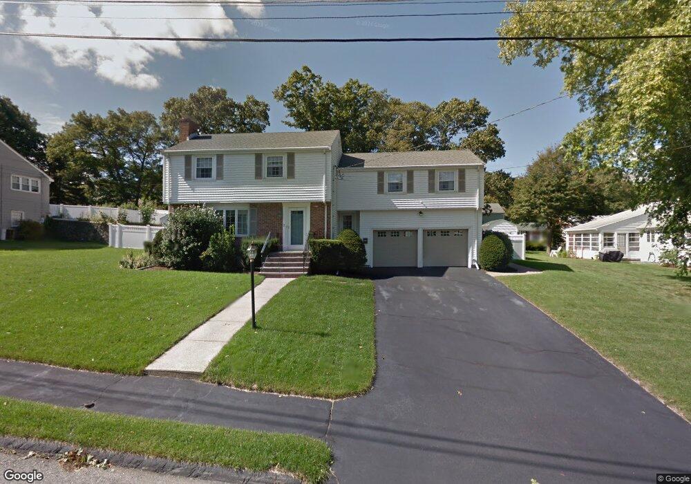
3 Arthur Rd Wakefield, MA 01880
Greenwood NeighborhoodEstimated Value: $980,000 - $1,269,000
4
Beds
3
Baths
2,427
Sq Ft
$465/Sq Ft
Est. Value
About This Home
This home is located at 3 Arthur Rd, Wakefield, MA 01880 and is currently estimated at $1,127,572, approximately $464 per square foot. 3 Arthur Rd is a home located in Middlesex County with nearby schools including Wakefield Memorial High School and Melrose Montessori School.
Ownership History
Date
Name
Owned For
Owner Type
Purchase Details
Closed on
Jul 30, 2010
Sold by
Regan Bryan M and Regan Kristine M
Bought by
Mccarthy David E and Mccarthy Heather J
Current Estimated Value
Home Financials for this Owner
Home Financials are based on the most recent Mortgage that was taken out on this home.
Original Mortgage
$417,000
Outstanding Balance
$279,003
Interest Rate
4.78%
Mortgage Type
Purchase Money Mortgage
Estimated Equity
$848,569
Purchase Details
Closed on
Jul 15, 1999
Sold by
Cerretani Marion P
Bought by
Regan Bryan M and Regan Kristine M
Create a Home Valuation Report for This Property
The Home Valuation Report is an in-depth analysis detailing your home's value as well as a comparison with similar homes in the area
Home Values in the Area
Average Home Value in this Area
Purchase History
| Date | Buyer | Sale Price | Title Company |
|---|---|---|---|
| Mccarthy David E | $617,000 | -- | |
| Regan Bryan M | $336,000 | -- |
Source: Public Records
Mortgage History
| Date | Status | Borrower | Loan Amount |
|---|---|---|---|
| Open | Mccarthy David E | $417,000 | |
| Closed | Regan Bryan M | $107,450 | |
| Previous Owner | Regan Bryan M | $278,000 |
Source: Public Records
Tax History
| Year | Tax Paid | Tax Assessment Tax Assessment Total Assessment is a certain percentage of the fair market value that is determined by local assessors to be the total taxable value of land and additions on the property. | Land | Improvement |
|---|---|---|---|---|
| 2025 | $11,988 | $1,056,200 | $411,700 | $644,500 |
| 2024 | $11,537 | $1,025,500 | $399,600 | $625,900 |
| 2023 | $11,148 | $950,400 | $370,000 | $580,400 |
| 2022 | $10,658 | $865,100 | $336,300 | $528,800 |
| 2021 | $10,161 | $798,200 | $312,600 | $485,600 |
| 2020 | $9,772 | $765,200 | $299,700 | $465,500 |
| 2019 | $9,478 | $738,700 | $289,300 | $449,400 |
| 2018 | $8,969 | $692,600 | $271,300 | $421,300 |
| 2017 | $8,593 | $659,500 | $258,300 | $401,200 |
| 2016 | $8,288 | $614,400 | $238,800 | $375,600 |
| 2015 | $7,752 | $575,100 | $223,300 | $351,800 |
| 2014 | $7,126 | $557,600 | $216,300 | $341,300 |
Source: Public Records
Map
Nearby Homes
- 11 Ludlow Ave
- 9 Lovis Ave
- 12 Lovis Ave
- 824 Main St Unit 1
- 33 Lake Ave
- 601 Franklin St Unit 2
- 1 Sidney St
- 11 Valdora Dr
- 23 Ellsworth Ave
- 7 West St
- 51 Spring St
- 24 Ellsworth Ave
- 159 Franklin St Unit D2
- 159 Franklin St Unit C2
- 159 Franklin St Unit E6
- 34-36 W Highland Ave
- 5 Chapel Way
- 9 Ledge St
- 17 Franklin St
- 98 Boardman Ave
Your Personal Tour Guide
Ask me questions while you tour the home.