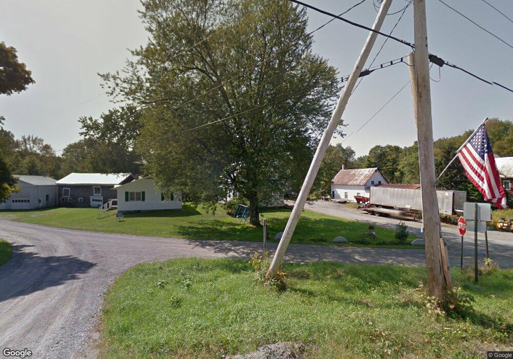
3 Atwood Hill Rd New Portland, ME 04954
Estimated Value: $154,000 - $300,000
3
Beds
2
Baths
2,000
Sq Ft
$106/Sq Ft
Est. Value
About This Home
This home is located at 3 Atwood Hill Rd, New Portland, ME 04954 and is currently estimated at $211,559, approximately $105 per square foot. 3 Atwood Hill Rd is a home located in Somerset County.
Ownership History
Date
Name
Owned For
Owner Type
Purchase Details
Closed on
Dec 9, 2013
Sold by
Franklin Sb
Bought by
Davenport Brent L
Current Estimated Value
Purchase Details
Closed on
Apr 2, 2007
Sold by
Davenport Bonni J
Bought by
Davenport Bonni J
Home Financials for this Owner
Home Financials are based on the most recent Mortgage that was taken out on this home.
Original Mortgage
$62,900
Interest Rate
6.33%
Mortgage Type
Commercial
Create a Home Valuation Report for This Property
The Home Valuation Report is an in-depth analysis detailing your home's value as well as a comparison with similar homes in the area
Home Values in the Area
Average Home Value in this Area
Purchase History
| Date | Buyer | Sale Price | Title Company |
|---|---|---|---|
| Davenport Brent L | -- | -- | |
| Davenport Bonni J | -- | -- |
Source: Public Records
Mortgage History
| Date | Status | Borrower | Loan Amount |
|---|---|---|---|
| Previous Owner | Davenport Bonni J | $62,900 |
Source: Public Records
Tax History Compared to Growth
Tax History
| Year | Tax Paid | Tax Assessment Tax Assessment Total Assessment is a certain percentage of the fair market value that is determined by local assessors to be the total taxable value of land and additions on the property. | Land | Improvement |
|---|---|---|---|---|
| 2024 | $1,544 | $109,500 | $20,600 | $88,900 |
| 2023 | $1,485 | $107,600 | $18,700 | $88,900 |
| 2022 | $1,656 | $111,900 | $18,700 | $93,200 |
| 2021 | $1,776 | $83,400 | $14,400 | $69,000 |
| 2020 | $1,918 | $83,400 | $14,400 | $69,000 |
| 2019 | $1,593 | $83,400 | $14,400 | $69,000 |
| 2018 | $1,729 | $95,500 | $14,400 | $81,100 |
| 2017 | $1,709 | $95,500 | $14,400 | $81,100 |
| 2016 | $1,624 | $90,700 | $14,400 | $76,300 |
| 2015 | $1,542 | $90,700 | $14,400 | $76,300 |
| 2014 | $1,542 | $90,700 | $14,400 | $76,300 |
| 2013 | $1,684 | $97,900 | $21,600 | $76,300 |
Source: Public Records
Map
Nearby Homes
- 42 43 47 & 49 River Rd
- 42 43 47 & 49 River Rd
- 130 Bennett Hill Rd
- 273 Lemon Stream Rd
- 368 Lemon Stream Rd
- 0 River Rd Unit 1621274
- 301 Carrabassett Rd
- 15 Spruce Rd
- MR8 L4-5 Shingle Mill Rd
- MR8 L4-4 Shingle Mill Rd
- Lot 18&20 Carrabassett Rd
- 155 Anson Valley Rd
- 152 Johnson Rd
- 56 School St
- MR7 L31&37 Taylor Hill Rd
- M12 Lot 5 22
- 320 School St
- 575 4 Mile Square Rd
- Lot 4 Middlegate Ln
- 73 Middlegate Ln
- 7 Atwood Hill Rd
- 0 Bennett Hill Rd Unit 866068
- 0 Bennett Hill Rd Unit 845694
- 0 Bennett Hill Unit 342105
- 0 Bennett Hill Rd Unit 342125
- 0 Bennett Hill Unit 342127
- 0 Bennett Hill Unit 342119
- 0 Bennett Hill Unit 342117
- 0 Bennett Hill Unit 342109
- 0 Bennett Hill Unit 342111
- 0 Bennett Hill Rd Unit 262439
- 0 Bennett Hill Rd Unit 147930
- 0 Bennett Hill Rd Unit 859954
- 0 Bennett Hill Unit 815599
- 0 Bennett Hill Unit 815589
- 0 Bennett Hill Rd Unit 776368
- 0 Bennett Hill Rd Unit 246403
- 0 Bennett Hill Rd Lot #4 Unit 894118
- 0 Bennett Hill Rd Lot #5 Unit 894127
- 0 Bennett Hill Unit 896522