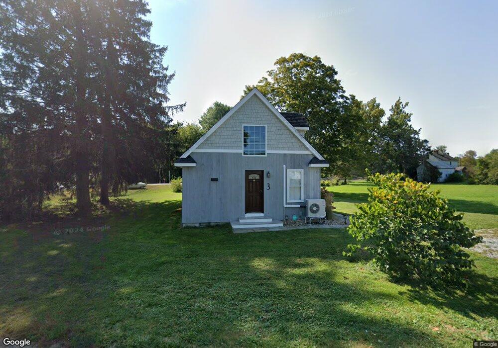
3 Bahr Rd Deep River, CT 06417
Estimated Value: $317,000 - $393,000
1
Bed
1
Bath
1,050
Sq Ft
$335/Sq Ft
Est. Value
About This Home
This home is located at 3 Bahr Rd, Deep River, CT 06417 and is currently estimated at $351,531, approximately $334 per square foot. 3 Bahr Rd is a home located in Middlesex County with nearby schools including Valley Regional High School.
Ownership History
Date
Name
Owned For
Owner Type
Purchase Details
Closed on
Apr 5, 2024
Sold by
Olson James
Bought by
3 Bahr Rd Llc
Current Estimated Value
Purchase Details
Closed on
Mar 4, 2024
Sold by
Rayner Mark P
Bought by
Olson James A and Olson Kimberly J
Create a Home Valuation Report for This Property
The Home Valuation Report is an in-depth analysis detailing your home's value as well as a comparison with similar homes in the area
Home Values in the Area
Average Home Value in this Area
Purchase History
| Date | Buyer | Sale Price | Title Company |
|---|---|---|---|
| 3 Bahr Rd Llc | -- | None Available | |
| 3 Bahr Rd Llc | -- | None Available | |
| 3 Bahr Rd Llc | -- | None Available | |
| Olson James A | $300,000 | None Available |
Source: Public Records
Tax History
| Year | Tax Paid | Tax Assessment Tax Assessment Total Assessment is a certain percentage of the fair market value that is determined by local assessors to be the total taxable value of land and additions on the property. | Land | Improvement |
|---|---|---|---|---|
| 2025 | $4,513 | $141,120 | $44,940 | $96,180 |
| 2024 | $4,312 | $137,410 | $44,940 | $92,470 |
| 2023 | $4,106 | $137,410 | $44,940 | $92,470 |
| 2022 | $3,982 | $137,410 | $44,940 | $92,470 |
| 2021 | $5 | $137,410 | $44,940 | $92,470 |
| 2020 | $0 | $136,920 | $43,820 | $93,100 |
| 2019 | $4,028 | $136,920 | $43,820 | $93,100 |
| 2018 | $2,959 | $100,590 | $43,820 | $56,770 |
| 2017 | $2,585 | $89,390 | $43,820 | $45,570 |
| 2016 | $1,376 | $49,980 | $43,820 | $6,160 |
| 2015 | $1,332 | $50,680 | $44,450 | $6,230 |
| 2014 | $1,312 | $50,680 | $44,450 | $6,230 |
Source: Public Records
Map
Nearby Homes
- 120 Warsaw St
- 214 Kelsey Hill Rd
- 46 Hemlock Dr
- 97 Bushy Hill Rd
- 29 Mitchel Terrace
- 151 Bushy Hill Rd
- 22 Ebony Ln
- 209 Main St
- 112 Cedar Swamp Rd
- 41 Bushy Hill Rd
- 43 Bokum Rd
- 0 Glen Grove Rd
- 92 Main St Unit 101
- 62 River St
- 11 Winter Ave
- 21 River Ln
- 272 Westbrook Rd
- 7 Hickory Hill Dr
- 33 Deep River Rd
- 538 Winthrop Rd
Your Personal Tour Guide
Ask me questions while you tour the home.