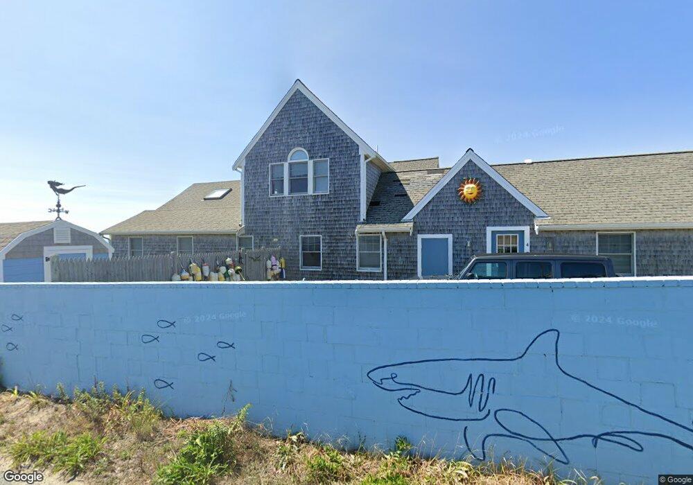
3 Beach Pine Rd Dennis Port, MA 02639
Dennis Port NeighborhoodEstimated Value: $1,007,000 - $1,435,000
4
Beds
2
Baths
1,874
Sq Ft
$655/Sq Ft
Est. Value
About This Home
This home is located at 3 Beach Pine Rd, Dennis Port, MA 02639 and is currently estimated at $1,226,901, approximately $654 per square foot. 3 Beach Pine Rd is a home located in Barnstable County with nearby schools including Dennis-Yarmouth Regional High School and St. Pius X. School.
Ownership History
Date
Name
Owned For
Owner Type
Purchase Details
Closed on
Feb 22, 2005
Sold by
Pearlman Michael R and Pearlman Sydney B
Bought by
Pearlman Michael R and Pearlman Sydney B
Current Estimated Value
Purchase Details
Closed on
Apr 21, 2004
Sold by
Sydney Rt
Bought by
Pearlman Michael R and Pearlman Sydney B
Purchase Details
Closed on
Oct 21, 1991
Sold by
Pearlman Michael R and Pearlman Sydney B
Bought by
Pearlman Michael R and Pearlman Sydney B
Home Financials for this Owner
Home Financials are based on the most recent Mortgage that was taken out on this home.
Original Mortgage
$165,000
Interest Rate
9.06%
Mortgage Type
Purchase Money Mortgage
Create a Home Valuation Report for This Property
The Home Valuation Report is an in-depth analysis detailing your home's value as well as a comparison with similar homes in the area
Home Values in the Area
Average Home Value in this Area
Purchase History
| Date | Buyer | Sale Price | Title Company |
|---|---|---|---|
| Pearlman Michael R | -- | -- | |
| Pearlman Michael R | -- | -- | |
| Pearlman Michael R | $100,000 | -- |
Source: Public Records
Mortgage History
| Date | Status | Borrower | Loan Amount |
|---|---|---|---|
| Previous Owner | Pearlman Michael R | $165,000 |
Source: Public Records
Tax History Compared to Growth
Tax History
| Year | Tax Paid | Tax Assessment Tax Assessment Total Assessment is a certain percentage of the fair market value that is determined by local assessors to be the total taxable value of land and additions on the property. | Land | Improvement |
|---|---|---|---|---|
| 2025 | $5,012 | $1,157,500 | $705,800 | $451,700 |
| 2024 | $4,877 | $1,111,000 | $678,700 | $432,300 |
| 2023 | $4,718 | $1,010,200 | $617,000 | $393,200 |
| 2022 | $4,754 | $848,900 | $555,800 | $293,100 |
| 2021 | $4,813 | $798,200 | $544,900 | $253,300 |
| 2020 | $4,634 | $759,600 | $520,700 | $238,900 |
| 2019 | $4,462 | $723,200 | $510,500 | $212,700 |
| 2018 | $4,391 | $692,600 | $486,000 | $206,600 |
| 2017 | $4,413 | $717,600 | $486,000 | $231,600 |
| 2016 | $5,018 | $768,400 | $570,700 | $197,700 |
| 2015 | $4,918 | $768,400 | $570,700 | $197,700 |
| 2014 | $4,839 | $762,000 | $570,700 | $191,300 |
Source: Public Records
Map
Nearby Homes
- 405 Old Wharf Rd Unit B204
- 405 Old Wharf Rd Unit B204
- 402 Old Wharf Rd
- 402 Old Wharf Rd
- 9 Chase Ave Unit 6
- 102 Sea St
- 11 Ocean Park W
- 22 Ferncliff Rd
- 37-A Beach Hills Rd
- 37 Beach Hills Rd
- 262 Old Wharf Rd Unit 67
- 262 Old Wharf Rd Unit 5
- 262 Old Wharf Rd Unit 5
- 262 Old Wharf Rd Unit 20
- 262 Old Wharf Rd Unit 87
- 241 Old Wharf Rd Unit 82
- 241 Old Wharf Rd Unit 127
- 241 Old Wharf Rd Unit 90
- 1 E Belmont Unit 630
- 26 Manning Rd
- 9 Beach Pine Rd
- 16 Highbank Cir
- 4 Beach Pine Rd
- 2 Beach Pine Rd
- 10 Beach Pine Rd
- 15 Highbank Cir
- 15 Beach Pine Rd
- 11 Highbank Cir
- 20 Highbank Cir
- 8 Highbank Cir
- 9 Highbank Cir
- 395 Old Wharf Rd
- 10 Town Pkwy
- 5 Highbank Cir
- 21 Highbank Cir
- 16 Beach Pine Rd
- 25 Highbank Cir
- 19 Beach Pine Rd
- 2 Highbank Cir
- 47 Highbank Cir