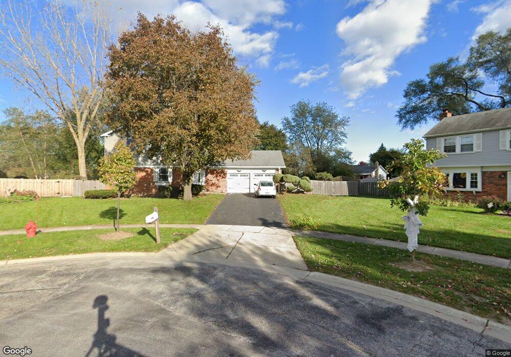
3 Belmar Ct Buffalo Grove, IL 60089
Estimated Value: $507,345 - $573,000
--
Bed
3
Baths
2,115
Sq Ft
$255/Sq Ft
Est. Value
About This Home
This home is located at 3 Belmar Ct, Buffalo Grove, IL 60089 and is currently estimated at $538,586, approximately $254 per square foot. 3 Belmar Ct is a home located in Lake County with nearby schools including Ivy Hall Elementary School, Twin Groves Middle School, and Adlai E Stevenson High School.
Ownership History
Date
Name
Owned For
Owner Type
Purchase Details
Closed on
Mar 24, 2017
Sold by
Klein John P and Fisher Klein Laura A
Bought by
Klein John P and Fischer Klein Laura A
Current Estimated Value
Home Financials for this Owner
Home Financials are based on the most recent Mortgage that was taken out on this home.
Original Mortgage
$50,000
Interest Rate
4.16%
Mortgage Type
Credit Line Revolving
Create a Home Valuation Report for This Property
The Home Valuation Report is an in-depth analysis detailing your home's value as well as a comparison with similar homes in the area
Home Values in the Area
Average Home Value in this Area
Purchase History
| Date | Buyer | Sale Price | Title Company |
|---|---|---|---|
| Klein John P | -- | Attorney |
Source: Public Records
Mortgage History
| Date | Status | Borrower | Loan Amount |
|---|---|---|---|
| Closed | Klein John P | $50,000 |
Source: Public Records
Tax History Compared to Growth
Tax History
| Year | Tax Paid | Tax Assessment Tax Assessment Total Assessment is a certain percentage of the fair market value that is determined by local assessors to be the total taxable value of land and additions on the property. | Land | Improvement |
|---|---|---|---|---|
| 2024 | $13,625 | $149,253 | $29,732 | $119,521 |
| 2023 | $12,794 | $140,831 | $28,054 | $112,777 |
| 2022 | $12,794 | $128,701 | $25,638 | $103,063 |
| 2021 | $12,309 | $127,314 | $25,362 | $101,952 |
| 2020 | $12,020 | $127,749 | $25,449 | $102,300 |
| 2019 | $11,854 | $127,278 | $25,355 | $101,923 |
| 2018 | $10,486 | $116,708 | $25,058 | $91,650 |
| 2017 | $10,287 | $113,984 | $24,473 | $89,511 |
| 2016 | $10,015 | $109,149 | $23,435 | $85,714 |
| 2015 | $9,745 | $102,075 | $21,916 | $80,159 |
| 2014 | $9,828 | $101,498 | $23,537 | $77,961 |
| 2012 | $9,764 | $101,701 | $23,584 | $78,117 |
Source: Public Records
Map
Nearby Homes
- 931 Shady Grove Ln
- 1141 Devonshire Rd
- 950 Belmar Ln
- 1265 Devonshire Rd
- 711 Woodhollow Ln
- 800 Clohesey Dr
- 1118 Larraway Dr
- 1152 Courtland Dr Unit 406
- 1032 Courtland Dr Unit 9
- 610 Checker Dr
- 12 Cloverdale Ct
- 1113 Lockwood Dr
- 890 Knollwood Dr
- 327 Lasalle Ln
- 938 Hidden Lake Dr
- 437 Caren Dr
- 1546 Brandywyn Ln
- 5107 N Arlington Heights Rd
- 1325 Fairfax Ln
- 1324 Fairfax Ln Unit B32
- 2 Belmar Ct
- 4 Belmar Ct
- 951 Checker Dr Unit 10
- 941 Checker Dr
- 3370 Mchenry Rd
- 841 Belmar Ln
- 821 Belmar Ln
- 931 Checker Dr
- 1118 Brandywyn Ct
- 851 Belmar Ln
- 1124 Brandywyn Ct
- 811 Belmar Ln
- 830 Belmar Ln
- 950 Shady Grove Ln
- 921 Checker Dr
- 1112 Brandywyn Ct
- 861 Ridgefield Ln
- 861 Belmar Ln
- 850 Belmar Ln
- 1130 Brandywyn Ct