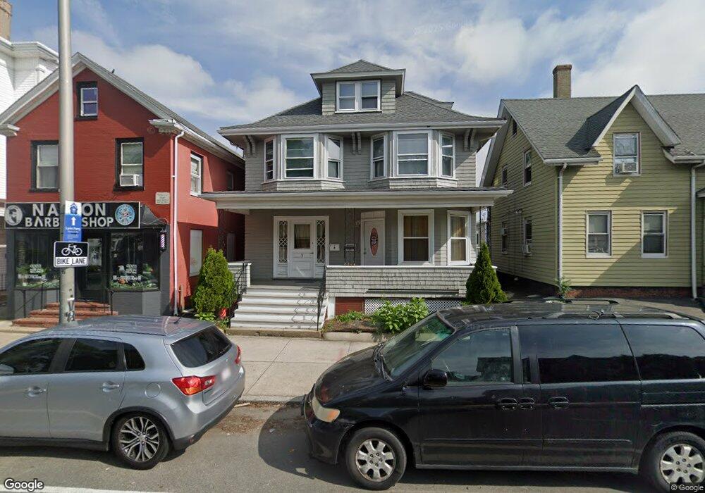
3 Broad St Unit 2 Lynn, MA 01902
Fayette Street NeighborhoodEstimated Value: $673,000 - $814,000
3
Beds
1
Bath
1,100
Sq Ft
$700/Sq Ft
Est. Value
About This Home
This home is located at 3 Broad St Unit 2, Lynn, MA 01902 and is currently estimated at $770,022, approximately $700 per square foot. 3 Broad St Unit 2 is a home located in Essex County with nearby schools including E.J. Harrington School, William R. Fallon School, and Marshall Middle School.
Ownership History
Date
Name
Owned For
Owner Type
Purchase Details
Closed on
Jan 15, 2019
Sold by
Castro Salvador
Bought by
Jean-Louis Jeanne
Current Estimated Value
Home Financials for this Owner
Home Financials are based on the most recent Mortgage that was taken out on this home.
Original Mortgage
$490,943
Outstanding Balance
$432,298
Interest Rate
4.87%
Mortgage Type
FHA
Estimated Equity
$337,724
Purchase Details
Closed on
May 18, 2018
Sold by
Al-Nic Rt and Alexandrou
Bought by
Castro Salvador
Home Financials for this Owner
Home Financials are based on the most recent Mortgage that was taken out on this home.
Original Mortgage
$320,000
Interest Rate
4.4%
Mortgage Type
New Conventional
Purchase Details
Closed on
Jun 30, 1989
Sold by
Broad St Rlty
Bought by
Al Nic Rt
Home Financials for this Owner
Home Financials are based on the most recent Mortgage that was taken out on this home.
Original Mortgage
$100,000
Interest Rate
10.56%
Mortgage Type
Commercial
Create a Home Valuation Report for This Property
The Home Valuation Report is an in-depth analysis detailing your home's value as well as a comparison with similar homes in the area
Home Values in the Area
Average Home Value in this Area
Purchase History
| Date | Buyer | Sale Price | Title Company |
|---|---|---|---|
| Jean-Louis Jeanne | $500,000 | None Available | |
| Castro Salvador | $280,000 | -- | |
| Al Nic Rt | $128,000 | -- |
Source: Public Records
Mortgage History
| Date | Status | Borrower | Loan Amount |
|---|---|---|---|
| Open | Jean-Louis Jeanne | $490,943 | |
| Previous Owner | Castro Salvador | $320,000 | |
| Previous Owner | Al Nic Rt | $100,000 | |
| Previous Owner | Al Nic Rt | $700,000 | |
| Previous Owner | Al Nic Rt | $95,000 |
Source: Public Records
Tax History
| Year | Tax Paid | Tax Assessment Tax Assessment Total Assessment is a certain percentage of the fair market value that is determined by local assessors to be the total taxable value of land and additions on the property. | Land | Improvement |
|---|---|---|---|---|
| 2025 | $7,748 | $747,891 | $175,400 | $572,491 |
| 2024 | $7,351 | $698,100 | $167,800 | $530,300 |
| 2023 | $7,508 | $673,400 | $179,400 | $494,000 |
| 2022 | $7,443 | $598,800 | $140,100 | $458,700 |
| 2021 | $6,837 | $524,700 | $114,800 | $409,900 |
| 2020 | $6,486 | $484,000 | $118,000 | $366,000 |
| 2019 | $0 | $349,200 | $136,500 | $212,700 |
| 2018 | $0 | $350,100 | $126,200 | $223,900 |
| 2017 | $0 | $345,000 | $126,200 | $218,800 |
| 2016 | -- | $331,700 | $121,300 | $210,400 |
| 2015 | -- | $312,500 | $121,300 | $191,200 |
Source: Public Records
Map
Nearby Homes
- 185 Lewis St Unit 4
- 14-16 Dexter St
- 13 Nahant St Unit 2D
- 13 Nahant St Unit 4A
- 13 Nahant St Unit 3A
- 13 Nahant St Unit 4C
- 13 Nahant St Unit 4B
- 6 Nichols St
- 25 W Baltimore St
- 45 School St
- 95 Nahant St Unit 12
- 95 Nahant St Unit 5-33
- 285 Lynn Shore Dr Unit 308
- 285 Lynn Shore Dr Unit 508
- 285 Lynn Shore Dr Unit 203
- 133 Chestnut St
- 2 Mount Vernon St
- 300 Lynn Shore Dr Unit 711
- 11 Seymour Ave Unit 3
- 7 Sidney Ave
- 3 Broad St
- 5 Broad St
- 5 Broad St Unit 1
- 1 Broad St
- 8 Chestnut St
- 17 Broad St Unit 3
- 17 Broad St Unit 1
- 17 Broad St
- 4 Broad St
- 4 - 4A Broad
- 8 Broad St
- 1 Atlantic St Unit 6
- 1 Atlantic St Unit 5
- 1 Atlantic St Unit 4
- 1 Atlantic St Unit 3
- 1 Atlantic St Unit 2
- 1 Atlantic St
- 1 Atlantic St Unit 1
- 1F64 Atlantic St Unit 1
- 19 Broad St Unit 2