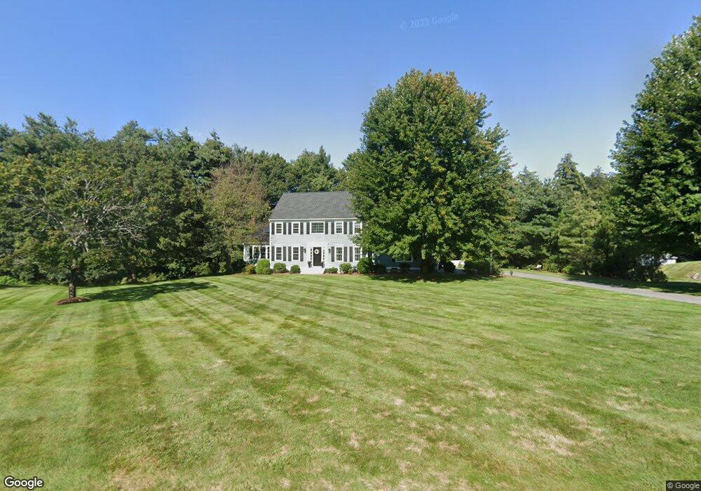
3 Buckskin Ln Westford, MA 01886
Estimated Value: $1,114,165 - $1,426,000
3
Beds
3
Baths
2,624
Sq Ft
$482/Sq Ft
Est. Value
About This Home
This home is located at 3 Buckskin Ln, Westford, MA 01886 and is currently estimated at $1,263,541, approximately $481 per square foot. 3 Buckskin Ln is a home located in Middlesex County with nearby schools including Col John Robinson, John A. Crisafulli Elementary School, and Blanchard Middle School.
Ownership History
Date
Name
Owned For
Owner Type
Purchase Details
Closed on
Aug 20, 2025
Sold by
Flynn Edward T and Flynn Robin K
Bought by
Flynn Ft and Flynn
Current Estimated Value
Purchase Details
Closed on
Oct 27, 1995
Sold by
Robert Hicks Realty
Bought by
Flynn Edward T and Flynn Robin
Create a Home Valuation Report for This Property
The Home Valuation Report is an in-depth analysis detailing your home's value as well as a comparison with similar homes in the area
Home Values in the Area
Average Home Value in this Area
Purchase History
| Date | Buyer | Sale Price | Title Company |
|---|---|---|---|
| Flynn Ft | -- | -- | |
| Flynn Ft | -- | -- | |
| Flynn Edward T | $320,475 | -- | |
| Flynn Edward T | $320,475 | -- |
Source: Public Records
Mortgage History
| Date | Status | Borrower | Loan Amount |
|---|---|---|---|
| Previous Owner | Flynn Edward T | $219,000 | |
| Previous Owner | Flynn Edward T | $226,000 |
Source: Public Records
Tax History Compared to Growth
Tax History
| Year | Tax Paid | Tax Assessment Tax Assessment Total Assessment is a certain percentage of the fair market value that is determined by local assessors to be the total taxable value of land and additions on the property. | Land | Improvement |
|---|---|---|---|---|
| 2025 | $13,280 | $985,900 | $322,200 | $663,700 |
| 2024 | $13,770 | $1,000,000 | $330,600 | $669,400 |
| 2023 | $12,998 | $880,600 | $314,600 | $566,000 |
| 2022 | $13,418 | $832,400 | $277,300 | $555,100 |
| 2021 | $12,245 | $735,900 | $277,300 | $458,600 |
| 2020 | $12,070 | $739,100 | $277,300 | $461,800 |
| 2019 | $11,671 | $704,800 | $277,300 | $427,500 |
| 2018 | $11,245 | $695,000 | $267,500 | $427,500 |
| 2017 | $10,667 | $650,000 | $267,500 | $382,500 |
| 2016 | $10,681 | $655,300 | $270,200 | $385,100 |
| 2015 | $10,501 | $646,600 | $260,200 | $386,400 |
| 2014 | $10,212 | $615,200 | $250,400 | $364,800 |
Source: Public Records
Map
Nearby Homes
- 14 Fieldstone Dr
- 1 Fieldstone Dr
- 17 Carlisle Rd
- 254 Concord Rd Unit Lot 2A
- 9 Drew Crossing
- 4 Drew Crossing
- 14 Banbury Dr
- 20 4th Ln
- 122 Carlisle Rd
- 5 Carriage Dr
- 9 Lakeside Ave
- 75 Garrison Rd
- 360 Littleton Rd Unit B-1
- 360 Littleton Rd Unit F1
- 92 Jimney Dr
- 1 Lawton Ave
- 209 New Yorker Ave
- 1 Courtney Ln
- 125 Concord Rd
- 9 Autumn Ln
- 19 Steeple Chase Cir
- 5 Buckskin Ln
- 4 Buckskin Ln
- 21 Steeple Chase Cir
- 20 Steeple Chase Cir
- 17 Steeple Chase Cir
- 23 Steeple Chase Cir
- 18 Steeple Chase Cir
- 33 Southgate Rd Unit 33
- 33 Southgate Rd Unit 32
- 31 Southgate Rd Unit 31
- 10 Applewood Dr
- 22 Steeple Chase Cir
- 25 Steeple Chase Cir
- 15 Steeple Chase Cir
- 30 Southgate Rd Unit 30
- 30 Southgate Rd Unit 34
- 32 Southgate Rd Unit 33
- 11 Applewood Dr
- 25 Southgate Rd Unit 28