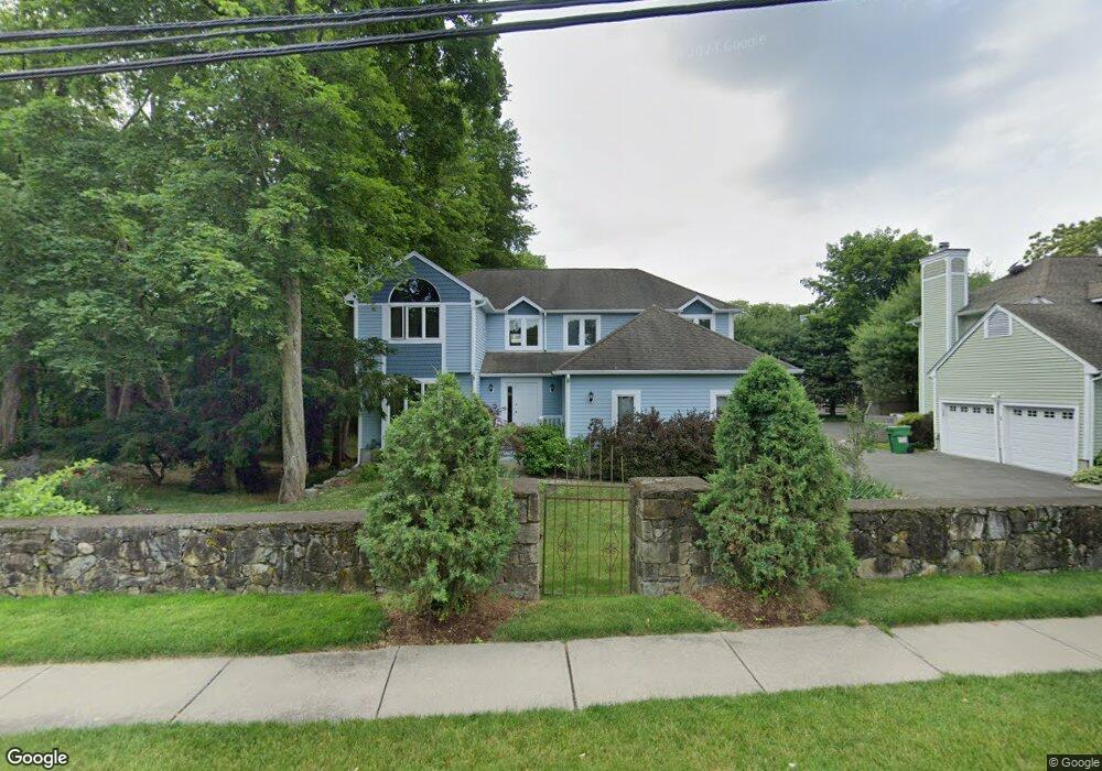
3 Cannon Brook Ln Unit 3 Norwalk, CT 06851
Woods Pond NeighborhoodEstimated Value: $754,000 - $1,073,000
3
Beds
3
Baths
2,671
Sq Ft
$358/Sq Ft
Est. Value
About This Home
This home is located at 3 Cannon Brook Ln Unit 3, Norwalk, CT 06851 and is currently estimated at $956,809, approximately $358 per square foot. 3 Cannon Brook Ln Unit 3 is a home located in Fairfield County with nearby schools including Tracey School, West Rocks Middle School, and Norwalk High School.
Ownership History
Date
Name
Owned For
Owner Type
Purchase Details
Closed on
Sep 4, 2015
Sold by
Brady Kevin and Brady Camile
Bought by
Freeman Karen and Freeman Richard
Current Estimated Value
Purchase Details
Closed on
Mar 6, 2012
Sold by
Testani Robert B and Testani Sandra
Bought by
Brady Camille B and Brady Kevin M
Home Financials for this Owner
Home Financials are based on the most recent Mortgage that was taken out on this home.
Original Mortgage
$406,200
Interest Rate
3.5%
Mortgage Type
Adjustable Rate Mortgage/ARM
Purchase Details
Closed on
Dec 30, 2005
Sold by
Toomey-Wilson David L and Toomey-Wilson Diana B
Bought by
Testani Robert B and Testani Sandra
Purchase Details
Closed on
Dec 7, 1999
Sold by
Marino Richard and Carr Waynne S
Bought by
Toomey-Wilson David C and Wilson Diana
Create a Home Valuation Report for This Property
The Home Valuation Report is an in-depth analysis detailing your home's value as well as a comparison with similar homes in the area
Home Values in the Area
Average Home Value in this Area
Purchase History
| Date | Buyer | Sale Price | Title Company |
|---|---|---|---|
| Freeman Karen | $630,000 | -- | |
| Freeman Karen | $630,000 | -- | |
| Brady Camille B | $625,000 | -- | |
| Brady Camille B | $625,000 | -- | |
| Testani Robert B | $745,000 | -- | |
| Testani Robert B | $745,000 | -- | |
| Toomey-Wilson David C | $429,000 | -- | |
| Toomey-Wilson David C | $429,000 | -- |
Source: Public Records
Mortgage History
| Date | Status | Borrower | Loan Amount |
|---|---|---|---|
| Previous Owner | Toomey-Wilson David C | $406,200 |
Source: Public Records
Tax History Compared to Growth
Tax History
| Year | Tax Paid | Tax Assessment Tax Assessment Total Assessment is a certain percentage of the fair market value that is determined by local assessors to be the total taxable value of land and additions on the property. | Land | Improvement |
|---|---|---|---|---|
| 2025 | $14,401 | $607,830 | $99,850 | $507,980 |
| 2024 | $14,179 | $607,830 | $99,850 | $507,980 |
| 2023 | $10,200 | $409,792 | $81,462 | $328,330 |
| 2022 | $10,010 | $409,792 | $81,462 | $328,330 |
| 2021 | $8,569 | $409,792 | $81,462 | $328,330 |
| 2020 | $9,640 | $409,792 | $81,462 | $328,330 |
| 2019 | $9,531 | $409,792 | $81,462 | $328,330 |
| 2018 | $10,996 | $425,010 | $88,210 | $336,800 |
| 2017 | $10,608 | $425,010 | $88,210 | $336,800 |
| 2016 | $10,812 | $425,011 | $88,211 | $336,800 |
| 2015 | $9,712 | $425,011 | $88,211 | $336,800 |
| 2014 | $10,642 | $425,010 | $88,210 | $336,800 |
Source: Public Records
Map
Nearby Homes
- 24 Sawmill Rd
- 14 E Rocks Rd
- 12 Merrill Rd
- 15 Dry Hill Rd
- 4 Union Ave Unit 26
- 1 Blue Mountain Ridge
- 31 High St Unit 4-2B
- 9 Park St Unit 217
- 133 Main St Unit 5
- 44 Ambler Dr
- 33 Center Ave
- 71 Saddle Rd
- 46 Sunrise Hill Rd
- 49 Barbara Dr
- 34 Sunrise Hill Rd
- 2 Clearview Ave
- 15 Delaware Ave
- 9 Allen Ct
- 22 Fair St
- 48 Fair St
- 3 Cannon Brook Ln
- 4 Cannon Brook Ln
- 2 Cannon Brook Ln
- 5 Cannon Brook Ln
- 5 Cannon Brook Ln Unit 5
- 13 Cannon Brook Ln
- 6 Cannon Brook Ln
- 1 Cannon Brook Ln
- 17 Cannon St
- 7 Cannon Brook Ln
- 15 Cannon St
- 19 Cannon St
- 2 E Rocks Rd
- 8 Cannon Brook Ln
- 12 Cannon Brook Ln
- 6 Cannon St
- 9 Cannon St
- 4 E Rocks Rd
- 11 Cannon St
- 9 Cannon Brook Ln