Estimated Value: $166,000 - $258,000
--
Bed
--
Bath
1,201
Sq Ft
$179/Sq Ft
Est. Value
About This Home
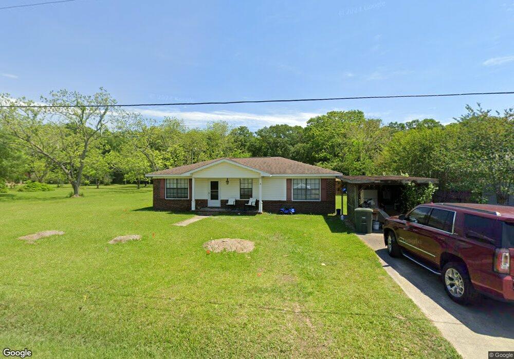
This home is located at 3 Canterberry Cir, Foley, AL 36535 and is currently estimated at $214,673, approximately $178 per square foot. 3 Canterberry Cir is a home with nearby schools including Florence Mathis Elementary School, Foley Middle School, and Foley High School.
Ownership History
Date
Name
Owned For
Owner Type
Purchase Details
Closed on
Jul 15, 2022
Sold by
Beviacqua David B
Bought by
Walters Tyler and Walters Alicia M
Current Estimated Value
Home Financials for this Owner
Home Financials are based on the most recent Mortgage that was taken out on this home.
Original Mortgage
$141,391
Outstanding Balance
$135,286
Interest Rate
5.78%
Mortgage Type
FHA
Estimated Equity
$79,387
Purchase Details
Closed on
Apr 13, 2021
Sold by
Farahrooz Elizabeth S and Farahrooz Ciorus
Bought by
Beviacqua David B
Home Financials for this Owner
Home Financials are based on the most recent Mortgage that was taken out on this home.
Original Mortgage
$64,000
Interest Rate
3%
Mortgage Type
New Conventional
Create a Home Valuation Report for This Property
The Home Valuation Report is an in-depth analysis detailing your home's value as well as a comparison with similar homes in the area
Home Values in the Area
Average Home Value in this Area
Purchase History
| Date | Buyer | Sale Price | Title Company |
|---|---|---|---|
| Walters Tyler | -- | Herbert Law Firm Llc | |
| Beviacqua David B | $80,000 | None Available |
Source: Public Records
Mortgage History
| Date | Status | Borrower | Loan Amount |
|---|---|---|---|
| Open | Walters Tyler | $141,391 | |
| Previous Owner | Beviacqua David B | $64,000 |
Source: Public Records
Tax History Compared to Growth
Tax History
| Year | Tax Paid | Tax Assessment Tax Assessment Total Assessment is a certain percentage of the fair market value that is determined by local assessors to be the total taxable value of land and additions on the property. | Land | Improvement |
|---|---|---|---|---|
| 2024 | $406 | $13,660 | $3,260 | $10,400 |
| 2023 | $397 | $13,380 | $3,840 | $9,540 |
| 2022 | $759 | $23,000 | $0 | $0 |
| 2021 | $348 | $10,560 | $0 | $0 |
| 2020 | $308 | $9,320 | $0 | $0 |
| 2019 | $298 | $9,020 | $0 | $0 |
| 2018 | $277 | $8,380 | $0 | $0 |
| 2017 | $261 | $7,920 | $0 | $0 |
| 2016 | $232 | $7,020 | $0 | $0 |
| 2015 | $228 | $6,900 | $0 | $0 |
| 2014 | $209 | $6,340 | $0 | $0 |
| 2013 | -- | $6,040 | $0 | $0 |
Source: Public Records
Map
Nearby Homes
- 0 S Poplar St Unit 340047
- 1720 Firefly Ln
- 1093 Pheasant Cir
- 1096 Pheasant Cir
- Plan 1525 at Heritage Landing
- Plan 1348 at Heritage Landing
- Plan 1635-C at Heritage Landing
- Plan 2200 at Heritage Landing
- Plan 1820-2 at Heritage Landing
- Plan 1425 at Heritage Landing
- Plan 1717 at Heritage Landing
- Plan 1900 at Heritage Landing
- Plan 2020 at Heritage Landing
- 1420 Plymouth Dr
- 1123 Pheasant Cir
- 624 Mayflower Dr
- 627 Mayflower Dr
- 628 Mayflower Dr
- 632 Mayflower Dr
- 635 Mayflower Dr
- 5 Canterberry Cir
- Lot 1 Canterberry Cir
- 1602 S Poplar St
- 1608 S Poplar St
- 4 Canterberry Cir
- 415 E Lawson Ave
- 1610 S Poplar St
- 407 E Lawson Ave
- 0 Canterberry Cir
- 1601 S Bay St
- 1611 S Bay St
- 1414 S Poplar St
- 405 E Lawson Ave
- 410 E East Lawson Ave
- 0 S Poplar St Unit 181914
- 0 S Poplar St Unit 181901
- 0 S Poplar St Unit 185948
- 0 S Poplar St Unit 239122
- 0 S Poplar St Unit 339282
- 0 S Poplar St Unit 238004