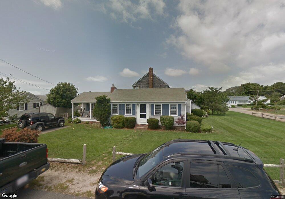
3 Captain Doane Way West Dennis, MA 02670
West Dennis NeighborhoodEstimated Value: $1,052,000 - $1,575,000
3
Beds
2
Baths
1,484
Sq Ft
$910/Sq Ft
Est. Value
About This Home
This home is located at 3 Captain Doane Way, West Dennis, MA 02670 and is currently estimated at $1,349,955, approximately $909 per square foot. 3 Captain Doane Way is a home located in Barnstable County with nearby schools including Dennis-Yarmouth Regional High School and St. Pius X. School.
Ownership History
Date
Name
Owned For
Owner Type
Purchase Details
Closed on
May 2, 2006
Sold by
Wolfe Esta F
Bought by
Esta F Wolfe T
Current Estimated Value
Create a Home Valuation Report for This Property
The Home Valuation Report is an in-depth analysis detailing your home's value as well as a comparison with similar homes in the area
Home Values in the Area
Average Home Value in this Area
Purchase History
| Date | Buyer | Sale Price | Title Company |
|---|---|---|---|
| Esta F Wolfe T | -- | -- |
Source: Public Records
Tax History Compared to Growth
Tax History
| Year | Tax Paid | Tax Assessment Tax Assessment Total Assessment is a certain percentage of the fair market value that is determined by local assessors to be the total taxable value of land and additions on the property. | Land | Improvement |
|---|---|---|---|---|
| 2025 | $5,740 | $1,325,600 | $888,900 | $436,700 |
| 2024 | $5,525 | $1,258,500 | $854,800 | $403,700 |
| 2023 | $5,344 | $1,144,300 | $777,100 | $367,200 |
| 2022 | $4,198 | $749,700 | $480,000 | $269,700 |
| 2021 | $4,202 | $696,900 | $470,600 | $226,300 |
| 2020 | $4,125 | $676,200 | $470,600 | $205,600 |
| 2019 | $3,976 | $644,400 | $461,400 | $183,000 |
| 2018 | $4,290 | $676,700 | $503,300 | $173,400 |
| 2017 | $4,015 | $652,900 | $485,000 | $167,900 |
| 2016 | $4,374 | $669,900 | $526,100 | $143,800 |
| 2015 | $4,287 | $669,900 | $526,100 | $143,800 |
| 2014 | $4,231 | $666,300 | $526,100 | $140,200 |
Source: Public Records
Map
Nearby Homes
- 22 Beach View Rd
- 14 Schoolhouse Ln
- 141 Main St Unit 4
- 141 Main St Unit 23
- 178 School St
- 209 Main St Unit 5
- 209 Main St Unit 6
- 209 Main St Unit 4
- 209 Main St Unit 3
- 209 Main St Unit 2
- 209 Main St Unit 1
- 251 Old Main St
- 181 Pleasant St
- 23 Doric Ave
- 308 Old Main St
- 45 Seth Ln
- 401 Main St Unit 201
- 401 Main St Unit 101
- 24 Regan Rd
- 22 Powhatan Rd
- 1 Surfside Rd
- 2 Captain Doane Way
- 7 Captain Doane Way
- 4 Surfside Rd
- 6 Captain Doane Way
- 8 Surfside Rd
- 10 Captain Doane Way
- 12 Surfside Rd
- 33 Merchant Ave
- 9 Captain Doane Way
- 3 Shore Rd
- 29 Merchant Ave
- 7 Shore Rd
- 17 Surfside Rd
- 16 Surfside Rd
- 11 Shore Rd
- 25 Merchant Ave
- 14 Captain Doane Way
- 11 Captain Doane Way
- 46 Merchant Ave