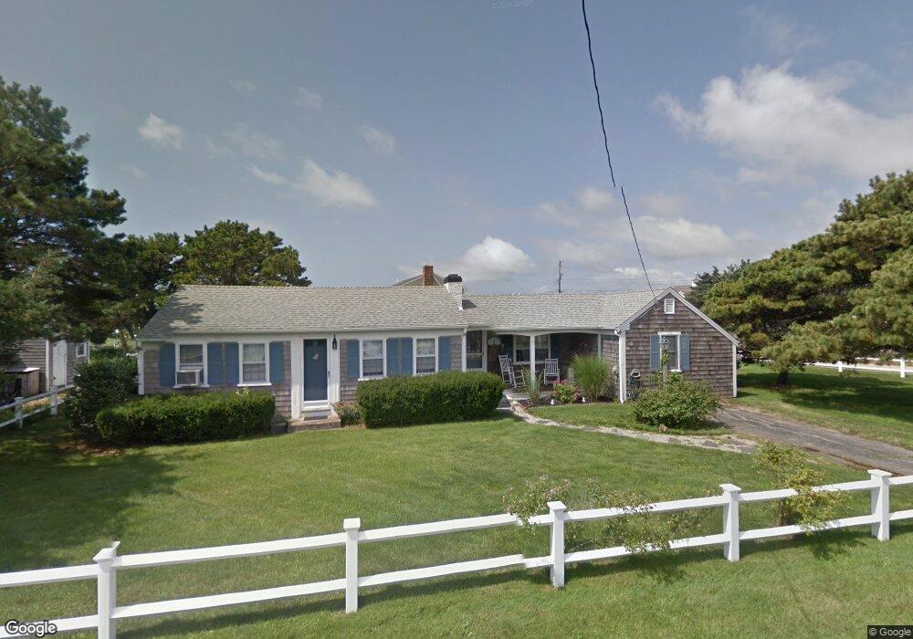
3 Captain Keavy Way West Dennis, MA 02670
West Dennis NeighborhoodEstimated Value: $722,000 - $1,041,000
3
Beds
2
Baths
1,001
Sq Ft
$905/Sq Ft
Est. Value
About This Home
This home is located at 3 Captain Keavy Way, West Dennis, MA 02670 and is currently estimated at $905,743, approximately $904 per square foot. 3 Captain Keavy Way is a home located in Barnstable County with nearby schools including Dennis-Yarmouth Regional High School and St. Pius X. School.
Ownership History
Date
Name
Owned For
Owner Type
Purchase Details
Closed on
Jun 18, 2018
Sold by
Arruda Donan J Est
Bought by
Emond Jared J
Current Estimated Value
Purchase Details
Closed on
Feb 28, 2003
Sold by
Downs Robin B and Downs Thomas Scott
Bought by
Arruda Richard C and Arruda Donna J
Home Financials for this Owner
Home Financials are based on the most recent Mortgage that was taken out on this home.
Original Mortgage
$250,000
Interest Rate
5.98%
Mortgage Type
Purchase Money Mortgage
Purchase Details
Closed on
Sep 11, 1998
Sold by
Murphy Evelyn E
Bought by
Downs Thomas S and Downs Robin B
Home Financials for this Owner
Home Financials are based on the most recent Mortgage that was taken out on this home.
Original Mortgage
$156,000
Interest Rate
6.92%
Mortgage Type
Purchase Money Mortgage
Create a Home Valuation Report for This Property
The Home Valuation Report is an in-depth analysis detailing your home's value as well as a comparison with similar homes in the area
Home Values in the Area
Average Home Value in this Area
Purchase History
| Date | Buyer | Sale Price | Title Company |
|---|---|---|---|
| Emond Jared J | -- | -- | |
| Arruda Richard C | $475,000 | -- | |
| Downs Thomas S | $195,000 | -- |
Source: Public Records
Mortgage History
| Date | Status | Borrower | Loan Amount |
|---|---|---|---|
| Previous Owner | Downs Thomas S | $250,000 | |
| Previous Owner | Downs Thomas S | $250,000 | |
| Previous Owner | Downs Thomas S | $156,000 |
Source: Public Records
Tax History Compared to Growth
Tax History
| Year | Tax Paid | Tax Assessment Tax Assessment Total Assessment is a certain percentage of the fair market value that is determined by local assessors to be the total taxable value of land and additions on the property. | Land | Improvement |
|---|---|---|---|---|
| 2025 | $4,161 | $960,900 | $648,300 | $312,600 |
| 2024 | $3,994 | $909,900 | $623,500 | $286,400 |
| 2023 | $3,863 | $827,200 | $566,800 | $260,400 |
| 2022 | $3,062 | $546,700 | $350,100 | $196,600 |
| 2021 | $3,060 | $507,400 | $343,200 | $164,200 |
| 2020 | $3,003 | $492,300 | $343,200 | $149,100 |
| 2019 | $2,893 | $468,900 | $336,500 | $132,400 |
| 2018 | $3,081 | $485,900 | $367,100 | $118,800 |
| 2017 | $2,882 | $468,600 | $353,700 | $114,900 |
| 2016 | $3,125 | $478,600 | $383,700 | $94,900 |
| 2015 | $3,063 | $478,600 | $383,700 | $94,900 |
| 2014 | $3,056 | $481,200 | $383,700 | $97,500 |
Source: Public Records
Map
Nearby Homes
- 2 Rita Mary Way
- 181 Pleasant St
- 308 Old Main St
- 745 Willow St
- 14 Schoolhouse Ln
- 209 Main St Unit 3
- 209 Main St Unit 6
- 209 Main St Unit 1
- 209 Main St Unit 2
- 209 Main St Unit 4
- 209 Main St Unit 5
- 178 School St
- 17 South St
- 45 Seth Ln
- 40 Kelley Rd
- 23 Doric Ave
- 22 Powhatan Rd
- 4 Braddock St
- 9 Cedar St
- 29 Bass River Rd
- 14 Capt Keavy Way
- 96 Merchant Ave
- 6 Capt Keavy Way
- 7 Captain Keavy Way
- 2 Capt Keavy Way
- 2 Captain Keavy Way
- 4 Captain Keavy Way
- 82 Buckley Rd
- 84 Buckley Rd
- 6 Captain Keavy Way
- 11 Captain Keavy Way
- 98 Merchant Ave
- 10 Captain Keavy Way
- 74 Buckley Rd
- 78 Merchant Ave
- 78 Merchant Ave
- 90 Buckley Rd
- 15 Captain Keavy Way
- 8 Riverside Way
- 14 Captain Keavy Way