Estimated Value: $636,000 - $882,000
About This Home
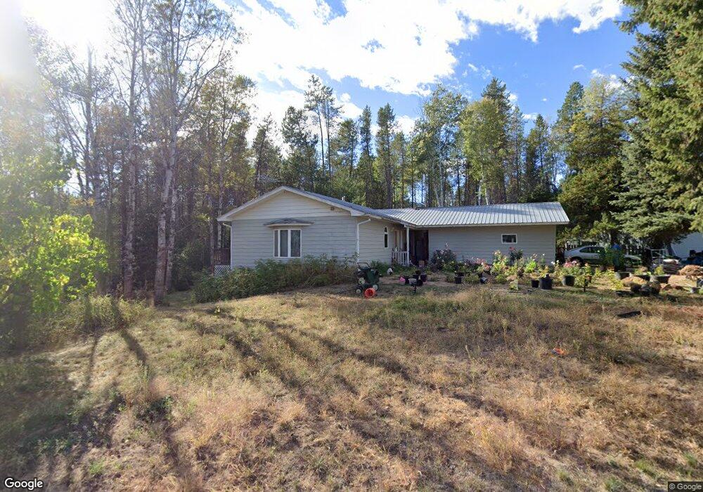
This home is located at 3 Carl Ln, Sagle, ID 83860 and is currently estimated at $752,461, approximately $236 per square foot. 3 Carl Ln is a home located in Bonner County with nearby schools including Sagle Elementary School, Sandpoint Middle School, and Sandpoint High School.
Ownership History
We collect this data history from publicly available records. To have your information removed, we recommend requesting removal directly through your county’s website.
Purchase Details
Home Financials for this Owner
Home Financials are based on the most recent Mortgage that was taken out on this home.Purchase Details
Home Values in the Area
Average Home Value in this Area
Purchase History
We collect this data history from publicly available records. To have your information removed, we recommend requesting removal directly through your county’s website.
| Date | Buyer | Sale Price | Title Company |
|---|---|---|---|
| -- | Servicelink | ||
| -- | None Available |
Mortgage History
We collect this data history from publicly available records. To have your information removed, we recommend requesting removal directly through your county’s website.
| Date | Status | Borrower | Loan Amount |
|---|---|---|---|
| Open | $170,762 |
Tax History
We collect this data history from publicly available records. To have your information removed, we recommend requesting removal directly through your county’s website.
| Year | Tax Paid | Tax Assessment Tax Assessment Total Assessment is a certain percentage of the fair market value that is determined by local assessors to be the total taxable value of land and additions on the property. | Land | Improvement |
|---|---|---|---|---|
| 2025 | $2,016 | $602,966 | $207,156 | $395,810 |
| 2024 | $2,087 | $568,620 | $179,130 | $389,490 |
| 2023 | $1,746 | $538,949 | $146,793 | $392,156 |
| 2022 | $2,405 | $584,092 | $120,793 | $463,299 |
| 2021 | $1,999 | $377,121 | $97,064 | $280,057 |
| 2020 | $1,947 | $324,275 | $70,975 | $253,300 |
| 2019 | $1,643 | $318,232 | $59,380 | $258,852 |
| 2018 | $1,288 | $278,128 | $59,380 | $218,748 |
| 2017 | $1,288 | $227,954 | $0 | $0 |
| 2016 | $1,429 | $234,464 | $0 | $0 |
| 2015 | $1,501 | $237,160 | $0 | $0 |
| 2014 | $1,551 | $237,160 | $0 | $0 |
Map
- 52 Robin Dr
- 74 Omaha Way
- 469010 Highway 95 Unit 34
- 469010 Highway 95 Unit 2
- 1601 Spades Rd
- 111 Gun Club Rd
- 111 Gun Club Rd Unit 27
- 467706 U S Route 95
- 438 Davis Rd
- NNA Lot 8 Luna Ridge
- Lot 2 Mikas View Estates
- 88 Horizon Dr
- 1024 S Sagle Rd
- 1169 Algoma Spur Rd
- 1169 Algoma Spur
- Lot 3 Mountain Ridge Dr
- 1025 Mountain Ridge Dr
- NKA Milky Way
- 288 Lignite Rd
- 316 Brisboys Rd
- 22 Carl Ln
- 219 Robin Dr
- 197 Robin Dr
- 177 Robin Dr
- 146 Robin Dr
- 141 Meadowlark Dr
- 151 Robin Dr
- 176 Meadowlark Dr
- 124 Robin Dr
- 142 Meadowlark Dr
- 121 Meadowlark Dr
- 212 Krystal Loop Dr
- 222 Krystal Loop Dr
- 212 Krystle Loop Dr
- 815 Gun Club Rd
- 244 Krystal Loop Dr
- 244 Krystle Loop Dr
- 222 Krystle Loop
- 102 Robin Dr
- 107 Meadowlark Dr
Ask me questions while you tour the home.