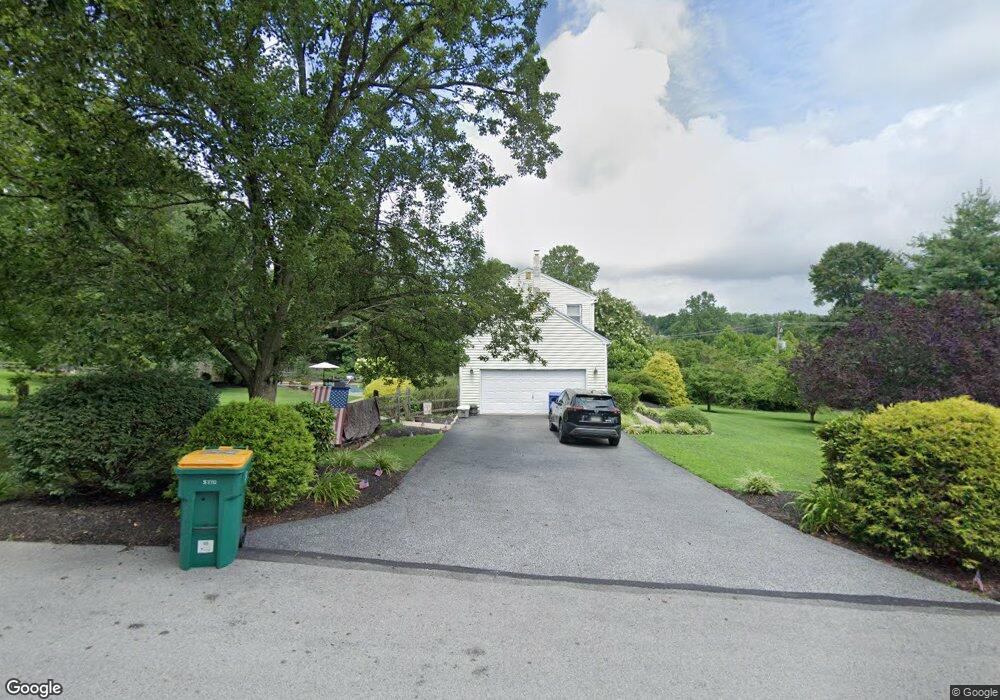
3 Carter Rd Thornton, PA 19373
Estimated Value: $748,613 - $848,000
4
Beds
3
Baths
2,828
Sq Ft
$277/Sq Ft
Est. Value
About This Home
This home is located at 3 Carter Rd, Thornton, PA 19373 and is currently estimated at $783,903, approximately $277 per square foot. 3 Carter Rd is a home located in Delaware County with nearby schools including Sarah W Starkweather Elementary School, Stetson Middle School, and Bayard Rustin High School.
Ownership History
Date
Name
Owned For
Owner Type
Purchase Details
Closed on
Nov 24, 1997
Sold by
Pugh Robert T and Pugh Caroline M
Bought by
Iovanisci Richard B and Iovanisci Gina A
Current Estimated Value
Home Financials for this Owner
Home Financials are based on the most recent Mortgage that was taken out on this home.
Original Mortgage
$182,500
Outstanding Balance
$29,951
Interest Rate
7.28%
Mortgage Type
Purchase Money Mortgage
Estimated Equity
$753,952
Create a Home Valuation Report for This Property
The Home Valuation Report is an in-depth analysis detailing your home's value as well as a comparison with similar homes in the area
Home Values in the Area
Average Home Value in this Area
Purchase History
| Date | Buyer | Sale Price | Title Company |
|---|---|---|---|
| Iovanisci Richard B | $232,500 | Commonwealth Land Title Ins |
Source: Public Records
Mortgage History
| Date | Status | Borrower | Loan Amount |
|---|---|---|---|
| Open | Iovanisci Richard B | $182,500 |
Source: Public Records
Tax History Compared to Growth
Tax History
| Year | Tax Paid | Tax Assessment Tax Assessment Total Assessment is a certain percentage of the fair market value that is determined by local assessors to be the total taxable value of land and additions on the property. | Land | Improvement |
|---|---|---|---|---|
| 2025 | $5,369 | $410,100 | $126,540 | $283,560 |
| 2024 | $5,369 | $410,100 | $126,540 | $283,560 |
| 2023 | $5,304 | $410,100 | $126,540 | $283,560 |
| 2022 | $5,133 | $410,100 | $126,540 | $283,560 |
| 2021 | $8,063 | $410,100 | $126,540 | $283,560 |
| 2020 | $4,975 | $229,040 | $67,190 | $161,850 |
| 2019 | $4,933 | $229,040 | $67,190 | $161,850 |
| 2018 | $4,766 | $229,040 | $0 | $0 |
| 2017 | $4,652 | $229,040 | $0 | $0 |
| 2016 | $1,257 | $229,040 | $0 | $0 |
| 2015 | $1,257 | $229,040 | $0 | $0 |
| 2014 | $1,257 | $229,040 | $0 | $0 |
Source: Public Records
Map
Nearby Homes
- 403 Brinton Lake Rd
- 111 Mill Rd
- 16 Fox Lair Ln
- 14 Stoneridge Rd
- 36 Judith Ln
- 0 Baltimore Pike
- 16 Creekview Cir
- 17 Judith Ln
- 12 Cherry Farm Ln
- 56 Old Barn Dr
- 186 Dilworthtown Rd
- 34 Oakland Rd Unit C2
- 131 Dilworthtown Rd
- 101 Harvey Ln
- 1707 Painters Crossing Unit 1707
- 1407 Painters Crossing
- Lot 3 149 Governor Markham Cheslen
- 1412 Painters Crossing Unit 1412
- 212 Painters Crossing Unit 212
- 1505 Painters Crossing Unit 1505
- 4 Lake Dr
- 8 Carter Rd
- 9 Carter Rd
- 370 Brinton Lake Rd
- 370 Brinton Lake Rd
- 11 Natalie Rd
- 13 Carter Rd
- 6 Natalie Rd
- 13 Natalie Rd
- 14 Natalie Rd
- 353 Brinton Lake Rd
- 10 Lake Dr
- 16 Carter Rd
- 381 Brinton Lake Rd
- 12 Natalie Rd
- 17 Natalie Rd
- 160 Mill Rd
- 5 Brandywine Green Ct Unit 1
- 5 Brandywine Green Ct
- 14 Lake Dr