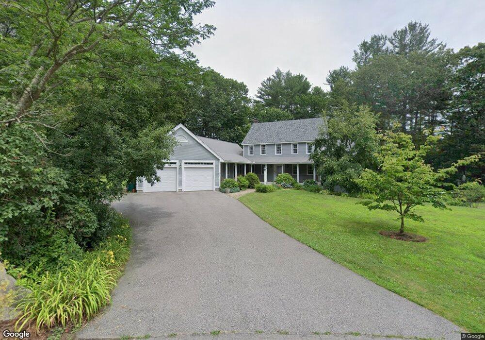
3 Clark Rd Littleton, MA 01460
Estimated Value: $988,000 - $1,287,000
3
Beds
2
Baths
1,600
Sq Ft
$690/Sq Ft
Est. Value
About This Home
This home is located at 3 Clark Rd, Littleton, MA 01460 and is currently estimated at $1,104,632, approximately $690 per square foot. 3 Clark Rd is a home located in Middlesex County with nearby schools including Shaker Lane Elementary School, Russell Street Elementary School, and Littleton Middle School.
Ownership History
Date
Name
Owned For
Owner Type
Purchase Details
Closed on
Apr 1, 2024
Sold by
Jeffrey S Burnett Ret and Burnett
Bought by
Article Vi Residuary T and Article Burnett
Current Estimated Value
Purchase Details
Closed on
Nov 10, 2020
Sold by
Burnett Jeffrey S and Burnett Janine D
Bought by
Jeffrey S Burnett Ret and Burnett
Purchase Details
Closed on
Sep 20, 1995
Sold by
Price David M and Price Sylvia
Bought by
Burnett Jeffrey S and Burnett Janine D
Purchase Details
Closed on
Aug 12, 1993
Sold by
Design Bldrs Rt 2 and Foley Stephen T
Bought by
Price David M and Taglioni Sylvia
Purchase Details
Closed on
May 21, 1993
Sold by
Clarke John G and Clarke Linda M
Bought by
Design Bldrs Rt 2 and Foley Stephen T
Create a Home Valuation Report for This Property
The Home Valuation Report is an in-depth analysis detailing your home's value as well as a comparison with similar homes in the area
Purchase History
| Date | Buyer | Sale Price | Title Company |
|---|---|---|---|
| Article Vi Residuary T | -- | None Available | |
| Article Vi Residuary T | -- | None Available | |
| Jeffrey S Burnett Ret | -- | None Available | |
| Jeffrey S Burnett Ret | -- | None Available | |
| Burnett Jeffrey S | $255,000 | -- | |
| Burnett Jeffrey S | $255,000 | -- | |
| Price David M | $215,000 | -- | |
| Price David M | $215,000 | -- | |
| Design Bldrs Rt 2 | $75,000 | -- | |
| Design Bldrs Rt 2 | $75,000 | -- |
Source: Public Records
Mortgage History
| Date | Status | Borrower | Loan Amount |
|---|---|---|---|
| Previous Owner | Design Bldrs Rt 2 | $514,000 | |
| Previous Owner | Design Bldrs Rt 2 | $227,000 |
Source: Public Records
Tax History
| Year | Tax Paid | Tax Assessment Tax Assessment Total Assessment is a certain percentage of the fair market value that is determined by local assessors to be the total taxable value of land and additions on the property. | Land | Improvement |
|---|---|---|---|---|
| 2025 | $14,752 | $992,700 | $227,400 | $765,300 |
| 2024 | $14,521 | $978,500 | $231,700 | $746,800 |
| 2023 | $13,674 | $841,500 | $214,300 | $627,200 |
| 2022 | $12,241 | $691,200 | $214,300 | $476,900 |
| 2021 | $10,914 | $616,600 | $181,600 | $435,000 |
| 2020 | $10,961 | $616,800 | $181,600 | $435,200 |
| 2019 | $10,957 | $600,700 | $182,300 | $418,400 |
| 2018 | $9,580 | $528,100 | $180,100 | $348,000 |
| 2017 | $9,585 | $528,100 | $180,100 | $348,000 |
| 2016 | $9,264 | $523,700 | $180,100 | $343,600 |
| 2015 | $8,869 | $490,000 | $156,200 | $333,800 |
Source: Public Records
Map
Nearby Homes
- 15 Gilson Rd
- Lot 2 Monarch Path
- Lot 1 Monarch Path
- 797 Boston Rd
- 176 Whiley Rd
- 1 Little Hollow Ln
- 76 Beaver Brook Rd
- 82 Pleasant St
- Lot 1 & 3 Beaver Brook Rd
- 6 Little Hollow Ln
- 10 Laurel Ln
- 66 Patten Rd
- 14 Island Rd
- 76 Robin Hill Rd
- 15 Oriole Dr
- 34 West St
- 563 Boston Rd
- 3 Cheyenne Valley Unit 3
- 23 Apache Way Unit 23
- 3 Hillside Ave
Your Personal Tour Guide
Ask me questions while you tour the home.