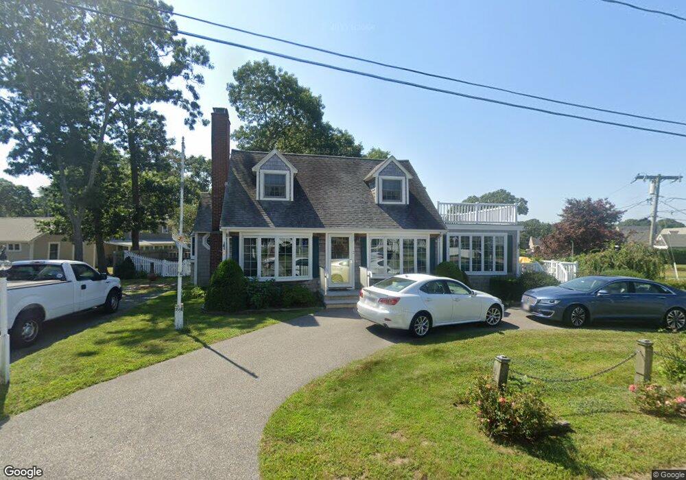
3 Cross Rd Bourne, MA 2532
Estimated Value: $701,216 - $806,000
4
Beds
3
Baths
1,249
Sq Ft
$607/Sq Ft
Est. Value
About This Home
This home is located at 3 Cross Rd, Bourne, MA 2532 and is currently estimated at $757,554, approximately $606 per square foot. 3 Cross Rd is a home located in Barnstable County with nearby schools including Bourne High School, St Margaret Regional School, and Cadence Academy Preschool - Bourne.
Ownership History
Date
Name
Owned For
Owner Type
Purchase Details
Closed on
Oct 25, 2019
Sold by
Winters Priscilla A and Winters Franklin A
Bought by
Franklin A Winters T A and Franklin Winters
Current Estimated Value
Purchase Details
Closed on
Apr 24, 1997
Sold by
Martin William A and Martin Joanne T
Bought by
Winters Franklin A and Winters Priscilla A
Home Financials for this Owner
Home Financials are based on the most recent Mortgage that was taken out on this home.
Original Mortgage
$85,000
Interest Rate
7.77%
Mortgage Type
Purchase Money Mortgage
Purchase Details
Closed on
Oct 22, 1993
Sold by
Nagel Robert C and Potts Margaret
Bought by
Martin William A and Martin Joanne T
Home Financials for this Owner
Home Financials are based on the most recent Mortgage that was taken out on this home.
Original Mortgage
$107,000
Interest Rate
6.73%
Mortgage Type
Purchase Money Mortgage
Create a Home Valuation Report for This Property
The Home Valuation Report is an in-depth analysis detailing your home's value as well as a comparison with similar homes in the area
Purchase History
| Date | Buyer | Sale Price | Title Company |
|---|---|---|---|
| Franklin A Winters T A | -- | -- | |
| Franklin A Winters T A | -- | -- | |
| Winters Franklin A | $135,000 | -- | |
| Winters Franklin A | $135,000 | -- | |
| Martin William A | $134,000 | -- | |
| Martin William A | $134,000 | -- |
Source: Public Records
Mortgage History
| Date | Status | Borrower | Loan Amount |
|---|---|---|---|
| Previous Owner | Martin William A | $85,000 | |
| Previous Owner | Martin William A | $107,000 |
Source: Public Records
Tax History
| Year | Tax Paid | Tax Assessment Tax Assessment Total Assessment is a certain percentage of the fair market value that is determined by local assessors to be the total taxable value of land and additions on the property. | Land | Improvement |
|---|---|---|---|---|
| 2025 | $5,191 | $664,600 | $379,200 | $285,400 |
| 2024 | $5,076 | $632,900 | $361,100 | $271,800 |
| 2023 | $4,963 | $563,300 | $319,600 | $243,700 |
| 2022 | $4,805 | $476,200 | $282,800 | $193,400 |
| 2021 | $4,668 | $433,400 | $257,400 | $176,000 |
| 2020 | $4,438 | $413,200 | $254,900 | $158,300 |
| 2019 | $4,269 | $406,200 | $254,900 | $151,300 |
| 2018 | $4,078 | $386,900 | $242,800 | $144,100 |
| 2017 | $4,285 | $416,000 | $273,300 | $142,700 |
| 2016 | $3,996 | $393,300 | $273,300 | $120,000 |
| 2015 | $3,961 | $393,300 | $273,300 | $120,000 |
Source: Public Records
Map
Nearby Homes
- 35 Benedict Rd
- 60 Bourne Neck Dr
- 5 Zoli Ln
- 46 Holt Rd Unit B
- 46 Holt Rd
- 40-A Lafayette Ave
- 203 County Rd
- 4 Van Bummel Rd
- 13 Laurel Hill Ct
- 44 Cotuit Rd
- 3 Fairway Dr Unit F
- 5 Sea Knoll Ct
- 23 Alderberry Rd
- 12 Turnberry Rd Unit 12
- 60 Sandwich Rd
- 38 Old Bridge Rd
- 4 Hollyhock Knoll Ct Unit 4
- 4 Hollyhock Knoll Ct Unit 4
- 3 Honora Ln Unit 3
- 6 Honora Ct
Your Personal Tour Guide
Ask me questions while you tour the home.