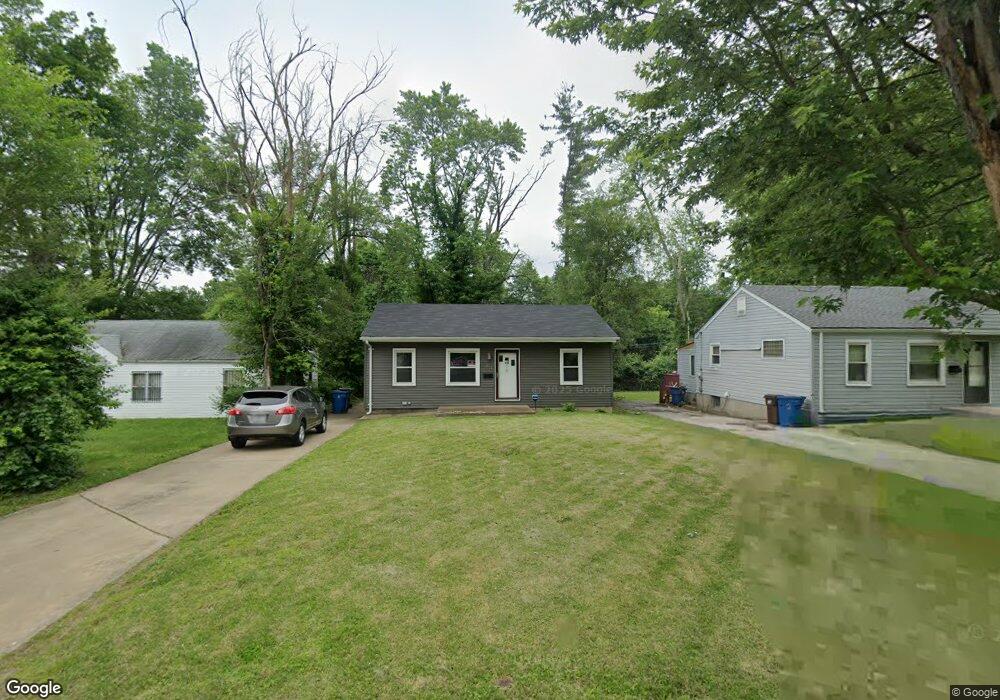
3 Dadebridge Ct Saint Louis, MO 63135
Estimated Value: $88,000 - $101,000
2
Beds
1
Bath
858
Sq Ft
$108/Sq Ft
Est. Value
About This Home
This home is located at 3 Dadebridge Ct, Saint Louis, MO 63135 and is currently estimated at $92,414, approximately $107 per square foot. 3 Dadebridge Ct is a home located in St. Louis County with nearby schools including Ferguson Middle School, Johnson Wabash Elementary School, and McCluer High School.
Ownership History
Date
Name
Owned For
Owner Type
Purchase Details
Closed on
Jul 30, 2025
Sold by
Wallace Cicily
Bought by
Trevino Rodney
Current Estimated Value
Home Financials for this Owner
Home Financials are based on the most recent Mortgage that was taken out on this home.
Original Mortgage
$3,613
Outstanding Balance
$3,610
Interest Rate
6.77%
Estimated Equity
$88,804
Purchase Details
Closed on
Sep 3, 2009
Sold by
Richardson Danny A and Richardson Loan T
Bought by
Wallace Cicily
Create a Home Valuation Report for This Property
The Home Valuation Report is an in-depth analysis detailing your home's value as well as a comparison with similar homes in the area
Home Values in the Area
Average Home Value in this Area
Purchase History
| Date | Buyer | Sale Price | Title Company |
|---|---|---|---|
| Trevino Rodney | -- | Continental Title | |
| Wallace Cicily | $20,700 | None Available |
Source: Public Records
Mortgage History
| Date | Status | Borrower | Loan Amount |
|---|---|---|---|
| Open | Trevino Rodney | $3,613 | |
| Open | Trevino Rodney | $90,333 |
Source: Public Records
Tax History
| Year | Tax Paid | Tax Assessment Tax Assessment Total Assessment is a certain percentage of the fair market value that is determined by local assessors to be the total taxable value of land and additions on the property. | Land | Improvement |
|---|---|---|---|---|
| 2025 | $923 | $15,870 | $2,000 | $13,870 |
| 2024 | $923 | $12,560 | $1,600 | $10,960 |
| 2023 | $918 | $12,560 | $1,600 | $10,960 |
| 2022 | $694 | $8,190 | $1,200 | $6,990 |
| 2021 | $672 | $8,190 | $1,200 | $6,990 |
| 2020 | $720 | $7,910 | $1,620 | $6,290 |
| 2019 | $706 | $7,910 | $1,620 | $6,290 |
| 2018 | $664 | $6,610 | $1,270 | $5,340 |
| 2017 | $651 | $6,610 | $1,270 | $5,340 |
| 2016 | $781 | $7,860 | $1,650 | $6,210 |
Source: Public Records
Map
Nearby Homes
- 324 N Dade Ave
- 415 N Dade Ave
- 318 N Dade Ave
- 310 N Marguerite Ave
- 825 Walters Dr
- 439 Warford Ave
- 324 Henquin Dr
- 411 Warford Ave
- 308 Henquin Dr
- 222 Henquin Dr
- 309 Newell Dr
- 138 N Marguerite Ave
- 213 Henquin Dr
- 8027 Aline Ave
- 35 Robert Ave
- 45 Beacon Ave
- 127 Thoroughman Ave
- 8115 Myrick St
- 847 N Florissant Rd
- 6005 Shillington Dr
- 2 Dadebridge Ct
- 4 Dadebridge Ct
- 1 Dadebridge Ct
- 6 Dadebridge Ct
- 418 N Dade Ave
- 7 Dadebridge Ct
- 9 Dadebridge Ct
- 422 N Dade Ave
- 415 Jehling Dr
- 8 Dadebridge Ct
- 423 Jehling Dr
- 409 Jehling Dr
- 426 N Dade Ave
- 411 N Dade Ave
- 430 N Dade Ave
- 431 Jehling Dr
- 319 N Marguerite Ave
- 333 N Dade Ave
- 437 Jehling Dr
- 423 N Dade Ave
Your Personal Tour Guide
Ask me questions while you tour the home.