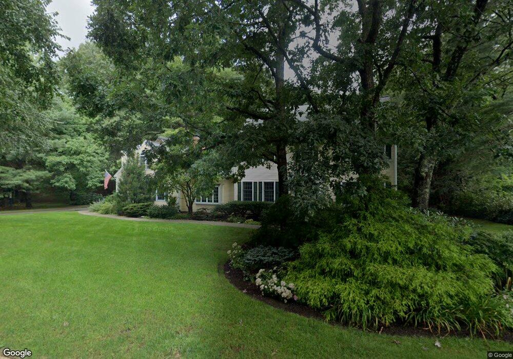
3 Davis Rd Southborough, MA 01772
Estimated Value: $1,371,603 - $1,583,000
4
Beds
3
Baths
3,543
Sq Ft
$418/Sq Ft
Est. Value
About This Home
This home is located at 3 Davis Rd, Southborough, MA 01772 and is currently estimated at $1,482,201, approximately $418 per square foot. 3 Davis Rd is a home located in Worcester County with nearby schools including Albert S. Woodward Memorial School, Margaret A. Neary School, and P. Brent Trottier Middle School.
Ownership History
Date
Name
Owned For
Owner Type
Purchase Details
Closed on
Feb 16, 2021
Sold by
Lewkowicz Paul E and Hamaker Mary M
Bought by
Hamaker & Lewkowicz Ft and Lewkowicz
Current Estimated Value
Home Financials for this Owner
Home Financials are based on the most recent Mortgage that was taken out on this home.
Original Mortgage
$304,500
Outstanding Balance
$271,096
Interest Rate
2.7%
Mortgage Type
New Conventional
Estimated Equity
$1,211,105
Purchase Details
Closed on
Jul 20, 2001
Sold by
Marquis Thomas W and Marquis Michele R
Bought by
Lewkowicz Paul E and Hamaker Mary M
Purchase Details
Closed on
Apr 29, 1999
Sold by
Haugen Peter K and Haugen Loretta S
Bought by
Marquis Thomas W and Marquis Michele R
Purchase Details
Closed on
Feb 5, 1993
Sold by
Barberry Farms Rt and Gallipeau Peter
Bought by
Haugen Peter K and Haugen Loretta
Purchase Details
Closed on
Sep 1, 1992
Sold by
Southborough Rt
Bought by
Barberry Farms Rt
Create a Home Valuation Report for This Property
The Home Valuation Report is an in-depth analysis detailing your home's value as well as a comparison with similar homes in the area
Home Values in the Area
Average Home Value in this Area
Purchase History
| Date | Buyer | Sale Price | Title Company |
|---|---|---|---|
| Hamaker & Lewkowicz Ft | -- | None Available | |
| Lewkowicz Paul E | $750,000 | -- | |
| Marquis Thomas W | $625,000 | -- | |
| Haugen Peter K | $315,000 | -- | |
| Barberry Farms Rt | $85,000 | -- |
Source: Public Records
Mortgage History
| Date | Status | Borrower | Loan Amount |
|---|---|---|---|
| Open | Hamaker & Lewkowicz Ft | $304,500 | |
| Previous Owner | Barberry Farms Rt | $398,846 | |
| Previous Owner | Barberry Farms Rt | $417,000 |
Source: Public Records
Tax History Compared to Growth
Tax History
| Year | Tax Paid | Tax Assessment Tax Assessment Total Assessment is a certain percentage of the fair market value that is determined by local assessors to be the total taxable value of land and additions on the property. | Land | Improvement |
|---|---|---|---|---|
| 2025 | $17,965 | $1,300,900 | $390,600 | $910,300 |
| 2024 | $16,522 | $1,187,800 | $375,400 | $812,400 |
| 2023 | $15,578 | $1,055,400 | $357,100 | $698,300 |
| 2022 | $14,356 | $881,800 | $310,400 | $571,400 |
| 2021 | $13,864 | $855,300 | $300,400 | $554,900 |
| 2020 | $13,918 | $835,400 | $295,200 | $540,200 |
| 2019 | $13,762 | $822,100 | $295,100 | $527,000 |
| 2018 | $13,030 | $807,300 | $295,100 | $512,200 |
| 2017 | $12,961 | $791,300 | $295,100 | $496,200 |
| 2016 | $13,066 | $825,900 | $300,500 | $525,400 |
| 2015 | $12,883 | $804,200 | $285,300 | $518,900 |
Source: Public Records
Map
Nearby Homes
- 5 Davis Rd
- 2 Davis Rd
- Lot 0 Davis Rd
- 1A Davis Rd
- 1 Davis Rd
- 7 Davis Rd
- 4 Davis Rd
- 67 Breakneck Hill Rd
- 63 Breakneck Hill Rd
- 57 Charles Ct
- 57 Charles Ct Unit 26,12
- 61 Breakneck Hill Rd
- 55 Charles Ct
- 53 Charles Ct
- 51 Charles Ct
- 51 Charles Ct Unit 15,34
- 69 Breakneck Hill Rd
- 65 Charles Ct
- 63 Charles Ct
- 61 Charles Ct