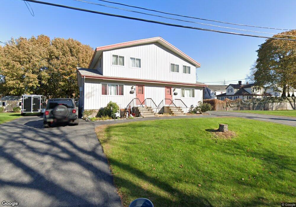
3 Donna Rd Woburn, MA 01801
North Woburn NeighborhoodEstimated Value: $709,000 - $964,000
4
Beds
4
Baths
2,152
Sq Ft
$387/Sq Ft
Est. Value
About This Home
This home is located at 3 Donna Rd, Woburn, MA 01801 and is currently estimated at $832,522, approximately $386 per square foot. 3 Donna Rd is a home located in Middlesex County with nearby schools including Linscott-Rumford Elementary School, John F. Kennedy Middle School, and Woburn High School.
Ownership History
Date
Name
Owned For
Owner Type
Purchase Details
Closed on
May 2, 2018
Sold by
Gatta Robert P and Gatta Deborah E
Bought by
Robert & D Gatta Ret and Gatta
Current Estimated Value
Purchase Details
Closed on
May 18, 1978
Bought by
Gatta Robert P
Create a Home Valuation Report for This Property
The Home Valuation Report is an in-depth analysis detailing your home's value as well as a comparison with similar homes in the area
Home Values in the Area
Average Home Value in this Area
Purchase History
| Date | Buyer | Sale Price | Title Company |
|---|---|---|---|
| Robert & D Gatta Ret | -- | -- | |
| Robert & D Gatta Ret | -- | -- | |
| Gatta Robert P | -- | -- |
Source: Public Records
Mortgage History
| Date | Status | Borrower | Loan Amount |
|---|---|---|---|
| Previous Owner | Gatta Robert P | $65,000 |
Source: Public Records
Tax History Compared to Growth
Tax History
| Year | Tax Paid | Tax Assessment Tax Assessment Total Assessment is a certain percentage of the fair market value that is determined by local assessors to be the total taxable value of land and additions on the property. | Land | Improvement |
|---|---|---|---|---|
| 2025 | $6,208 | $726,900 | $337,000 | $389,900 |
| 2024 | $5,651 | $701,100 | $321,000 | $380,100 |
| 2023 | $5,709 | $656,200 | $291,900 | $364,300 |
| 2022 | $5,635 | $603,300 | $254,100 | $349,200 |
| 2021 | $13,107 | $591,300 | $242,100 | $349,200 |
| 2020 | $5,047 | $541,500 | $242,100 | $299,400 |
| 2019 | $9,408 | $502,300 | $230,700 | $271,600 |
| 2018 | $4,705 | $475,700 | $211,800 | $263,900 |
| 2017 | $7,985 | $422,500 | $201,900 | $220,600 |
| 2016 | $3,970 | $395,000 | $188,800 | $206,200 |
| 2015 | $3,893 | $382,800 | $176,600 | $206,200 |
| 2014 | $3,959 | $379,200 | $176,600 | $202,600 |
Source: Public Records
Map
Nearby Homes
- 5 Nichols St
- 3 Nichols St
- 13 Nichols St
- 924 Main St Unit 37
- 924 Main St Unit 36
- 924 Main St Unit 35
- 924 Main St Unit 34
- 924 Main St Unit 33
- 924 Main St Unit 32
- 924 Main St Unit 31
- 924 Main St Unit 30
- 924 Main St Unit 27
- 924 Main St Unit 25
- 924 Main St Unit 24
- 924 Main St Unit 22
- 924 Main St Unit 21
- 924 Main St Unit 20
- 924 Main St Unit 17
- 924 Main St Unit 16
- 924 Main St Unit 15