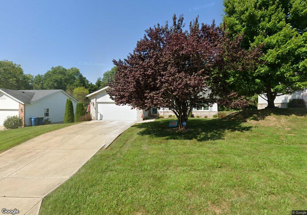
3 Dunlap Cove Dr Edwardsville, IL 62025
Estimated Value: $334,625 - $395,000
4
Beds
3
Baths
1,302
Sq Ft
$277/Sq Ft
Est. Value
About This Home
This home is located at 3 Dunlap Cove Dr, Edwardsville, IL 62025 and is currently estimated at $360,156, approximately $276 per square foot. 3 Dunlap Cove Dr is a home located in Madison County with nearby schools including LeClaire Elementary School, Columbus Elementary School, and Liberty Middle School.
Ownership History
Date
Name
Owned For
Owner Type
Purchase Details
Closed on
Mar 26, 2010
Sold by
King Andrew B and King Jennifer L
Bought by
Hilliard Anthony W and Hilliard Nieccole M
Current Estimated Value
Home Financials for this Owner
Home Financials are based on the most recent Mortgage that was taken out on this home.
Original Mortgage
$208,160
Outstanding Balance
$140,348
Interest Rate
5.25%
Mortgage Type
FHA
Estimated Equity
$219,808
Purchase Details
Closed on
Jul 30, 2004
Sold by
Christiansen Thomas R and Christansen Tammy
Bought by
King Andrew B and King Jennifer L
Home Financials for this Owner
Home Financials are based on the most recent Mortgage that was taken out on this home.
Original Mortgage
$150,400
Interest Rate
6.34%
Mortgage Type
Unknown
Create a Home Valuation Report for This Property
The Home Valuation Report is an in-depth analysis detailing your home's value as well as a comparison with similar homes in the area
Home Values in the Area
Average Home Value in this Area
Purchase History
| Date | Buyer | Sale Price | Title Company |
|---|---|---|---|
| Hilliard Anthony W | $212,000 | First American Title Ins Co | |
| King Andrew B | $174,666 | Fatic |
Source: Public Records
Mortgage History
| Date | Status | Borrower | Loan Amount |
|---|---|---|---|
| Open | Hilliard Anthony W | $208,160 | |
| Previous Owner | King Andrew B | $150,400 |
Source: Public Records
Tax History Compared to Growth
Tax History
| Year | Tax Paid | Tax Assessment Tax Assessment Total Assessment is a certain percentage of the fair market value that is determined by local assessors to be the total taxable value of land and additions on the property. | Land | Improvement |
|---|---|---|---|---|
| 2024 | $6,322 | $94,550 | $15,790 | $78,760 |
| 2023 | $6,322 | $87,740 | $14,650 | $73,090 |
| 2022 | $5,920 | $81,100 | $13,540 | $67,560 |
| 2021 | $5,276 | $76,970 | $12,850 | $64,120 |
| 2020 | $5,102 | $74,590 | $12,450 | $62,140 |
| 2019 | $5,063 | $73,340 | $12,240 | $61,100 |
| 2018 | $4,973 | $70,050 | $11,690 | $58,360 |
| 2017 | $4,835 | $68,570 | $11,440 | $57,130 |
| 2016 | $4,369 | $68,570 | $11,440 | $57,130 |
| 2015 | $4,171 | $63,570 | $10,610 | $52,960 |
| 2014 | $4,171 | $63,570 | $10,610 | $52,960 |
| 2013 | $4,171 | $63,570 | $10,610 | $52,960 |
Source: Public Records
Map
Nearby Homes
- 424 Circle Dr
- 1120 Franklin Ave
- 311 Barnett Dr
- 105 Barnett Dr
- 114 Barnett Dr
- 808 Meade Ave
- 4 Hadley Ct
- 629 Bollman Ave
- 7 Colleen Dr
- 340 E Lake Dr
- 821 Sherman Ave
- 714 Sherman Ave
- 424 Hadley Ave
- 115 Branch Dr
- 426 Roanoke Dr
- 503 Bollman Ave
- 104 Poplar Ct
- 638 Yale Ave
- 7301 Providence Dr
- 417 Montclaire Ave
- 5 Dunlap Cove Dr
- 2 Dunlap Cove Dr
- 7 Dunlap Cove Dr
- 300 Circle Dr
- 108 Dunlap Cove Ct S
- 1 Dunlap Cove Dr
- 306 Circle Dr
- 230 Circle Dr
- 9 Dunlap Cove Dr
- 8 Dunlap Cove Dr
- 310 Circle Dr
- 403 Barnett Dr
- 106 Dunlap Cove Ct S
- 11 Dunlap Cove Dr
- 102 Dunlap Cove Ct S
- 401 Barnett Dr
- 1050 Schwarz Rd
- 12 Dunlap Cove Dr
- 303 Circle Dr
- 13 Dunlap Cove Dr