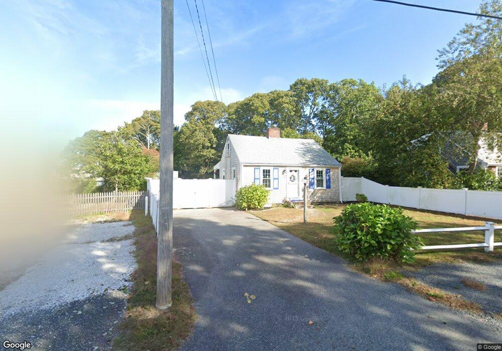
3 Elwood Rd West Harwich, MA 02671
Northwest Harwich NeighborhoodEstimated Value: $515,572 - $629,000
2
Beds
1
Bath
756
Sq Ft
$744/Sq Ft
Est. Value
About This Home
This home is located at 3 Elwood Rd, West Harwich, MA 02671 and is currently estimated at $562,643, approximately $744 per square foot. 3 Elwood Rd is a home located in Barnstable County with nearby schools including Harwich Elementary School, Chatham Elementary School, and Monomoy Regional Middle School.
Ownership History
Date
Name
Owned For
Owner Type
Purchase Details
Closed on
Oct 14, 2016
Sold by
Jackson Edward H and Jackson Janice B
Bought by
Edward H Jackson Ft
Current Estimated Value
Purchase Details
Closed on
Jan 24, 1989
Sold by
Est Miller Mary E
Bought by
Jackson Edward H
Home Financials for this Owner
Home Financials are based on the most recent Mortgage that was taken out on this home.
Original Mortgage
$94,500
Interest Rate
10.38%
Mortgage Type
Purchase Money Mortgage
Create a Home Valuation Report for This Property
The Home Valuation Report is an in-depth analysis detailing your home's value as well as a comparison with similar homes in the area
Home Values in the Area
Average Home Value in this Area
Purchase History
| Date | Buyer | Sale Price | Title Company |
|---|---|---|---|
| Edward H Jackson Ft | -- | -- | |
| Jackson Edward H | $105,000 | -- |
Source: Public Records
Mortgage History
| Date | Status | Borrower | Loan Amount |
|---|---|---|---|
| Previous Owner | Jackson Edward H | $94,500 |
Source: Public Records
Tax History Compared to Growth
Tax History
| Year | Tax Paid | Tax Assessment Tax Assessment Total Assessment is a certain percentage of the fair market value that is determined by local assessors to be the total taxable value of land and additions on the property. | Land | Improvement |
|---|---|---|---|---|
| 2025 | $2,632 | $445,300 | $257,600 | $187,700 |
| 2024 | $2,549 | $422,700 | $243,000 | $179,700 |
| 2023 | $2,496 | $375,900 | $221,000 | $154,900 |
| 2022 | $2,359 | $290,900 | $179,300 | $111,600 |
| 2021 | $2,219 | $258,000 | $163,000 | $95,000 |
| 2020 | $2,084 | $238,700 | $145,100 | $93,600 |
| 2019 | $1,993 | $229,900 | $138,100 | $91,800 |
| 2018 | $1,937 | $213,700 | $125,500 | $88,200 |
| 2017 | $1,806 | $201,300 | $114,400 | $86,900 |
| 2016 | $1,793 | $197,700 | $114,400 | $83,300 |
| 2015 | $1,741 | $194,100 | $112,100 | $82,000 |
| 2014 | $1,662 | $189,500 | $108,800 | $80,700 |
Source: Public Records
Map
Nearby Homes
- 73 Division St
- 148 Belmont Rd
- 45 Route 28
- 141 Division St
- 141 Division St
- 79 Massachusetts 28
- 47 Telegraph Rd Unit 1
- 6 Bayberry Ln
- 9 Bells Neck Rd Unit 10
- 9 Mansion St
- 12 Cross St
- 3 Fairbanks Dr
- 9 Country Ln
- 10 Candlewood Ln Unit 2-1
- 12 Candlewood Ln Unit 2-9
- 12 Candlewood Ln Unit 1-6
- 126 Massachusetts 28
- 64 Smith St
- 91 Depot Rd W
- 104 Toms Path