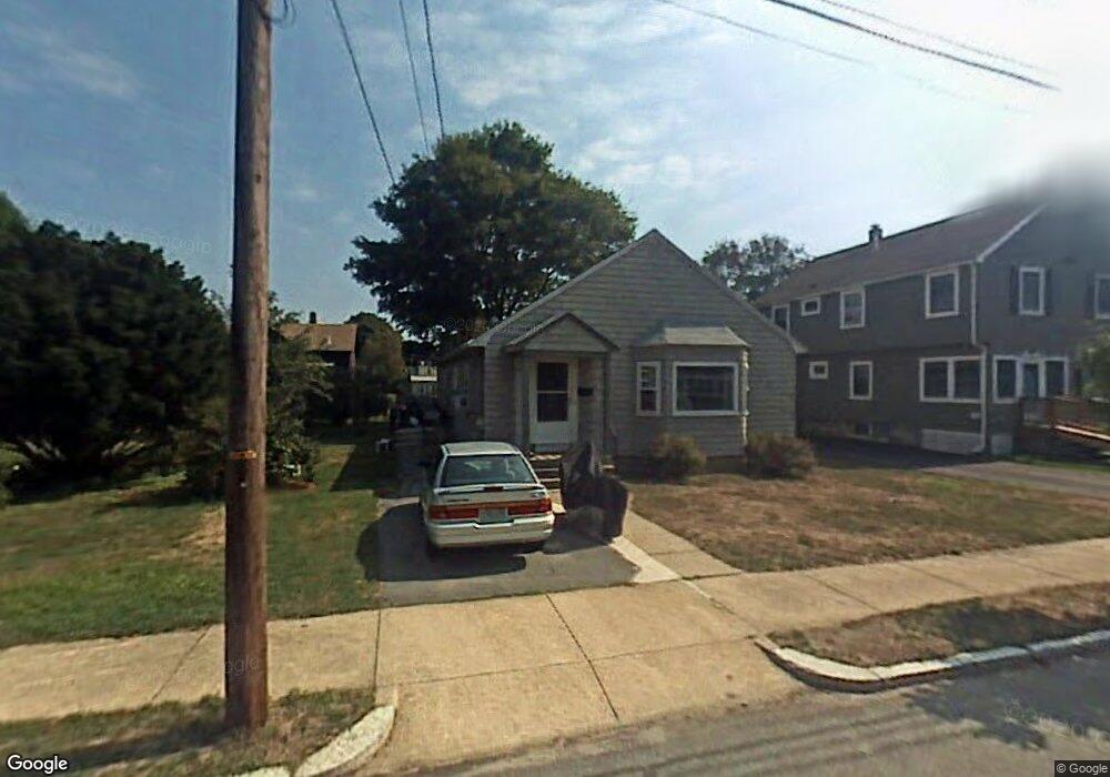
3 Felspa Rd Stoneham, MA 02180
Colonial Park NeighborhoodEstimated Value: $614,000 - $742,135
3
Beds
2
Baths
1,325
Sq Ft
$519/Sq Ft
Est. Value
About This Home
This home is located at 3 Felspa Rd, Stoneham, MA 02180 and is currently estimated at $687,284, approximately $518 per square foot. 3 Felspa Rd is a home located in Middlesex County with nearby schools including Stoneham High School, St. Patrick Elementary School, and Greater Boston Academy.
Ownership History
Date
Name
Owned For
Owner Type
Purchase Details
Closed on
Aug 30, 2018
Sold by
Udlinek Lucia C and Hughes Judith W
Bought by
Dawson Daniel R
Current Estimated Value
Home Financials for this Owner
Home Financials are based on the most recent Mortgage that was taken out on this home.
Original Mortgage
$397,700
Outstanding Balance
$346,104
Interest Rate
4.5%
Mortgage Type
New Conventional
Estimated Equity
$341,180
Purchase Details
Closed on
Oct 9, 2014
Sold by
Lae Moses and Hughes Judith W
Bought by
3 Felsa Road Rt
Purchase Details
Closed on
Aug 27, 2014
Sold by
White Clara M
Bought by
Udlinek Lucia C and Hughes Judith W
Purchase Details
Closed on
Jun 5, 1985
Bought by
White Clara
Create a Home Valuation Report for This Property
The Home Valuation Report is an in-depth analysis detailing your home's value as well as a comparison with similar homes in the area
Home Values in the Area
Average Home Value in this Area
Purchase History
| Date | Buyer | Sale Price | Title Company |
|---|---|---|---|
| Dawson Daniel R | -- | -- | |
| Dawson Daniel R | $410,000 | -- | |
| 3 Felsa Road Rt | -- | -- | |
| Udlinek Lucia C | -- | -- | |
| White Clara | -- | -- |
Source: Public Records
Mortgage History
| Date | Status | Borrower | Loan Amount |
|---|---|---|---|
| Open | Dawson Daniel R | $397,700 | |
| Closed | Dawson Daniel R | $397,700 |
Source: Public Records
Tax History Compared to Growth
Tax History
| Year | Tax Paid | Tax Assessment Tax Assessment Total Assessment is a certain percentage of the fair market value that is determined by local assessors to be the total taxable value of land and additions on the property. | Land | Improvement |
|---|---|---|---|---|
| 2025 | $5,805 | $567,400 | $380,000 | $187,400 |
| 2024 | $5,620 | $530,700 | $351,500 | $179,200 |
| 2023 | $5,481 | $493,800 | $323,000 | $170,800 |
| 2022 | $4,738 | $455,100 | $294,500 | $160,600 |
| 2021 | $4,632 | $428,100 | $275,500 | $152,600 |
| 2020 | $4,508 | $417,800 | $263,200 | $154,600 |
| 2019 | $4,533 | $404,000 | $234,000 | $170,000 |
| 2018 | $4,198 | $358,500 | $204,000 | $154,500 |
| 2017 | $4,109 | $331,600 | $184,000 | $147,600 |
| 2016 | $4,049 | $318,800 | $184,000 | $134,800 |
| 2015 | $3,976 | $306,800 | $184,000 | $122,800 |
| 2014 | $3,842 | $284,800 | $168,000 | $116,800 |
Source: Public Records
Map
Nearby Homes