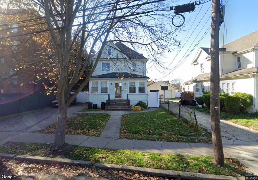
3 Graffing Place Freeport, NY 11520
Estimated Value: $438,000 - $633,549
4
Beds
2
Baths
1,868
Sq Ft
$287/Sq Ft
Est. Value
About This Home
This home is located at 3 Graffing Place, Freeport, NY 11520 and is currently estimated at $535,775, approximately $286 per square foot. 3 Graffing Place is a home located in Nassau County with nearby schools including Columbus Avenue School, Caroline G. Atkinson Intermediate School, and John W Dodd Middle School.
Ownership History
Date
Name
Owned For
Owner Type
Purchase Details
Closed on
May 5, 2017
Sold by
Wallace Derrick
Bought by
Ferman Jorge A
Current Estimated Value
Home Financials for this Owner
Home Financials are based on the most recent Mortgage that was taken out on this home.
Original Mortgage
$198,750
Outstanding Balance
$165,285
Interest Rate
4.1%
Mortgage Type
New Conventional
Estimated Equity
$370,490
Purchase Details
Closed on
Jul 2, 2007
Sold by
Wallace Derrick
Purchase Details
Closed on
Mar 4, 1999
Sold by
Ranger Capital Corp
Bought by
Wallace Derrick
Purchase Details
Closed on
Jul 23, 1996
Sold by
Bode Michael J As Nominee
Bought by
Ranger Capital Corp
Create a Home Valuation Report for This Property
The Home Valuation Report is an in-depth analysis detailing your home's value as well as a comparison with similar homes in the area
Home Values in the Area
Average Home Value in this Area
Purchase History
| Date | Buyer | Sale Price | Title Company |
|---|---|---|---|
| Ferman Jorge A | $265,000 | Ram Abstract Ltd | |
| -- | -- | -- | |
| Wallace Derrick | $147,000 | -- | |
| Ranger Capital Corp | $105,000 | -- |
Source: Public Records
Mortgage History
| Date | Status | Borrower | Loan Amount |
|---|---|---|---|
| Open | Ferman Jorge A | $198,750 |
Source: Public Records
Tax History
| Year | Tax Paid | Tax Assessment Tax Assessment Total Assessment is a certain percentage of the fair market value that is determined by local assessors to be the total taxable value of land and additions on the property. | Land | Improvement |
|---|---|---|---|---|
| 2025 | $7,611 | $353 | $103 | $250 |
| 2024 | $805 | $353 | $103 | $250 |
| 2023 | $8,578 | $373 | $109 | $264 |
| 2022 | $8,578 | $353 | $103 | $250 |
| 2021 | $12,377 | $357 | $104 | $253 |
| 2020 | $9,637 | $655 | $340 | $315 |
| 2019 | $9,639 | $655 | $340 | $315 |
| 2018 | $9,484 | $655 | $0 | $0 |
| 2017 | $6,483 | $655 | $340 | $315 |
| 2016 | $7,466 | $655 | $340 | $315 |
| 2015 | $946 | $655 | $340 | $315 |
| 2014 | $946 | $655 | $340 | $315 |
| 2013 | $894 | $655 | $340 | $315 |
Source: Public Records
Map
Nearby Homes
- 26 Rosedale Ave
- 70 N Grove St Unit 1N
- 70 N Grove St Unit 1R
- 45 Dehnhoff Ave
- 70 S Main St Unit 307-PH
- 98 N Columbus Ave
- 96 N Columbus Ave
- 58 Rutland Rd
- 67 E Dean St
- 58 Shonnard Ave
- 99 Randall Ave Unit 1Q
- 55 S Bergen Place Unit 3F
- 100 S Ocean Ave Unit 3U
- 100 S Ocean Ave Unit 3m
- 115 N Bergen Place
- 101 Harris Ave
- 6 Frederick Ave
- 101 Wallace St
- 158 Church St
- 124 Smith St Unit 3B
- 5 Graffing Place
- 17 Graffing Place
- 45 Broadway
- 19 Graffing Place
- 65 Broadway
- 67 Broadway
- 30 Harding Place
- 30 Harding Place
- 22 Graffing Place
- 32 Harding Place
- 73 Broadway
- 70 Broadway
- 74 Broadway Unit 2B
- 74 Broadway Unit 2C
- 74 Broadway Unit 2A
- 23 Harding Place
- 23 Harding Place Unit 2nd Fl
- 70-74 Broadway
- 15 Harding Place
- 7 Harding Place
Your Personal Tour Guide
Ask me questions while you tour the home.