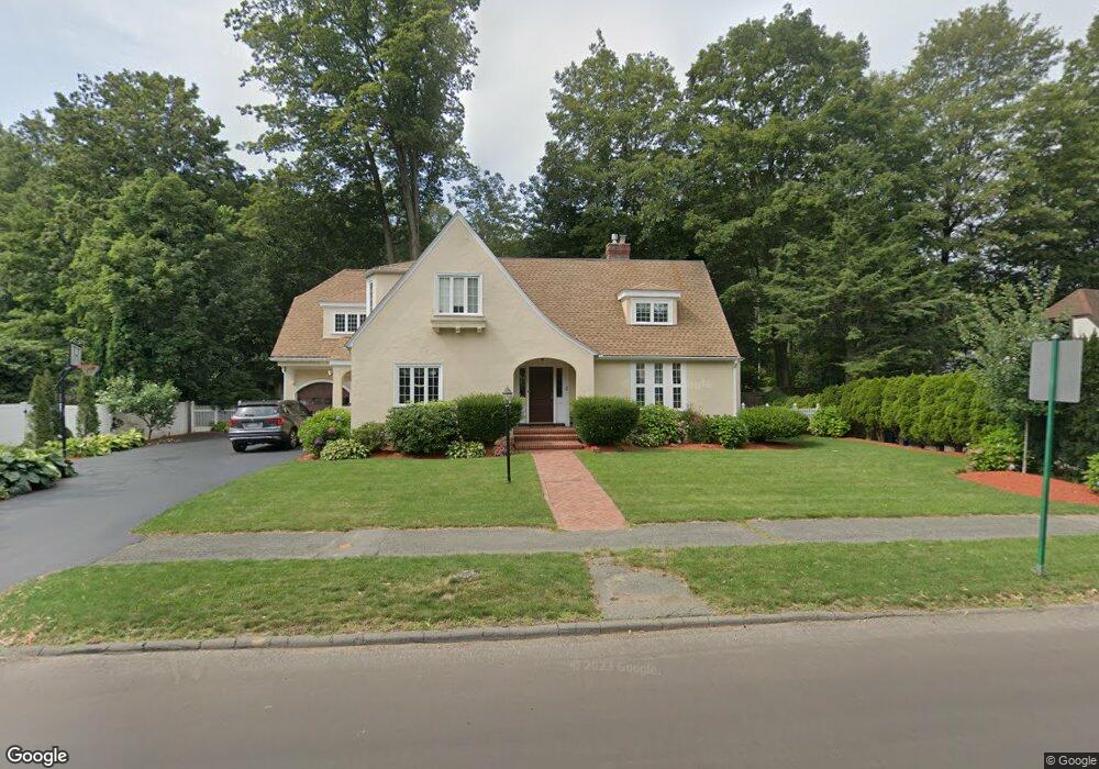
3 Grantland Rd Wellesley Hills, MA 02481
Wellesley Hills NeighborhoodEstimated Value: $1,213,000 - $2,164,000
4
Beds
4
Baths
3,412
Sq Ft
$472/Sq Ft
Est. Value
About This Home
This home is located at 3 Grantland Rd, Wellesley Hills, MA 02481 and is currently estimated at $1,610,963, approximately $472 per square foot. 3 Grantland Rd is a home located in Norfolk County with nearby schools including Joseph E. Fiske Elementary School, Wellesley Middle School, and Wellesley Sr High School.
Ownership History
Date
Name
Owned For
Owner Type
Purchase Details
Closed on
Nov 15, 1996
Sold by
Flanagan Francis L
Bought by
Masiello Thomas P
Current Estimated Value
Home Financials for this Owner
Home Financials are based on the most recent Mortgage that was taken out on this home.
Original Mortgage
$236,000
Interest Rate
7.99%
Mortgage Type
Purchase Money Mortgage
Create a Home Valuation Report for This Property
The Home Valuation Report is an in-depth analysis detailing your home's value as well as a comparison with similar homes in the area
Home Values in the Area
Average Home Value in this Area
Purchase History
| Date | Buyer | Sale Price | Title Company |
|---|---|---|---|
| Masiello Thomas P | $295,000 | -- |
Source: Public Records
Mortgage History
| Date | Status | Borrower | Loan Amount |
|---|---|---|---|
| Open | Masiello Thomas P | $388,500 | |
| Closed | Masiello Thomas P | $417,000 | |
| Closed | Masiello Thomas P | $241,000 | |
| Closed | Masiello Thomas P | $236,000 |
Source: Public Records
Tax History Compared to Growth
Tax History
| Year | Tax Paid | Tax Assessment Tax Assessment Total Assessment is a certain percentage of the fair market value that is determined by local assessors to be the total taxable value of land and additions on the property. | Land | Improvement |
|---|---|---|---|---|
| 2025 | $13,528 | $1,316,000 | $843,000 | $473,000 |
| 2024 | $13,117 | $1,260,000 | $803,000 | $457,000 |
| 2023 | $13,591 | $1,187,000 | $751,000 | $436,000 |
| 2022 | $12,287 | $1,052,000 | $616,000 | $436,000 |
| 2021 | $12,361 | $1,052,000 | $616,000 | $436,000 |
| 2020 | $12,161 | $1,052,000 | $616,000 | $436,000 |
| 2019 | $11,848 | $1,024,000 | $588,000 | $436,000 |
| 2018 | $12,655 | $1,059,000 | $609,000 | $450,000 |
| 2017 | $12,486 | $1,059,000 | $609,000 | $450,000 |
| 2016 | $12,256 | $1,036,000 | $599,000 | $437,000 |
| 2015 | $11,329 | $980,000 | $565,000 | $415,000 |
Source: Public Records
Map
Nearby Homes
- 1 Grantland Rd
- 5 Grantland Rd
- 400 Worcester St
- 400 Worcester St
- 4 Grantland Rd
- 12 Grantland Rd
- 7 Grantland Rd
- 386 Worcester St
- 18 Grantland Rd
- 12 Wareland Rd
- 12 Wareland Rd Unit 12
- 406 Worcester St
- 406 Worcester St (Carriage Lane)
- 18 Wareland Rd
- 391 Worcester St
- 1 Grantland Road Extension
- 5 Cunningham Rd
- 24 Wareland Rd
- 389 Worcester St
- 382 Worcester St