Estimated Value: $872,000 - $994,000
3
Beds
2
Baths
2,412
Sq Ft
$387/Sq Ft
Est. Value
About This Home
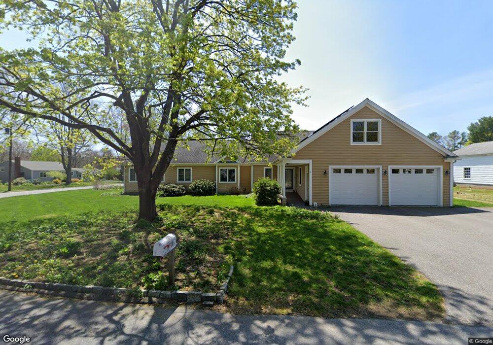
This home is located at 3 Heritage Rd, Acton, MA 01720 and is currently estimated at $932,700, approximately $386 per square foot. 3 Heritage Rd is a home located in Middlesex County with nearby schools including Acton-Boxborough Regional High School, Maynard Knowledge Beginnings, and The Imago School.
Ownership History
Date
Name
Owned For
Owner Type
Purchase Details
Closed on
Feb 4, 2004
Sold by
Gianetto Barbara A and Gianetto Edmund A
Bought by
Berlied Deborah L and Pollard James M
Current Estimated Value
Home Financials for this Owner
Home Financials are based on the most recent Mortgage that was taken out on this home.
Original Mortgage
$239,900
Outstanding Balance
$112,278
Interest Rate
5.8%
Mortgage Type
Purchase Money Mortgage
Estimated Equity
$820,422
Create a Home Valuation Report for This Property
The Home Valuation Report is an in-depth analysis detailing your home's value as well as a comparison with similar homes in the area
Home Values in the Area
Average Home Value in this Area
Purchase History
| Date | Buyer | Sale Price | Title Company |
|---|---|---|---|
| Berlied Deborah L | $299,900 | -- |
Source: Public Records
Mortgage History
| Date | Status | Borrower | Loan Amount |
|---|---|---|---|
| Open | Berlied Deborah L | $239,900 |
Source: Public Records
Tax History Compared to Growth
Tax History
| Year | Tax Paid | Tax Assessment Tax Assessment Total Assessment is a certain percentage of the fair market value that is determined by local assessors to be the total taxable value of land and additions on the property. | Land | Improvement |
|---|---|---|---|---|
| 2025 | $15,288 | $891,400 | $313,700 | $577,700 |
| 2024 | $14,415 | $864,700 | $313,700 | $551,000 |
| 2023 | $13,746 | $782,800 | $285,200 | $497,600 |
| 2022 | $13,811 | $710,100 | $248,000 | $462,100 |
| 2021 | $13,154 | $650,200 | $229,600 | $420,600 |
| 2020 | $12,375 | $643,200 | $229,600 | $413,600 |
| 2019 | $11,796 | $609,000 | $229,600 | $379,400 |
| 2018 | $10,733 | $553,800 | $229,600 | $324,200 |
| 2017 | $10,555 | $553,800 | $229,600 | $324,200 |
| 2016 | $9,707 | $504,800 | $229,600 | $275,200 |
| 2015 | $9,775 | $513,100 | $229,600 | $283,500 |
| 2014 | $9,918 | $509,900 | $229,600 | $280,300 |
Source: Public Records
Map
Nearby Homes
- 2 Clover Hill Rd
- 65 Summit St
- 118 Parker St Unit 16
- 128 Parker St Unit 3B
- 70 Hillside Ave
- 10 Wright Rd
- 88 Wright Rd
- 132 Parker St Unit G5
- 5 Oakwood Rd
- 8 Laurel Ct
- 37 Water St
- 27 Water St
- 11 Horseshoe Dr
- 70 River St
- 1828 Main St
- 1844 Main St Unit 1844
- 1687 Main St
- 80 N Branch Rd
- 128 Audubon Dr
- 86 School St