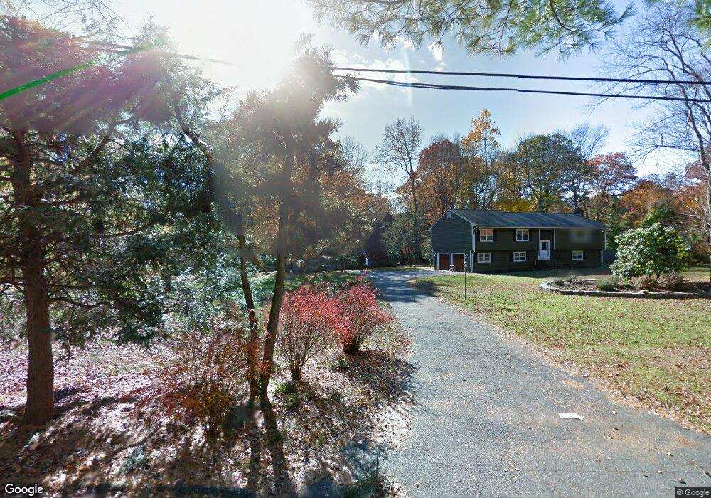
3 Hermit Ct Westport, CT 06880
Red Coat NeighborhoodEstimated Value: $1,833,504 - $2,341,000
6
Beds
4
Baths
3,602
Sq Ft
$552/Sq Ft
Est. Value
About This Home
This home is located at 3 Hermit Ct, Westport, CT 06880 and is currently estimated at $1,987,626, approximately $551 per square foot. 3 Hermit Ct is a home located in Fairfield County with nearby schools including Coleytown Elementary School, Coleytown Middle School, and Staples High School.
Ownership History
Date
Name
Owned For
Owner Type
Purchase Details
Closed on
Dec 22, 2020
Sold by
Haberstroh Charles W and Haberstroh Patricia C
Bought by
Haberstroh Charles C and Haberstroh Jacqueline H
Current Estimated Value
Home Financials for this Owner
Home Financials are based on the most recent Mortgage that was taken out on this home.
Original Mortgage
$990,000
Outstanding Balance
$882,967
Interest Rate
2.8%
Mortgage Type
Purchase Money Mortgage
Estimated Equity
$1,104,659
Purchase Details
Closed on
Jan 30, 1991
Sold by
Root James and Root Nancy
Bought by
Haberstro Charles and Haberstro Patricia
Create a Home Valuation Report for This Property
The Home Valuation Report is an in-depth analysis detailing your home's value as well as a comparison with similar homes in the area
Home Values in the Area
Average Home Value in this Area
Purchase History
| Date | Buyer | Sale Price | Title Company |
|---|---|---|---|
| Haberstroh Charles C | $1,100,000 | None Available | |
| Haberstroh Charles C | $1,100,000 | None Available | |
| Haberstro Charles | $605,000 | -- |
Source: Public Records
Mortgage History
| Date | Status | Borrower | Loan Amount |
|---|---|---|---|
| Open | Haberstroh Charles C | $990,000 | |
| Closed | Haberstroh Charles C | $990,000 | |
| Previous Owner | Haberstro Charles | $200,000 | |
| Previous Owner | Haberstro Charles | $1,293,700 |
Source: Public Records
Tax History Compared to Growth
Tax History
| Year | Tax Paid | Tax Assessment Tax Assessment Total Assessment is a certain percentage of the fair market value that is determined by local assessors to be the total taxable value of land and additions on the property. | Land | Improvement |
|---|---|---|---|---|
| 2025 | $14,490 | $768,300 | $407,000 | $361,300 |
| 2024 | $14,306 | $768,300 | $407,000 | $361,300 |
| 2023 | $14,098 | $768,300 | $407,000 | $361,300 |
| 2022 | $13,883 | $768,300 | $407,000 | $361,300 |
| 2021 | $13,883 | $768,300 | $407,000 | $361,300 |
| 2020 | $15,014 | $898,500 | $429,600 | $468,900 |
| 2019 | $15,149 | $898,500 | $429,600 | $468,900 |
| 2018 | $15,149 | $898,500 | $429,600 | $468,900 |
| 2017 | $15,149 | $898,500 | $429,600 | $468,900 |
| 2016 | $15,149 | $898,500 | $429,600 | $468,900 |
| 2015 | $14,695 | $812,300 | $406,600 | $405,700 |
| 2014 | $14,573 | $812,300 | $406,600 | $405,700 |
Source: Public Records
Map
Nearby Homes
- 4A Newtown Turnpike
- 40 Hermit Ln
- 25 Hermit Ln
- 30 Cavalry Rd
- 87 Red Coat Rd
- 93 E Meadow Rd
- 17 Huckleberry Ln
- 31 Riverfield Dr
- 4 Good Hill Rd
- 10 Twin Falls Ln
- 6 Tulip Tree Ln
- 259 Wilton Rd
- 4 Newtown Turnpike
- 56 Partrick Rd
- 14 Northfield Dr
- 32 Thistle Rd
- 10 Wilton Hunt Rd
- 489 Main St
- 57 Partrick Rd
- 29 Grumman Ave