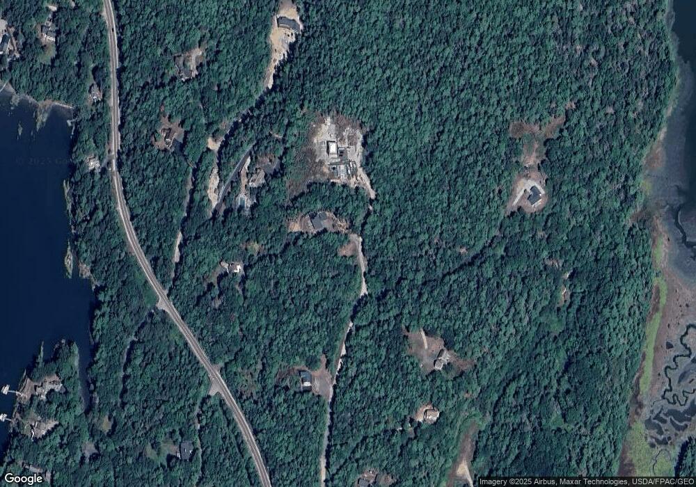
3 High View Rd Harpswell, ME 04079
Harpswell NeighborhoodEstimated Value: $904,125 - $1,230,000
2
Beds
2
Baths
1,695
Sq Ft
$588/Sq Ft
Est. Value
About This Home
This home is located at 3 High View Rd, Harpswell, ME 04079 and is currently estimated at $997,031, approximately $588 per square foot. 3 High View Rd is a home with nearby schools including Mt Ararat High School.
Ownership History
Date
Name
Owned For
Owner Type
Purchase Details
Closed on
Aug 14, 2017
Sold by
Gerschefski Mary G and Gerschefski Charles E
Bought by
Kilbride Karen E
Current Estimated Value
Purchase Details
Closed on
Sep 24, 2012
Sold by
Wille Kathryn A and Wille Margaret L
Bought by
Gerschefski Mary G and Gerschefski Charles E
Home Financials for this Owner
Home Financials are based on the most recent Mortgage that was taken out on this home.
Original Mortgage
$123,375
Interest Rate
3.59%
Mortgage Type
New Conventional
Purchase Details
Closed on
Aug 30, 2007
Sold by
Wolle Charles K
Bought by
Wille Margaret L and Wille Kathryn A
Create a Home Valuation Report for This Property
The Home Valuation Report is an in-depth analysis detailing your home's value as well as a comparison with similar homes in the area
Home Values in the Area
Average Home Value in this Area
Purchase History
| Date | Buyer | Sale Price | Title Company |
|---|---|---|---|
| Kilbride Karen E | -- | -- | |
| Gerschefski Mary G | -- | -- | |
| Wille Margaret L | -- | -- | |
| Kilbride Karen E | -- | -- | |
| Gerschefski Mary G | -- | -- | |
| Wille Margaret L | -- | -- |
Source: Public Records
Mortgage History
| Date | Status | Borrower | Loan Amount |
|---|---|---|---|
| Previous Owner | Gerschefski Mary G | $123,375 |
Source: Public Records
Tax History
| Year | Tax Paid | Tax Assessment Tax Assessment Total Assessment is a certain percentage of the fair market value that is determined by local assessors to be the total taxable value of land and additions on the property. | Land | Improvement |
|---|---|---|---|---|
| 2024 | $4,230 | $665,100 | $169,900 | $495,200 |
| 2023 | $4,063 | $666,000 | $169,900 | $496,100 |
| 2022 | $3,798 | $643,800 | $169,900 | $473,900 |
| 2021 | $3,409 | $504,300 | $175,100 | $329,200 |
| 2020 | $3,399 | $504,300 | $175,100 | $329,200 |
| 2019 | $3,379 | $504,300 | $175,100 | $329,200 |
| 2018 | $894 | $138,000 | $138,000 | $0 |
| 2017 | $891 | $138,000 | $138,000 | $0 |
| 2016 | $883 | $138,000 | $138,000 | $0 |
| 2015 | $861 | $138,000 | $138,000 | $0 |
| 2013 | $798 | $138,000 | $138,000 | $0 |
Source: Public Records
Map
Nearby Homes
- 30 Driftwood Tide Ln
- lot C Long Point Rd
- 242 Long Reach Ln
- 21 Spring Hill Rd
- 0 Bayview Rd Unit 2 1632776
- Lot 2B Allen Point Rd
- 1 Mallard Pond Rd
- Map 80 Lot 18-0 White Island
- 87 Lowells Cove Rd
- 646 Gurnet Rd
- 29 & 30 Nob Hill Ave
- 46 Blackstone Club Rd
- 0 Gundalo Gap Rd Unit 1638108
- 83 Central Ave
- 1450 Harpswell Neck Rd
- 260 Coombs Rd
- 250 Mere Point Rd
- 6 Chebeague Ln
- 291 Maquoit Rd
- 111 Rockweed Rd
- 8 Holly Hill Rd
- 367 Mountain Rd
- 0 Holly Hill Rd Unit 747078
- 0 Holly Hill Rd Unit 974750
- 0 Holly Hill Rd Unit 1436141
- 0 Holly Hill Rd Unit 1540683
- 29 Upland Ln
- Lot# 79 Upland Ln
- 21 Holly Hill Rd
- Lot# 75 Upland Ln
- 42 Upland Ln
- 0 Mountain Rd
- 22 Holly Hill Rd
- 18 Upland Ln
- 344 Mountain Rd
- 48 Upland Ln
- 332 Mountain Rd
- 14 Reach Rd
- 14 Upland Ln
- 13 Bunchberry Ln
Your Personal Tour Guide
Ask me questions while you tour the home.
