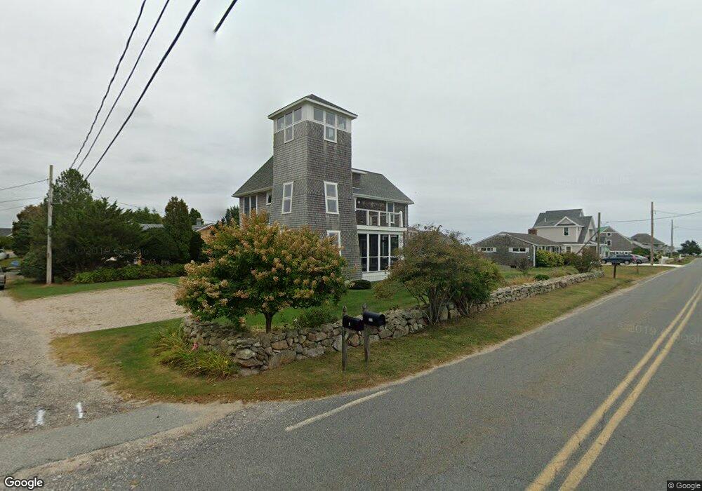
3 Hillside Rd Westport, MA 02790
Acoaxet NeighborhoodEstimated Value: $1,254,000 - $1,769,000
2
Beds
2
Baths
2,432
Sq Ft
$668/Sq Ft
Est. Value
About This Home
This home is located at 3 Hillside Rd, Westport, MA 02790 and is currently estimated at $1,624,673, approximately $668 per square foot. 3 Hillside Rd is a home located in Bristol County with nearby schools including Alice A. Macomber Primary School, Westport Elementary School, and Westport Middle-High School.
Ownership History
Date
Name
Owned For
Owner Type
Purchase Details
Closed on
Sep 19, 2008
Sold by
Lee Gary L and Glynn Janice M
Bought by
Kraft Tr Daniel P and Kraft Elizabeth D
Current Estimated Value
Purchase Details
Closed on
May 26, 2000
Sold by
Groteau Mary E and Rooney Mary E
Bought by
Lee Gary L and Glynn Janice M
Home Financials for this Owner
Home Financials are based on the most recent Mortgage that was taken out on this home.
Original Mortgage
$290,000
Interest Rate
8.1%
Mortgage Type
Purchase Money Mortgage
Purchase Details
Closed on
Jul 12, 1996
Sold by
Hazen Anthony and Hazen Carol
Bought by
Rooney John J and Rooney Mary E
Home Financials for this Owner
Home Financials are based on the most recent Mortgage that was taken out on this home.
Original Mortgage
$213,750
Interest Rate
7.98%
Mortgage Type
Purchase Money Mortgage
Create a Home Valuation Report for This Property
The Home Valuation Report is an in-depth analysis detailing your home's value as well as a comparison with similar homes in the area
Home Values in the Area
Average Home Value in this Area
Purchase History
| Date | Buyer | Sale Price | Title Company |
|---|---|---|---|
| Kraft Tr Daniel P | $625,000 | -- | |
| Lee Gary L | $290,000 | -- | |
| Rooney John J | $237,500 | -- |
Source: Public Records
Mortgage History
| Date | Status | Borrower | Loan Amount |
|---|---|---|---|
| Previous Owner | Rooney John J | $290,000 | |
| Previous Owner | Rooney John J | $213,750 |
Source: Public Records
Tax History Compared to Growth
Tax History
| Year | Tax Paid | Tax Assessment Tax Assessment Total Assessment is a certain percentage of the fair market value that is determined by local assessors to be the total taxable value of land and additions on the property. | Land | Improvement |
|---|---|---|---|---|
| 2025 | $9,155 | $1,228,900 | $784,900 | $444,000 |
| 2024 | $8,975 | $1,161,100 | $727,200 | $433,900 |
| 2023 | $8,996 | $1,102,500 | $692,600 | $409,900 |
| 2022 | $8,669 | $1,022,300 | $692,600 | $329,700 |
| 2021 | $8,033 | $931,900 | $602,200 | $329,700 |
| 2020 | $7,653 | $907,800 | $578,100 | $329,700 |
| 2019 | $8,296 | $1,003,100 | $683,200 | $319,900 |
| 2018 | $8,087 | $989,800 | $619,400 | $370,400 |
| 2017 | $7,826 | $981,900 | $614,900 | $367,000 |
| 2016 | $7,560 | $955,700 | $614,900 | $340,800 |
| 2015 | $7,051 | $889,100 | $558,000 | $331,100 |
Source: Public Records
Map
Nearby Homes
- 189 Brayton Point Rd
- 304 Brayton Point Rd
- 19 Seabury Ln
- 255 John Dyer Rd
- 18 Old Barn Rd
- 1881 Main Rd
- 128 Maple Ave
- 0 Reed Rd (Ss)
- 245 John Dyer Rd
- 1580 Main Rd
- 505 Long Hwy
- 141 S Of Commons Rd
- 1702J Drift Rd
- 1702 Drift Rd
- 1346 Main Rd Unit B
- 0 Willow Ave
- 17 Quail Trail
- 116 Amy Hart Path
- 238-242 E Beach Rd
- 83 Long Hwy
- 7 Hillside Rd
- 246 Howland Rd
- 19A Hillside Rd
- 19 Hillside Rd
- 243 Howland Rd
- 239 Howland Rd
- 252 Howland Rd
- 23 Hillside Rd
- 249 Howland Rd
- 229 Howland Rd
- 256 Howland Rd
- 40 Lakeside Ave
- 220 Howland Rd
- 11 Richmond Pond Ln
- 11 Richmond Pond Dr
- 10 Hillside Rd
- 13 Richmond Pond Ln
- 255 Howland Rd
- 26 Hillside Rd
- 15 Richmond Pond Dr