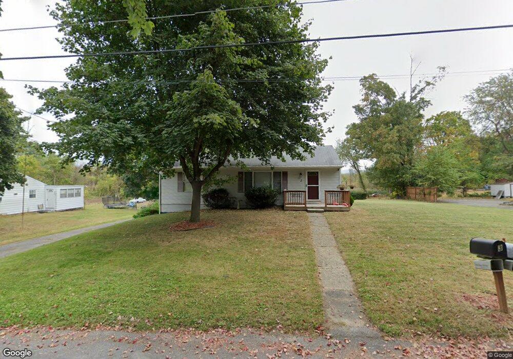
3 Hob St Newburgh, NY 12550
Estimated Value: $356,327 - $418,000
3
Beds
1
Bath
960
Sq Ft
$400/Sq Ft
Est. Value
About This Home
This home is located at 3 Hob St, Newburgh, NY 12550 and is currently estimated at $384,332, approximately $400 per square foot. 3 Hob St is a home located in Orange County with nearby schools including Newburgh Free Academy Main Campus and San Miguel Academy Of Newburgh.
Ownership History
Date
Name
Owned For
Owner Type
Purchase Details
Closed on
Dec 22, 2020
Sold by
Mcdowell Robert T
Bought by
Tatar Matthew J and Steindore Andrea
Current Estimated Value
Home Financials for this Owner
Home Financials are based on the most recent Mortgage that was taken out on this home.
Original Mortgage
$176,000
Outstanding Balance
$155,272
Interest Rate
2.71%
Mortgage Type
New Conventional
Estimated Equity
$229,060
Purchase Details
Closed on
Sep 14, 2007
Sold by
Anderson Kenneth
Bought by
Mcdowell Robert
Purchase Details
Closed on
Feb 13, 1997
Sold by
Beller Lois and Mccarthy Lois
Bought by
Mccarthy Daniel Kevin
Create a Home Valuation Report for This Property
The Home Valuation Report is an in-depth analysis detailing your home's value as well as a comparison with similar homes in the area
Home Values in the Area
Average Home Value in this Area
Purchase History
| Date | Buyer | Sale Price | Title Company |
|---|---|---|---|
| Tatar Matthew J | $220,000 | Attorney Only | |
| Mcdowell Robert | $249,000 | Carl Chu | |
| Mccarthy Daniel Kevin | -- | -- |
Source: Public Records
Mortgage History
| Date | Status | Borrower | Loan Amount |
|---|---|---|---|
| Open | Tatar Matthew J | $176,000 |
Source: Public Records
Tax History
| Year | Tax Paid | Tax Assessment Tax Assessment Total Assessment is a certain percentage of the fair market value that is determined by local assessors to be the total taxable value of land and additions on the property. | Land | Improvement |
|---|---|---|---|---|
| 2024 | $4,891 | $46,500 | $5,300 | $41,200 |
| 2023 | $4,891 | $46,500 | $5,300 | $41,200 |
| 2022 | $5,035 | $46,500 | $5,300 | $41,200 |
| 2021 | $5,058 | $46,500 | $5,300 | $41,200 |
| 2020 | $5,026 | $46,500 | $5,300 | $41,200 |
| 2019 | $1,494 | $46,500 | $5,300 | $41,200 |
| 2018 | $1,494 | $46,500 | $5,300 | $41,200 |
| 2017 | $5,155 | $46,500 | $5,300 | $41,200 |
| 2016 | $5,062 | $46,500 | $5,300 | $41,200 |
| 2015 | -- | $46,500 | $5,300 | $41,200 |
| 2014 | -- | $46,500 | $5,300 | $41,200 |
Source: Public Records
Map
Nearby Homes
- 166 Brookside Farms Rd
- 164 Brookside Farms Rd
- 0 Brookside Farms Rd
- 17 Brookside Ave
- 809 South St
- 25 Pierpont Ave
- 97 Maple St
- 111 High Point Cir
- 62 Poplar St
- 63 Poplar St
- 64 High Point Cir Unit 64
- 88 Brookview Ln
- 23 Oak St
- 9 Williams Ave
- 13 Poplar St
- 103 N Pierpont Ave
- 111 N Pierpont Ave
- 5 Poplar St
- 75 Wisner Ave
- 72 Wisner Ave
Your Personal Tour Guide
Ask me questions while you tour the home.