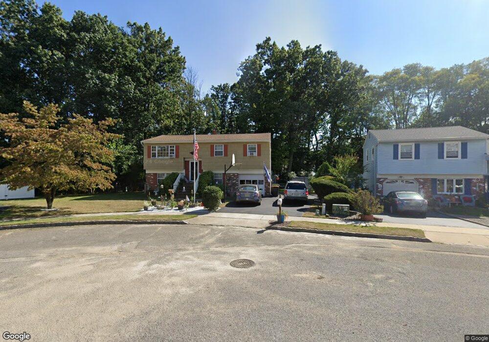
3 Independence Way Hazlet, NJ 07730
Estimated Value: $607,000 - $643,417
3
Beds
3
Baths
1,792
Sq Ft
$351/Sq Ft
Est. Value
About This Home
This home is located at 3 Independence Way, Hazlet, NJ 07730 and is currently estimated at $628,854, approximately $350 per square foot. 3 Independence Way is a home located in Monmouth County with nearby schools including Raritan High School and Baytul-Iman Academy.
Ownership History
Date
Name
Owned For
Owner Type
Purchase Details
Closed on
Sep 18, 2002
Sold by
Budd Donald
Bought by
Lonnay Laurie and Lonnay James
Current Estimated Value
Home Financials for this Owner
Home Financials are based on the most recent Mortgage that was taken out on this home.
Original Mortgage
$174,900
Interest Rate
6.04%
Create a Home Valuation Report for This Property
The Home Valuation Report is an in-depth analysis detailing your home's value as well as a comparison with similar homes in the area
Home Values in the Area
Average Home Value in this Area
Purchase History
| Date | Buyer | Sale Price | Title Company |
|---|---|---|---|
| Lonnay Laurie | $249,900 | -- |
Source: Public Records
Mortgage History
| Date | Status | Borrower | Loan Amount |
|---|---|---|---|
| Previous Owner | Lonnay Laurie | $174,900 |
Source: Public Records
Tax History Compared to Growth
Tax History
| Year | Tax Paid | Tax Assessment Tax Assessment Total Assessment is a certain percentage of the fair market value that is determined by local assessors to be the total taxable value of land and additions on the property. | Land | Improvement |
|---|---|---|---|---|
| 2025 | $10,164 | $537,000 | $365,600 | $171,400 |
| 2024 | $9,911 | $483,300 | $313,600 | $169,700 |
| 2023 | $9,911 | $463,800 | $295,600 | $168,200 |
| 2022 | $9,267 | $396,700 | $248,600 | $148,100 |
| 2021 | $8,855 | $361,300 | $229,600 | $131,700 |
| 2020 | $9,125 | $353,400 | $224,600 | $128,800 |
| 2019 | $8,855 | $337,600 | $209,600 | $128,000 |
| 2018 | $9,051 | $342,200 | $204,600 | $137,600 |
| 2017 | $8,570 | $324,000 | $190,600 | $133,400 |
| 2016 | $8,448 | $320,600 | $190,600 | $130,000 |
| 2015 | $8,207 | $312,300 | $185,600 | $126,700 |
| 2014 | $7,879 | $281,200 | $149,600 | $131,600 |
Source: Public Records
Map
Nearby Homes
- 64 Hawthorne Ave
- 6 Ridge Dr
- 51 Angela Cir
- 53 Lafayette Dr
- 44 Stanford Dr
- 8 Leocadia Ct
- 35 Violet Ct
- 9 Borick Ave
- 3 Lisa Dr
- 22 Weller Place Unit 22
- 26 Nevada Dr
- 12 Creek Rd
- 1 Oxford Rd Unit 34A
- 32 Bristel Rd Unit 212
- 58 Freesia Ct
- 58 Agostina Dr Unit 250
- 64 Agostina Dr Unit 64
- 53 Agostina Dr
- 8 Stagecoach Dr Unit 13
- 13 Irwin Place
- 5 Independence Way
- 1 Independence Way
- 7 Independence Way
- 7 Nappi Ct
- 9 Nappi Ct
- 16 Bunkerhill Rd
- 2 Independence Way
- 5 Nappi Ct
- 14 Bunkerhill Rd
- 4 Independence Way
- 18 Bunkerhill Rd
- 9 Independence Way
- 6 Independence Way
- 12 Bunkerhill Rd
- 20 Bunkerhill Rd
- 8 Independence Way
- 10 Bunkerhill Rd
- 3 Nappi Ct
- 22 Bunkerhill Rd
- 4 Nappi Ct